

Danny 4 p.m. Update: Maximum Winds 45 mph; Will Move onto the South Carolina Coast This Evening
Here is the latest on Tropical Storm Danny.
For Alabama, the weakening depression that is the remnants of Danny will enhance rain amounts over the next 48 hours over Northeast, North Central, and North Alabama. Here are forecasted rainfall amounts from the WPC for now…
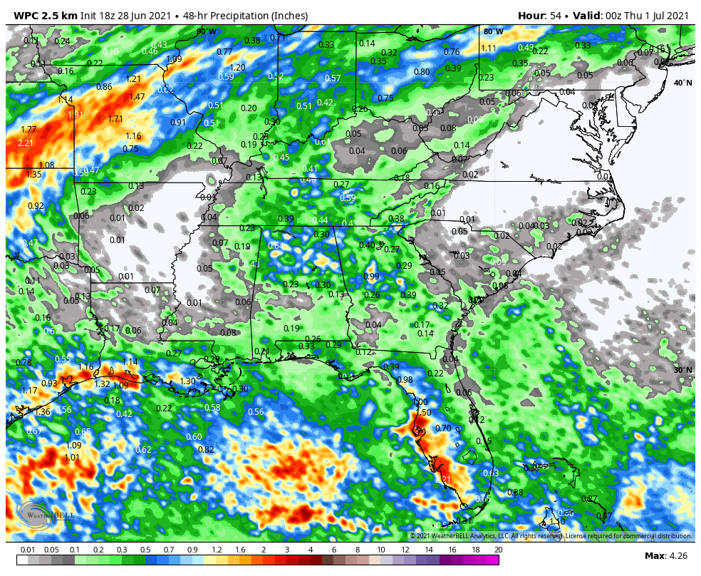
Some spots might pick up an inch.
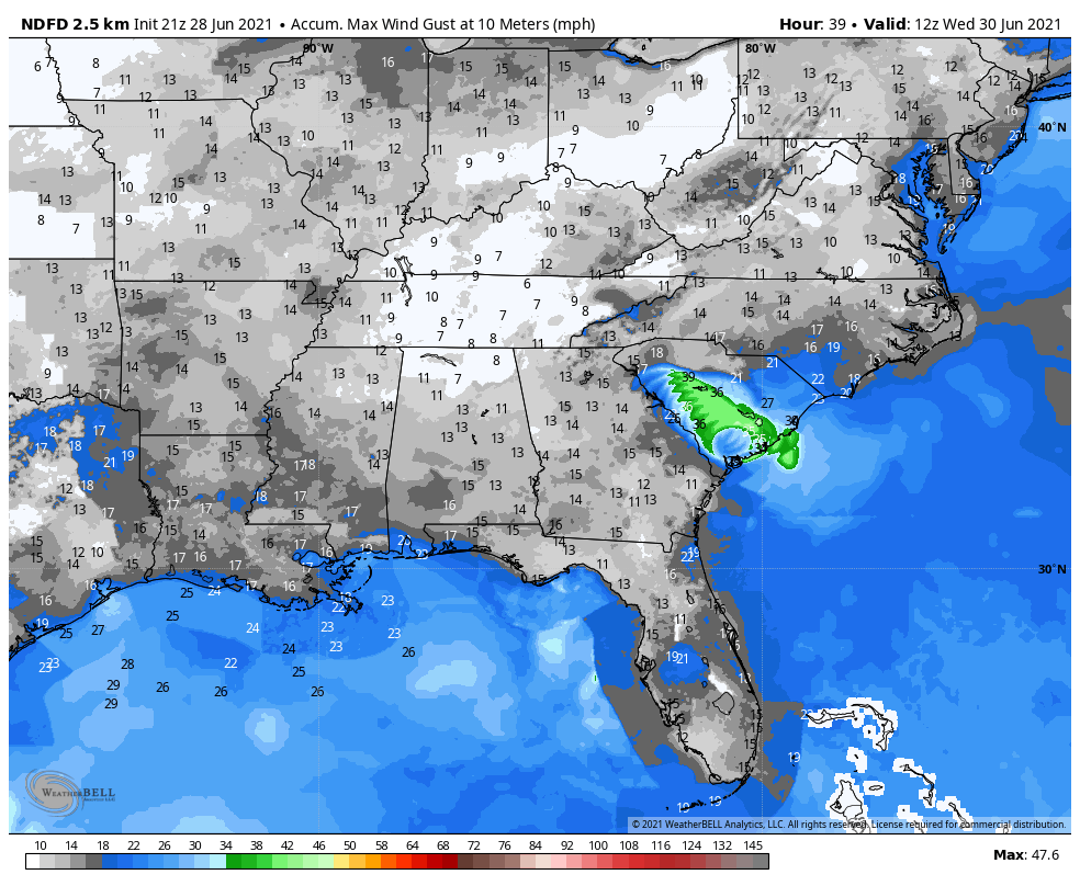
Here is the wind gust swth over the next 48 hours. As you can see, winds won’t be a problem here in Alabama.
Here is the official forecast track.

BULLETIN
Tropical Storm Danny Advisory Number 2
NWS National Hurricane Center Miami FL AL042021
500 PM EDT Mon Jun 28 2021
…TROPICAL STORM DANNY STRENGTHENS SOME MORE AS IT NEARS THE
SOUTH CAROLINA COAST…
SUMMARY OF 500 PM EDT…2100 UTC…INFORMATION
———————————————-
LOCATION…32.3N 80.1W
ABOUT 35 MI…55 KM E OF BEAUFORT SOUTH CAROLINA
ABOUT 35 MI…60 KM SSW OF CHARLESTON SOUTH CAROLINA
MAXIMUM SUSTAINED WINDS…45 MPH…75 KM/H
PRESENT MOVEMENT…WNW OR 290 DEGREES AT 16 MPH…26 KM/H
MINIMUM CENTRAL PRESSURE…1009 MB…29.80 INCHES
WATCHES AND WARNINGS
——————–
CHANGES WITH THIS ADVISORY:
None.
SUMMARY OF WATCHES AND WARNINGS IN EFFECT:
A Tropical Storm Warning is in effect for…
* Edisto Beach to South Santee River South Carolina
A Tropical Storm Warning means that tropical storm conditions are
expected somewhere within the warning area, in this case within the
next 6 hours.
For storm information specific to your area, including possible
inland watches and warnings, please monitor products issued by your
local National Weather Service forecast office.
DISCUSSION AND OUTLOOK
———————-
At 500 PM EDT (2100 UTC), the center of Tropical Storm Danny was
located near latitude 32.3 North, longitude 80.1 West. Danny is
moving toward the west-northwest near 16 mph (26 km/h) and this
general motion is expected to continue into Tuesday. On the
forecast track, Danny will make landfall along the southern coast
of South Carolina early this evening, and move into east-central
Georgia late tonight and early Tuesday morning.
Data from NOAA Doppler radars and reconnaissance aircraft indicate
that maximum sustained winds have increased to near 45 mph (75 km/h)
with higher gusts. No change in strength is expected until landfall
occurs in a few hours. Rapid weakening is forecast after Danny
moves inland.
Tropical-storm-force winds extend outward up to 35 miles (55 km)
from the center.
The minimum central pressure based on reports from An Air Force
Reserve Unit reconnaissance aircraft is estimated to be 1009 mb
(29.80 inches).
HAZARDS AFFECTING LAND
———————-
Key messages for Tropical Storm Danny can be found in the Tropical
Cyclone Discussion under AWIPS header MIATCDAT4, WMO header WTNT44
KNHC and on the web at
www.hurricanes.gov/graphics_at4.shtml?key_messages.
WIND: Tropical storm conditions are expected to first reach the
coast within the warning area very soon making outside preparations
difficult or dangerous.
RAINFALL: Danny could produce 1 to 3 inches of rainfall with
locally higher amounts along the immediate coasts of Georgia and
southern South Carolina. This region has been dry, limiting
potential widespread flooding impacts, however, local flooding
impacts, especially in urban areas along the southern South Carolina
and Georgia coasts, cannot be ruled out at this time.
Farther inland, 1 to 2 inches of rainfall is possible across Upstate
South Carolina, the Piedmont of Georgia, and into northeastern
Alabama.
STORM SURGE: The combination of storm surge and the tide will cause
normally dry areas near the coast to be flooded by rising waters
moving inland from the shoreline. The water could reach the
following heights above ground somewhere in the indicated areas if
the peak surge occurs at the time of high tide…
Port Royal Sound, SC to South Santee River, SC…1 to 3 ft
Surge-related flooding depends on the relative timing of the surge
and the tidal cycle, and can vary greatly over short distances. For
information specific to your area, please see products issued by
your local National Weather Service forecast office.
TORNADOES: An isolated tornado will be possible this evening along
the South Carolina coast.
NEXT ADVISORY
————-
Next intermediate advisory at 800 PM EDT.
Next complete advisory at 1100 PM EDT.
$$
Forecaster Stewart
Category: Alabama's Weather, ALL POSTS, Tropical
About the Author (Author Profile)
Bill Murray is the President of The Weather Factory. He is the site's official weather historian and a weekend forecaster. He also anchors the site's severe weather coverage. Bill Murray is the proud holder of National Weather Association Digital Seal #0001 @wxhistorianSubscribe
If you enjoyed this article, subscribe to receive more just like it.


