

Moisture Levels Header Higher; Scattered Storms Return
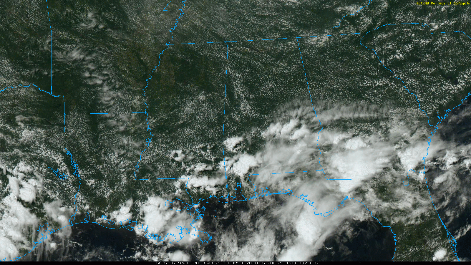
RADAR CHECK: We have a few scattered showers and thunderstorms over the southern half of Alabama this afternoon… mainly south of U.S. 80, where moisture is deeper. The northern half of the state is dry, and temperatures are generally in the 87-90 degree range. Scattered storms over South Alabama will fade a bit tonight after sunset.
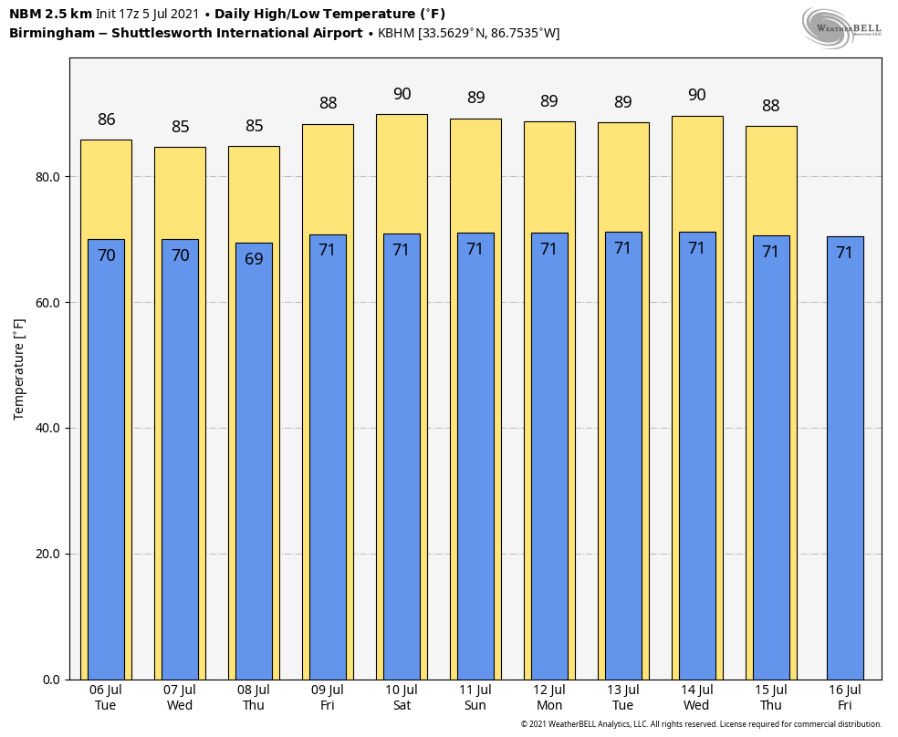
REST OF THE WEEK: Tomorrow will be a partly sunny, warm, humid day with scattered showers and thunderstorms, most active between noon and midnight. Chance of any one spot getting wet is 25-35 percent, and the high will be in the mid to upper 80s. Then, an approaching trough will bring scattered to numerous showers and thunderstorms to the state Wednesday and Thursday. The sky will be occasionally cloudy both days with highs between 81 and 86. Friday looks like a fairly typical summer day with a mix of sun and clouds and the usual chance of scattered showers and thunderstorms, mostly during the afternoon and evening hours. The high Friday will be in the upper 80s.
THE ALABAMA WEEKEND: We aren’t expecting much change Saturday and Sunday; pretty routine summer weather both days with the usual mix of sun and scattered storms. Chance of any one spot getting wet both days will be in the 25-35 percent range, and highs will remain mostly in the upper 80s… a little below average for July in Alabama.
NEXT WEEK: We will go with a persistence forecast; partly sunny, warm, humid days with the continued chance of random, scattered, pop-up afternoon and evening showers and storms each day. Highs will be generally between 86 and 90… See the Weather Xtreme video for maps, graphics, and more details.
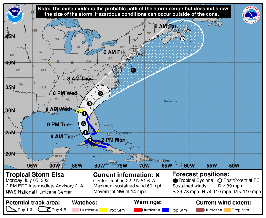
ELSA: Tropical Storm Elsa, with sustained winds of 60 mph, is over Cuba this afternoon and slowly weakening. It will move over the far eastern Gulf of Mexico tomorrow, then moving into Florida west coast north of Tampa late tomorrow night or early Wednesday morning. From there, it moves up the south Atlantic coast, and back into the Atlantic by Thursday night. As Elsa approaches the Florida Keys, the Florida Peninsula, and coastal Georgia through Wednesday, heavy rainfall may result in isolated flash, urban, and minor river flooding. Mid to late week, heavy rains across coastal South Carolina and North Carolina may result in isolated flash and urban flooding. A few brief, isolated tornadoes or waterspouts are possible along and east of the circulation center track.
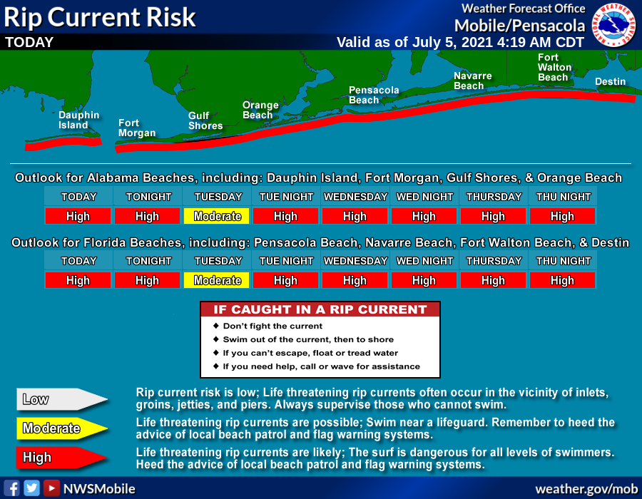
While the direct impact of Elsa remains east of Alabama and the Central Gulf Coast (Gulf Shores, Pensacola, Destin, Panama City Beach), there will be a high danger of rip currents this week.
The rest of the Atlantic basin is very quiet.
ON THIS DATE IN 1937: The temperature at Medicine Lake, Montana soared to 117 degrees to tie the state record. Glendive, Montana reached 117 degrees on July 20th, 1893.
BEACH FORECAST: Click here to see the AlabamaWx Beach Forecast Center page.
WEATHER BRAINS: Don’t forget you can listen to our weekly 90 minute show anytime on your favorite podcast app. This is the show all about weather featuring many familiar voices, including our meteorologists here at ABC 33/40.
CONNECT: You can find me on all of the major social networks…
Look for the next Weather Xtreme video here by 6:00 a.m. tomorrow…
Category: Alabama's Weather, ALL POSTS, Weather Xtreme Videos
About the Author (Author Profile)
James Spann is one of the most recognized and trusted television meteorologists in the industry. He holds the AMS CCM designation and television seals from the AMS and NWA. He is a past winner of the Broadcast Meteorologist of the Year from both professional organizations.Subscribe
If you enjoyed this article, subscribe to receive more just like it.


