

Alabama Radar Update at 4:20 p.m.
Strong thunderstorms continue across parts of North and Central Alabama this afternoon.
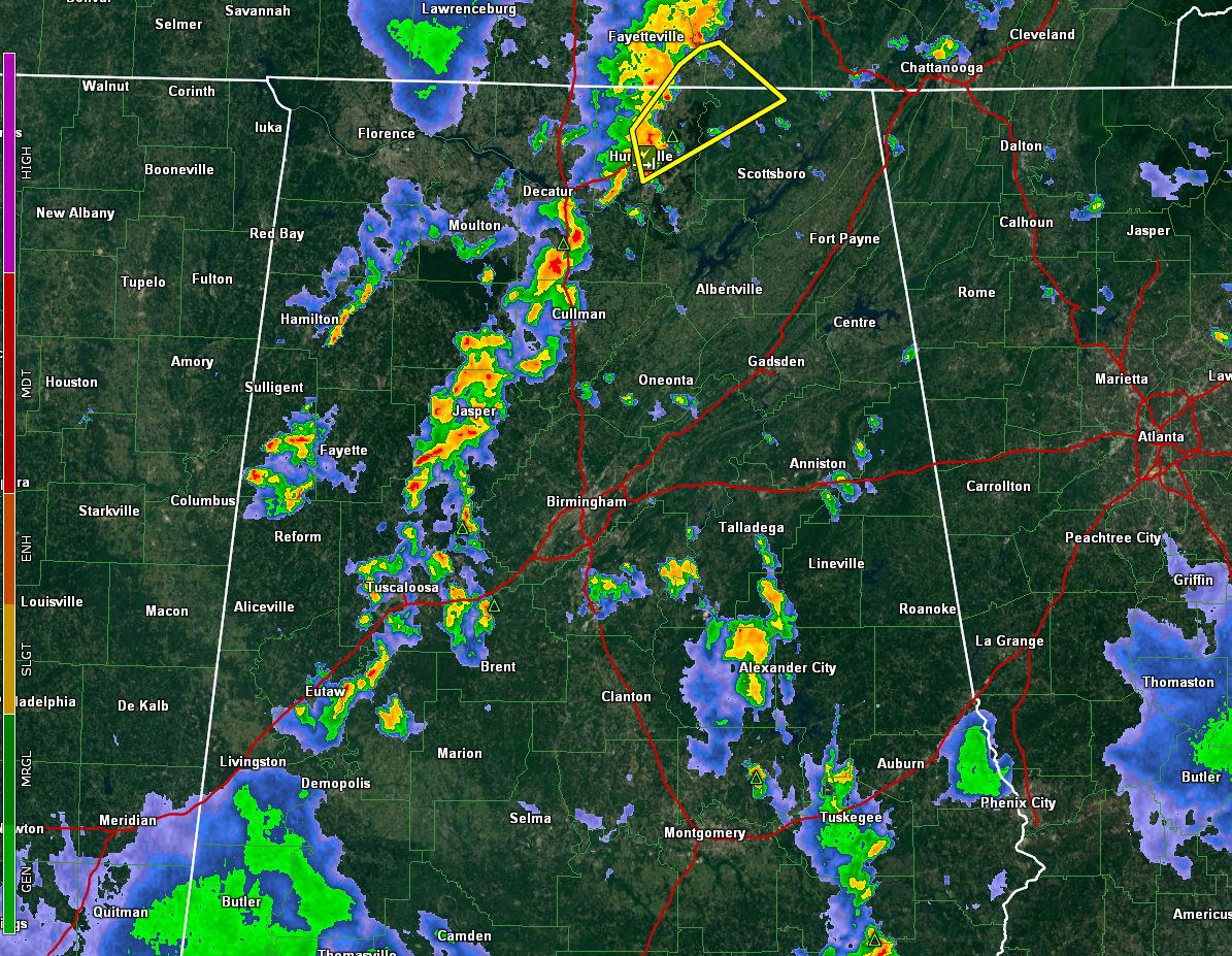
The strongest storm is moving across the Huntsville area of Madison County, moving into Jackson County, where a severe thunderstorm warning is in effect.
That storm is the northernmost storm in Alabama of a line that goes back through Morgan, Cullman, Walker, Tuscaloosa, and Greene Counties. The storm north of Cullman has lots of lightning in it.
The line is pushing east while the cells are moving north northeast.
The storms over eastern Tuscaloosa and northern Bibb County may affect the Birmingham area. They have lightning and heavy rain as well as gusty winds but are not severe. But we note that some of the strongest instability is over the Birmingham Metro, so the storms may intensify. There is not much if any bulk shear available to them though, so they will probably remain disorganized.
Other storms extend down US-280 across Shelby, Coosa, and Elmore counties down to Tuskegee and Clayton. Some of the strongest are near Clayton. They will move into Clay County and approach Ashland.
Some of them may become strong to severe with damaging winds, heavy rain, and lightning. Be prepared to go inside if you see darkening skies or hear thunder.
Category: Alabama's Weather, ALL POSTS, Severe Weather
About the Author (Author Profile)
Bill Murray is the President of The Weather Factory. He is the site's official weather historian and a weekend forecaster. He also anchors the site's severe weather coverage. Bill Murray is the proud holder of National Weather Association Digital Seal #0001 @wxhistorianSubscribe
If you enjoyed this article, subscribe to receive more just like it.


