

More Rain and Storms Impacting North/Central Alabama
RAIN & STRONG STORMS: An upper trough moving through the region today and tomorrow is causing numerous showers and storms across the Alabama landscape and some of the stronger storms will produce heavy rain, gusty winds, lots of lightning, and small hail.
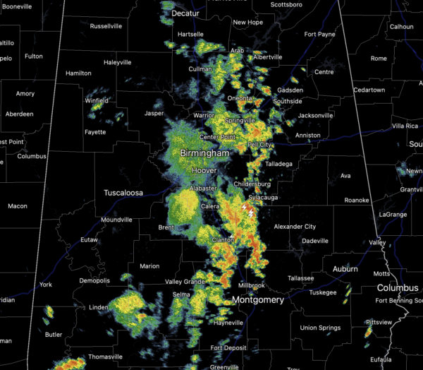
Most of the activity this morning developed across Southwest Alabama and Mississippi and has been pushing northeast through Alabama. Again, expects lightning, torrential downpours, and gusty winds. More showers and storms are developing back across Mississippi and even as we head through the afternoon hours, more showers and storms will develop across Alabama as well.
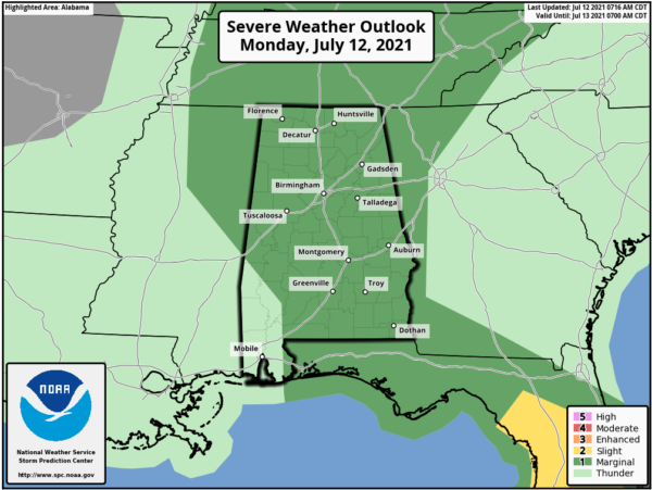
The SPC has introduced a “marginal risk” (level 1/5) for severe storms across much of Alabama today as for there could be a few warnings, like we have seen the past days. Where it is not raining, it remains mostly cloudy with temperatures in the 80s.
REST OF THE WEEK: Rinse and repeat the forecast for tomorrow as the sky will be occasionally cloudy with scattered to numerous showers and thunderstorms, especially during the afternoon and evening hours. Temperatures will remain well below average with a high in the low to mid 80s. Humidity levels stay high Wednesday through Friday, and showers and storms will continue to develop on these three days, but they should be a bit more scattered in nature as the upper-trough lifts out and an upper ridge builds in over the region. Highs for the second half of the week will be in the mid to upper 80s; chance of any one spot getting wet Wednesday through Friday will be in the 40-50 percent range.
ROUTINE WEEKEND WEATHER: Warm and humid weather will continue as both Saturday and Sunday we expect a mix of sun and clouds with scattered to perhaps numerous showers and thunderstorms, mostly during the afternoon and evening hours. Highs will be in the mid to upper 80s range.
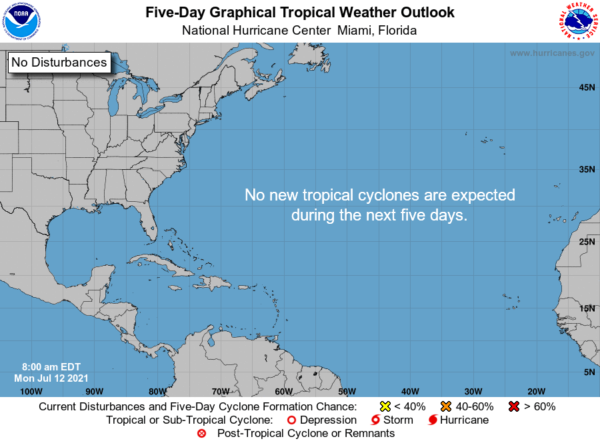
TROPICAL UPDATE: All is quiet across the Atlantic basin thanks to dry air and sinking air, and tropical storm formation is not expected at least for the next five days. In fact, the tropics around the world are all quiet with not tropical cyclones or invest areas.
BEACH FORECAST CENTER: Get the latest weather and rip current forecasts for the beaches from Fort Morgan to Panama City on our Beach Forecast Center page. There, you can select the forecast of the region that you are interested in visiting.
WORLD TEMPERATURE EXTREMES: Over the last 24 hours, the highest observation outside the U.S. was 129.7F at Lufi-Lufi, Samoa. The lowest observation was -97.1F at Vostok, Antarctica.
CONTIGUOUS TEMPERATURE EXTREMES: Over the last 24 hours, the highest observation was 128F at Death Valley, CA. The lowest observation was 29F at Peter Sinks, UT.
Category: Alabama's Weather, ALL POSTS
About the Author (Author Profile)
Macon, Georgia Television Chief Meteorologist, Birmingham native, and long time Contributor on AlabamaWX. Stormchaser. I did not choose Weather, it chose Me. College Football Fanatic. @Ryan_StinnetSubscribe
If you enjoyed this article, subscribe to receive more just like it.


