

North/Central Alabama Included in a Slight Risk for Excessive Rainfall
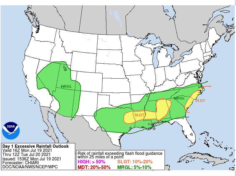
The WPC has included much of North/Central Alabama in a Slight Risk for excessive rainfall in its latest Excessive Rainfall Outlook for the rest of today and through the overnight hours until 7 am Tuesday morning. Here is the text from that update:
The Slight risk will be over much of AL into northwest GA. This is a new Slight risk area, based primarily on the signal in the 00z HREF suite of products. HREF EAS probabilities indicate an area of more organized convection here, and 3 hr FFG exceedance probabilities get into the 30-50 % range. A well-defined low to mid level low near the MS/AL/TN border will not move much through the period. It is to the south and southeast of this feature where rounds of convection will continue to be favored. Tough to pin down exact timing details…but the persistently favorable mid/upper level pattern, along with a persistence of a stronger corridor of westerly 850mb moisture transport, certainly supports periodic convection through the period. Areal averaged rainfall seems to stay more in the 1-2″ range…but small scale areas of 3″+ amounts should be pretty common over the Slight risk area, and even some localized totals over 5″ appear possible. Soil saturation anomalies are around the 90th percentile over some of this region, potentially indicating a bit more susceptibility to flash flooding than a typical mid-July day.
Category: Alabama's Weather, ALL POSTS
About the Author (Author Profile)
Scott Martin is an operational meteorologist, professional graphic artist, musician, husband, and father. Not only is Scott a member of the National Weather Association, but he is also the Central Alabama Chapter of the NWA president. Scott is also the co-founder of Racecast Weather, which provides forecasts for many racing series across the USA. He also supplies forecasts for the BassMaster Elite Series events including the BassMaster Classic.Subscribe
If you enjoyed this article, subscribe to receive more just like it.


