

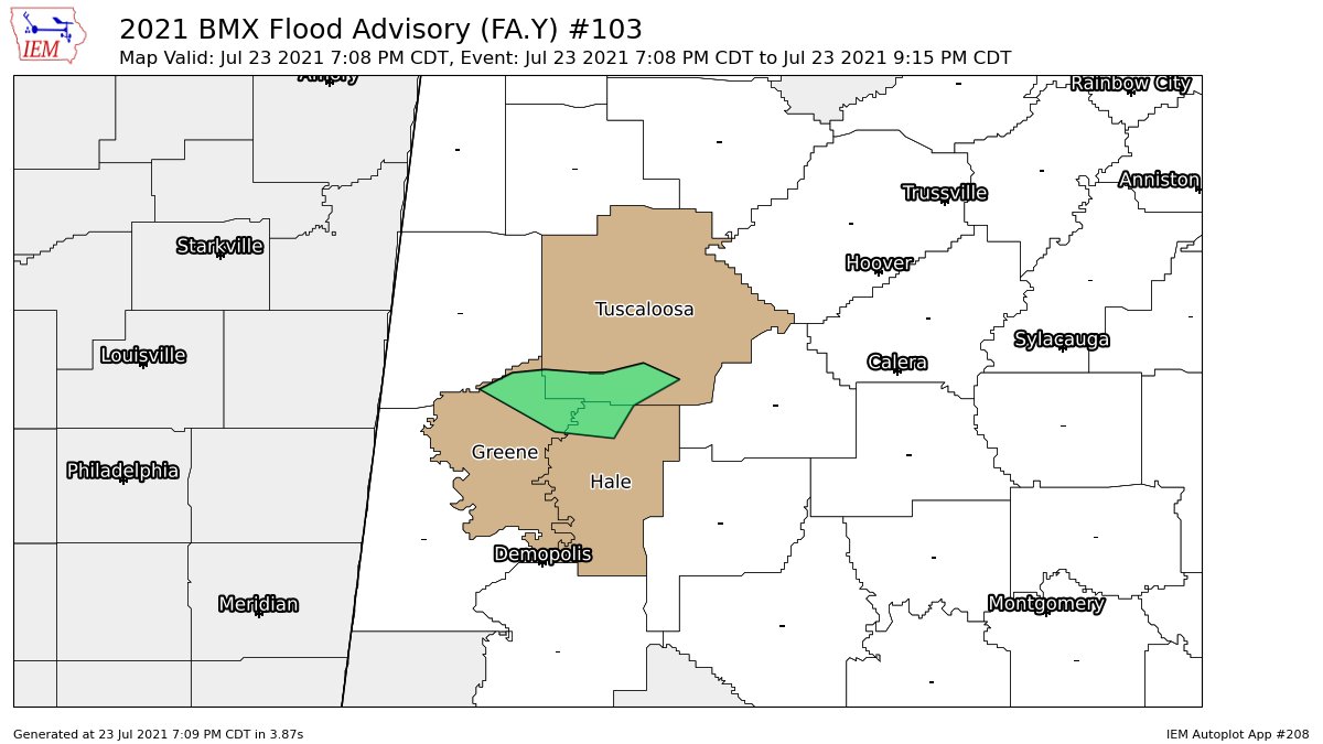
Flood Advisory for Parts of Greene, Hale, & Tuscaloosa Counties Until 9:15 pm
The National Weather Service in Birmingham has issued a
* Urban and Small Stream Flood Advisory for…
Northeastern Greene County in west central Alabama…
North Central Hale County in west central Alabama…
Southwestern Tuscaloosa County in west central Alabama…
* Until 915 PM CDT.
* At 708 PM CDT, Doppler radar indicated heavy rain due to
thunderstorms. This will cause urban and small stream flooding.
Between 1 and 2 inches of rain have fallen.
* Some locations that will experience flooding include…
Moundville, Union, Knoxville, Shelton State Community College,
Mantua, Ralph, Fosters, Mound State Park, Moundville Airport,
Elliots Creek, Hull, Snoddy, Maxwell, Little Sandy, Englewood and
Duncanville.
Additional rainfall amounts of 1 to 2 inches are expected over the
area. This additional rain will result in minor flooding.
PRECAUTIONARY/PREPAREDNESS ACTIONS…
Turn around, don’t drown when encountering flooded roads. Most flood
deaths occur in vehicles.
Please report observed flooding to local emergency services or law
enforcement and request they pass this information to the National
Weather Service when you can do so safely.
Category: Alabama's Weather, ALL POSTS
About the Author (Author Profile)
Scott Martin is an operational meteorologist, professional graphic artist, musician, husband, and father. Not only is Scott a member of the National Weather Association, but he is also the Central Alabama Chapter of the NWA president. Scott is also the co-founder of Racecast Weather, which provides forecasts for many racing series across the USA. He also supplies forecasts for the BassMaster Elite Series events including the BassMaster Classic.Subscribe
If you enjoyed this article, subscribe to receive more just like it.


