

CANCELED – Flash Flood Warning for Parts of Tuscaloosa County Until 10:15 pm
The National Weather Service in Birmingham has issued a
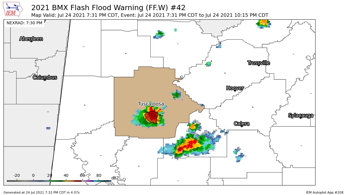
* Flash Flood Warning for…
Southern Tuscaloosa County in west central Alabama…
* Until 1015 PM CDT.
* At 731 PM CDT, Doppler radar indicated thunderstorms producing
heavy rain across the warned area. Between 1 and 1.5 inches of
rain have fallen. The expected rainfall rate is 3 to 4 inches in 1
hour. Additional rainfall amounts of 2 to 3 inches are possible in
the warned area. Flash flooding is ongoing or expected to begin
shortly.
HAZARD…Flash flooding caused by thunderstorms.
SOURCE…Radar.
IMPACT…Flash flooding of small creeks and streams, urban
areas, highways, streets and underpasses as well as
other poor drainage and low-lying areas.
* Some locations that will experience flash flooding include…
Tuscaloosa, Holt, University Mall, McFarland Mall, Bryant Denny
Stadium, University Of Alabama Quad and Taylorville.
PRECAUTIONARY/PREPAREDNESS ACTIONS…
Turn around, don’t drown when encountering flooded roads. Most flood
deaths occur in vehicles.
Please report observed flooding to local emergency services or law
enforcement and request they pass this information to the National
Weather Service when you can do so safely.
Category: Alabama's Weather, ALL POSTS
About the Author (Author Profile)
Scott Martin is an operational meteorologist, professional graphic artist, musician, husband, and father. Not only is Scott a member of the National Weather Association, but he is also the Central Alabama Chapter of the NWA president. Scott is also the co-founder of Racecast Weather, which provides forecasts for many racing series across the USA. He also supplies forecasts for the BassMaster Elite Series events including the BassMaster Classic.Subscribe
If you enjoyed this article, subscribe to receive more just like it.


