

No Surprise… Hot, Humid, with Scattered Afternoon Showers & Storms at Midday
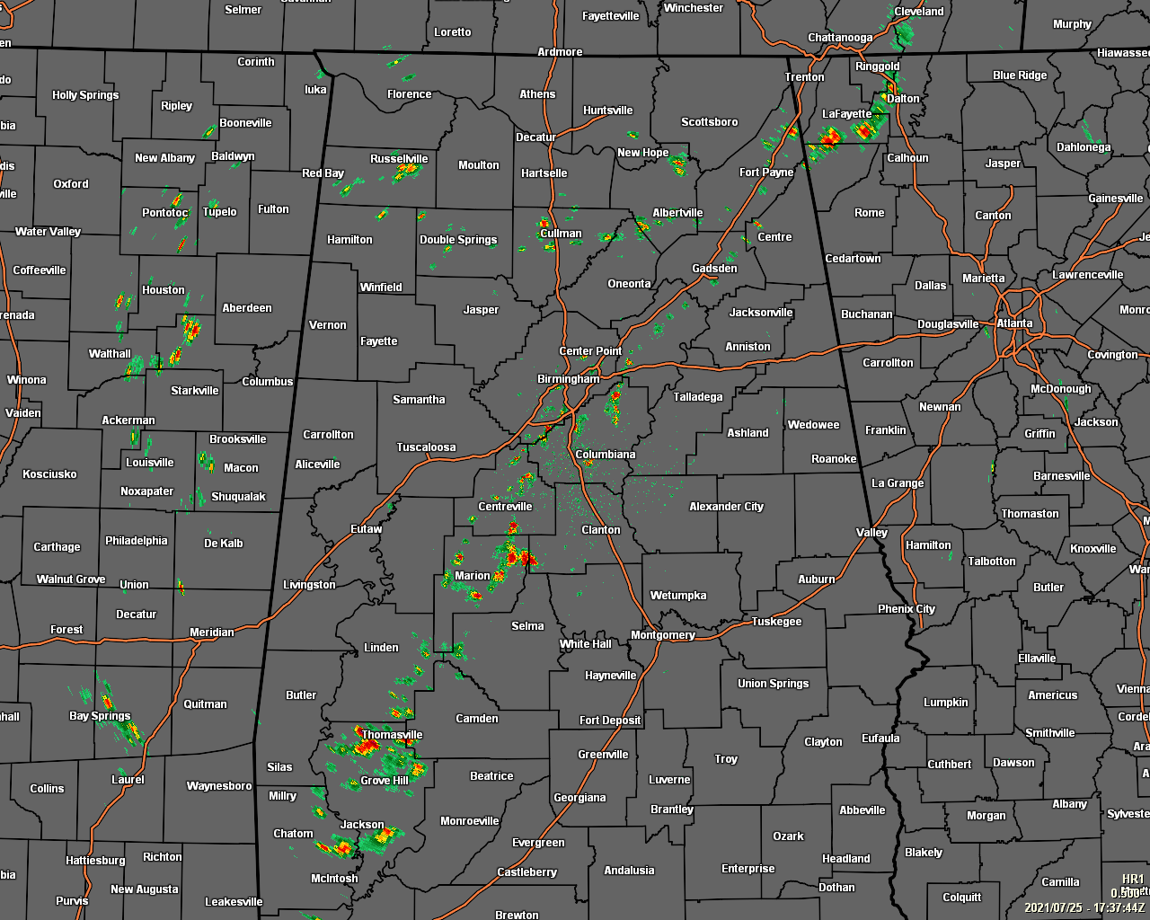
As expected, scattered showers and thunderstorms have developed mainly along the I-59 corridor and north of I-20 in the northern half of the area, and mainly in-between the I-65 and I-59/20 corridors in the southern half of the area. A few more spotty showers have formed across the northern half of the area and in North Alabama as well.
Temperatures as of the 12 pm roundup were in the mid 80s to the lower 90s already across the area. Demopolis was the hot spot at 91 degrees, while the cool spot was Birmingham, with heavy rain falling at that time, at 83 degrees.
It will continue to be hot and humid throughout the rest of the daylight hours with around a 50% chance of scattered showers and thunderstorms for much of the area north of the I-85 corridor, with lesser chances south of that. Afternoon highs will be in the upper 80s to the mid 90s. For tonight, after the shower and thunderstorm activity dies off by or just after sunset, expect areas of patchy fog to develop around waterways and where it rained late in the day. Other than the fog, skies will be partly to mostly clear, with lows only falling into the lower to mid-70s.
More scattered showers and thunderstorms will be possible for all of Central Alabama during the afternoon hours on Monday, but that activity will be likely along and north of I-20. No matter the rainfall, it will remain hot and humid, as highs will be in the upper 80s to the mid 90s.
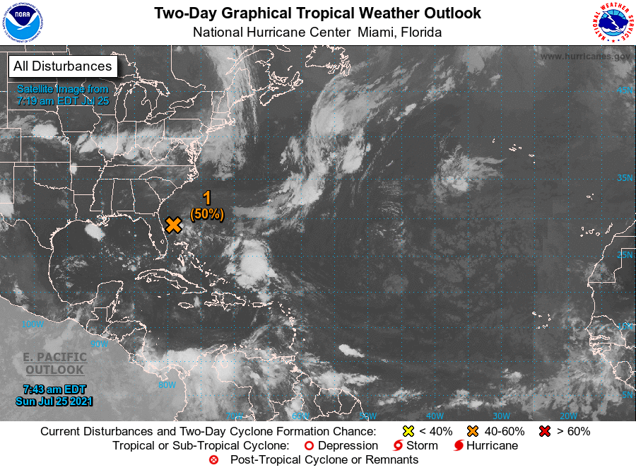
THE TROPICS: A well-defined low pressure area located about 160 miles east of Daytona Beach, Florida, continues to produce disorganized shower and thunderstorm activity mainly to the east and southeast of the center. Environmental conditions are expected to be marginally conducive for development, and a tropical depression could still form later today or early Monday while the system drifts westward toward the east coast of Florida. An Air Force Reserve reconnaissance aircraft is scheduled to investigate the low this afternoon, if necessary. Interests in Florida should continue to monitor the progress of this system.
Category: Alabama's Weather, ALL POSTS, Tropical
About the Author (Author Profile)
Scott Martin is an operational meteorologist, professional graphic artist, musician, husband, and father. Not only is Scott a member of the National Weather Association, but he is also the Central Alabama Chapter of the NWA president. Scott is also the co-founder of Racecast Weather, which provides forecasts for many racing series across the USA. He also supplies forecasts for the BassMaster Elite Series events including the BassMaster Classic.Subscribe
If you enjoyed this article, subscribe to receive more just like it.


