

Weather Xtreme: Increased Rain Chances Through Midweek; Little Drier by the End of the Week
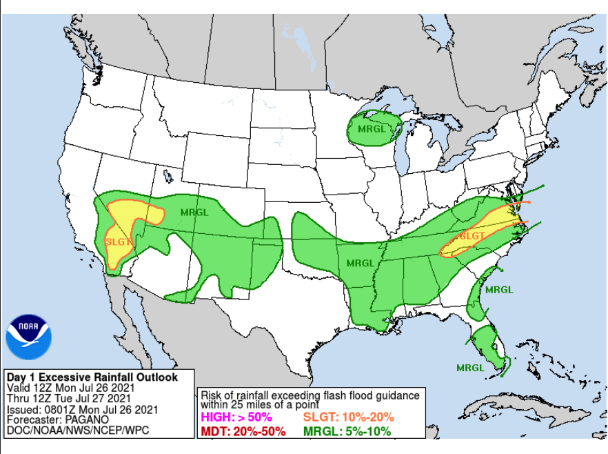
TODAY: The forecast will be pretty similar to what we saw across North/Central Alabama on Sunday, as we’ll start off the day with a decent amount of sunshine. Clouds will start building during the second half of the morning and scattered to numerous showers and thunderstorms will begin popping up mainly during the late morning through the early evening hours. These rain chances will be elevated over the Tennessee Valley and mainly north of the I-59 corridor, and with precipitable water values potentially reaching 2.2 inches, some of the heavier storms will produce some ponding and minor flooding issues. Just like Sunday, these storms will be slow-movers as well, which could also lead to those ponding and flooding issues. Highs across North Alabama will be in the mid-80s to the lower 90s, while Central Alabama will see highs in the upper 80s to the mid-90s. Heat index values may reach as high as 104º, so please be careful if having to work or be outside for extended amounts of time.
THIS WEEK: Ridging over the southeast will keep the area very humid and hot throughout this last week of July. Rain chances will stay elevated for Tuesday and Wednesday across the area as the tropical moisture involved with Invest 90L will move westward into the area. Tuesday looks to be the day with the highest rain chances for all of the area, while those higher rain chances will mainly be located over the southern half of the area for Wednesday. Highs on both days will be in the upper 80s to the mid-90s.
Thursday and Friday will be more of your typical summer days as ridging builds over the southeast. The good news is that overall rain chances look low enough that nearly everyone will stay dry with tons of sunshine, but a few isolated showers can’t be ruled out. Highs on both days will be in the lower to mid 90s.
THE WEEKEND AHEAD: A trough will start working its way into the area late on Friday and will bring an increase to the scattered afternoon to early evening shower and thunderstorm chances on Saturday and Sunday, at this point the odds will be around 40-50%. Highs on both days will be in the upper 80s to the mid 90s.
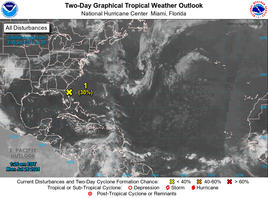
THE TROPICS: As of 1 am CDT this morning, we see that Invest 90L remains poorly organized as it was located around 45 miles to the east of St Augustine, Florida. Conditions are becoming less conducive before the system moves over land this morning in northeastern Florida or southeastern Georgia this morning. For Central Alabama, this will keep shower chances elevated over the southern half of the area on Tuesday and Wednesday. NHC has lowered the odds for development down to 30% over the next two days.
Category: Alabama's Weather, ALL POSTS, Tropical, Weather Xtreme Videos
About the Author (Author Profile)
Scott Martin is an operational meteorologist, professional graphic artist, musician, husband, and father. Not only is Scott a member of the National Weather Association, but he is also the Central Alabama Chapter of the NWA president. Scott is also the co-founder of Racecast Weather, which provides forecasts for many racing series across the USA. He also supplies forecasts for the BassMaster Elite Series events including the BassMaster Classic.Subscribe
If you enjoyed this article, subscribe to receive more just like it.


