

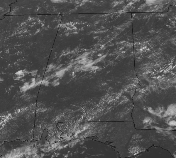
Midday Nowcast: Plenty of Sunshine & Hot
A downright miserable week of weather is ahead with lots of heat, even more humidity, and daily storms scattered about the Alabama landscape during the afternoon and evening hours. An upper ridge is in place over the region causing our weather to trend hotter. We are seeing plenty of sunshine as we approach the midday hours as the sky continues to be mainly sunny.
Still, with such a moisture rich air mass in place, we will have the daily risk of scattered showers and storms, rain chances any give day this week are in the 40-60% range. Of course, showers and storms this time of year produce a lot of lightning and are prolific rain producers as well, easily causing areas of isolated flash flooding. These daily storms are going to be the only heat relief as the days will feature a mix of sun and clouds and highs in the low to mid-90s. Before noon, most locations are just below the 90 degree mark.
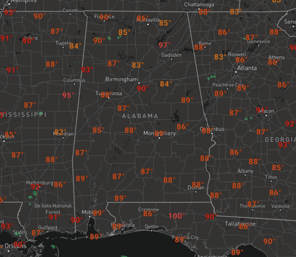
However, when you add in dew points in the mid-70s, heat index values this week will be well over 100° each afternoon this week, in fact we are forecasting these to be in the 100°-108° across the state, which could warrant some heat advisories later this week.
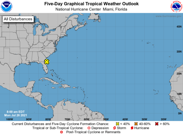
IN THE TROPICS: Still watching Invest 90L off the East Coast of Florida…Satellite images and radar data indicate that shower and thunderstorm activity associated with a low pressure system located a short distance east of Jacksonville, Florida, remains disorganized and limited in coverage. Development of this system has become less likely before the low moves inland over northeastern Florida or southeastern Georgia later today. However, interests in these areas should continue to monitor the progress of this system due to the possibility of brief periods of gusty winds and locally heavy rainfall. Formation chance through 48 hours…low…30 percent.
BEACH FORECAST CENTER: Get the latest weather and rip current forecasts for the beaches from Fort Morgan to Panama City on our Beach Forecast Center page. There, you can select the forecast of the region that you are interested in visiting.
WORLD TEMPERATURE EXTREMES: Over the last 24 hours, the highest observation outside the U.S. was 123.8F at Amarah, Iraq. The lowest observation was -99.6F at Vostok, Antarctica.
CONTIGUOUS TEMPERATURE EXTREMES: Over the last 24 hours, the highest observation was 118F at Death Valley, CA. The lowest observation was 28F at Peter Sinks, UT.
Category: Alabama's Weather, ALL POSTS
About the Author (Author Profile)
Macon, Georgia Television Chief Meteorologist, Birmingham native, and long time Contributor on AlabamaWX. Stormchaser. I did not choose Weather, it chose Me. College Football Fanatic. @Ryan_StinnetSubscribe
If you enjoyed this article, subscribe to receive more just like it.


