

Midday Nowcast: HOT, but Watching the Radar
A weak trough is moving through the upper-levels of the atmosphere, add in hot temperatures and high humidity, and the radar is going to be quite active later today.
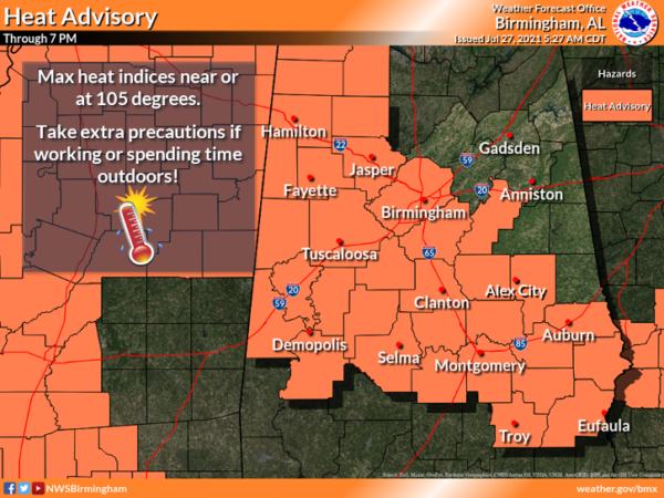
We are seeing a mix of sun and clouds today, temperatures will surge into the low and mid-90s, while heat index values are well over 100° at times, and could be as high as 108°. For this reason, the NWS in Birmingham has issued a Heat Advisory for much of Central Alabama for today as the combination of hot temps and high humidity will lead to dangerous heat levels this afternoon.
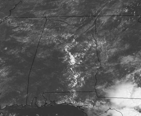
Big heat means big storms, and this afternoon we should see numerous showers and storms showing up across the Alabama landscape. Stronger storms will produce gusty winds and lots of lightning, plus tropical downpours could lead to isolated areas of flash flooding. Also, I would not be surprised if there were a few warnings today. Most of the rain and storm activity will gradually wind down overnight. A quick midday radar check shows storms starting to develop, but the more concentrated activity is to the south right now, near Montgomery.
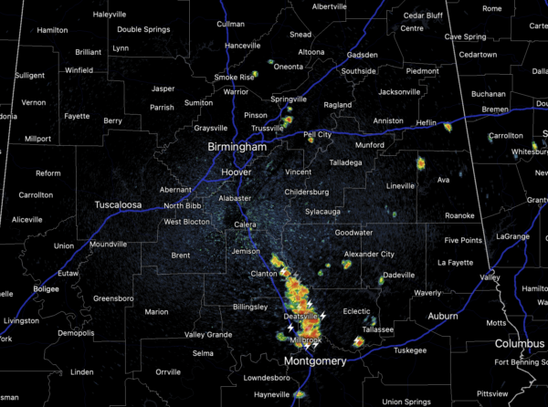
Storms will continue to expand in coverage through the rest of the afternoon. The general motion is off towards the southeast today.
REST OF WEEK: The upper ridge in place over the region and will begin to intensify, causing our weather to trend hotter. Still, with such a moisture rich air mass in place, we will have the daily risk of scattered showers and storms, rain chances tomorrow will be around 50%, but will likely decrease more to end the week, closer to the 20-30% range which is more typical for late July in Alabama. Temperatures to end the week will be in the mid and upper 90s and heat index will be well over 100° each afternoon, in fact we are forecasting these to be in the 100°-108° across the state, which could warrant additional heat advisories later this week.
IN THE TROPICS: Still watching Invest 90L but for now the remnants of a weak low pressure area that moved inland along the Georgia coastline last night are located just inland near the Georgia/South Carolina border and are producing a few showers and thunderstorms. Significant redevelopment of this system is not expected. Formation chance through 48 hours…low…near 0 percent.
BEACH FORECAST CENTER: Get the latest weather and rip current forecasts for the beaches from Fort Morgan to Panama City on our Beach Forecast Center page. There, you can select the forecast of the region that you are interested in visiting.
WORLD TEMPERATURE EXTREMES: Over the last 24 hours, the highest observation outside the U.S. was 124.3F at Omidieh, Iran. The lowest observation was -101.6F at Vostok, Antarctica.
CONTIGUOUS TEMPERATURE EXTREMES: Over the last 24 hours, the highest observation was 109F at Rio Grande Village, TX. The lowest observation was 26F at Peter Sinks, UT.
Category: Alabama's Weather, ALL POSTS
About the Author (Author Profile)
Macon, Georgia Television Chief Meteorologist, Birmingham native, and long time Contributor on AlabamaWX. Stormchaser. I did not choose Weather, it chose Me. College Football Fanatic. @Ryan_StinnetSubscribe
If you enjoyed this article, subscribe to receive more just like it.


