

A Few Strong Storms & Dangerous Heat Out There This Afternoon
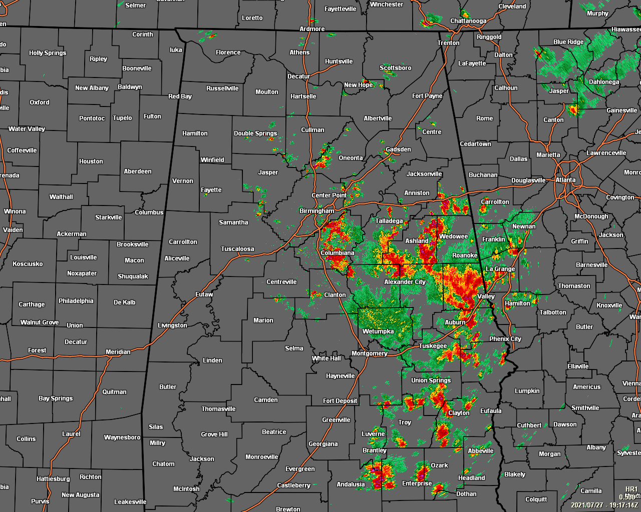
As of 2:20 pm, we have scattered to numerous showers and thunderstorms mainly occurring east of I-65 and south of I-20 producing plenty of rain, plenty of thunder, and some gusty winds at times. The strongest of those storms are over the locations in-between I-20 and I-85 in the eastern part of the area. For the northern and western halves of the area, coverage of showers and storms are pretty sparse at this point. All of this activity is slowly drifting to the east or southeast.
Temperatures as of the 2 pm roundup were in the mid-70s with rain-cooled air, to the lower 90s where the air has been untouched by rainfall so far. Eufaula, Selma, and Tuscaloosa were the hot spots at 93º, while the cool spot was Alexander City at 74º. Birmingham was at 89º.
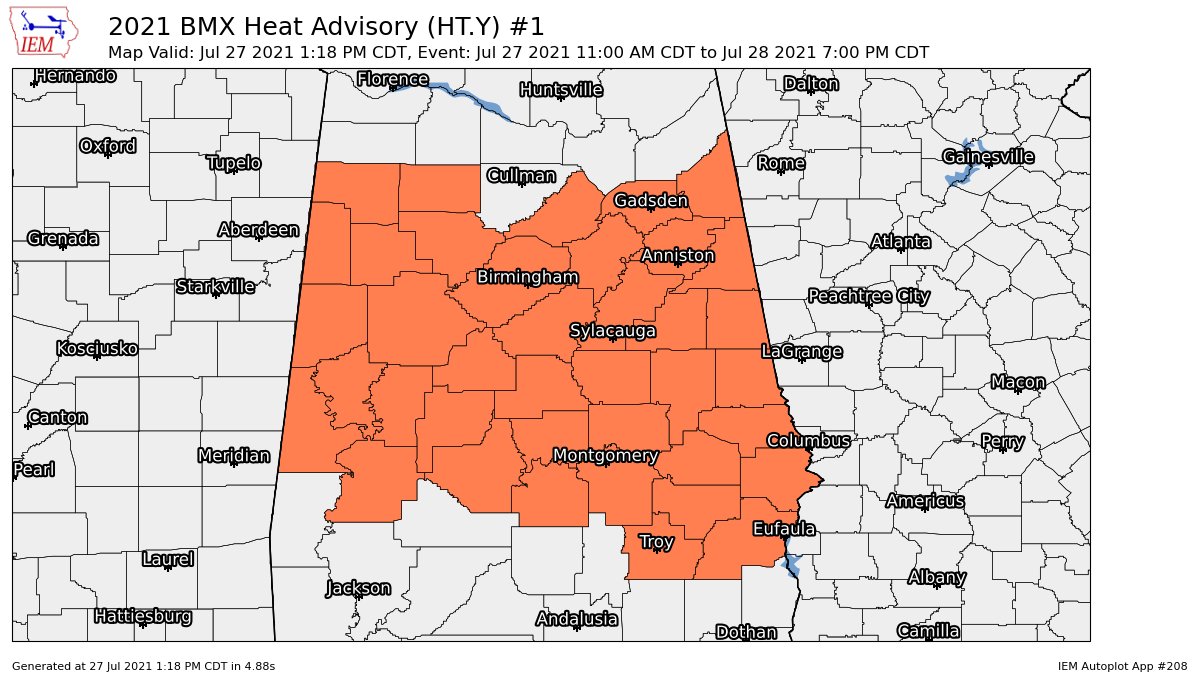
As mentioned in our previous post, the Heat Advisory has been extended in time until 7 pm Wednesday evening and expanded in area to include all counties in Central Alabama. Heat index readings will be in excess of 105 degrees this afternoon and again on Wednesday afternoon. I would not be surprised if it may be extended again on Thursday and possibly on Friday as highs across the area look to top out in the mid to upper 90s.
NWS Huntsville continues the Heat Advisory for Colbert, Franklin, Lauderdale, and Lawrence counties in North Alabama until 7 pm this evening. No word on any extension from their office yet.
Category: Alabama's Weather, ALL POSTS
About the Author (Author Profile)
Scott Martin is an operational meteorologist, professional graphic artist, musician, husband, and father. Not only is Scott a member of the National Weather Association, but he is also the Central Alabama Chapter of the NWA president. Scott is also the co-founder of Racecast Weather, which provides forecasts for many racing series across the USA. He also supplies forecasts for the BassMaster Elite Series events including the BassMaster Classic.Subscribe
If you enjoyed this article, subscribe to receive more just like it.


