


The National Weather Service in Birmingham has issued a
* Flash Flood Warning for…
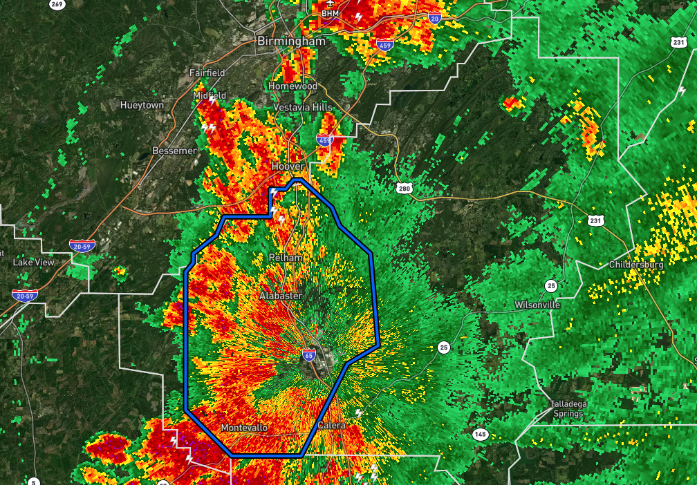
Southwestern Shelby County in central Alabama…
* Until 630 PM CDT.
* At 332 PM CDT, Doppler radar indicated thunderstorms producing
heavy rain across the warned area. Across parts of the warning
area, as much as 2 and 3 inches of rain have fallen onto already
wet ground, with additional heavy rain expected to continue. Flash
flooding is ongoing or expected to begin shortly.
HAZARD…Flash flooding caused by thunderstorms.
SOURCE…Radar.
IMPACT…Flash flooding of small creeks and streams, urban
areas, highways, streets and underpasses as well as
other poor drainage and low-lying areas.
* Some locations that will experience flash flooding include…
Hoover, Alabaster, Pelham, Helena, Calera, Montevallo, Indian
Springs Village, Wilton, Maylene, Shelby County Airport, American
Village, University Of Montevallo, Oak Mountain Amphitheater,
Riverchase, Oak Mountain State Park, Siluria, Alabaster Veterans
Park, Saginaw, Saddle Lake Farms and Camp Branch.
PRECAUTIONARY/PREPAREDNESS ACTIONS…
Turn around, don’t drown when encountering flooded roads. Most flood
deaths occur in vehicles.


