

EXPIRED – Severe T-Storm Warning for Parts of Calhoun, St. Clair, Talladega Co. Until 3:45 pm
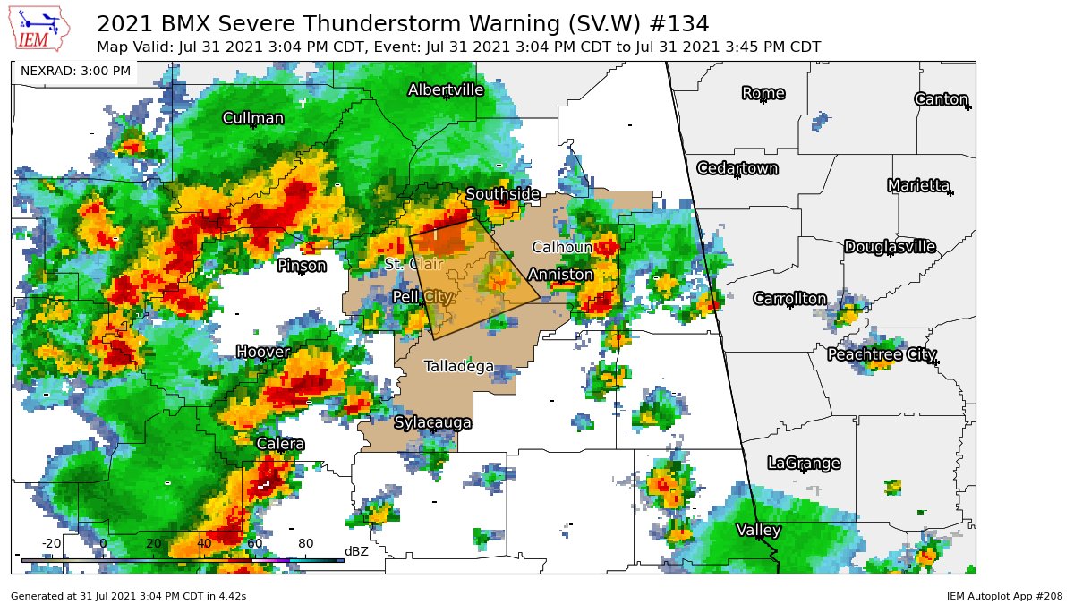
The National Weather Service in Birmingham has issued a
* Severe Thunderstorm Warning for…
North central Talladega County in east central Alabama…
Southwestern Calhoun County in east central Alabama…
Eastern St. Clair County in central Alabama…
* Until 345 PM CDT.
* At 304 PM CDT, a severe thunderstorm was located near Ragland, or
12 miles northeast of Odenville, moving southeast at 20 mph.
HAZARD…60 mph wind gusts.
SOURCE…Radar indicated.
IMPACT…Expect damage to roofs, siding, and trees.
* Locations impacted include…
Pell City, Lincoln, Ashville, Riverside, Ragland, Ohatchee,
Talladega Superspeedway, Honda Manufacturing Of Alabama, Bynum,
Talladega Municipal Airport, Logan Martin Lake, Neely Henry Lake,
Anniston Army Depot, St. Clair County Airport, Wattsville, Neely
Henry Dam, Eastaboga, Jackson Shoals and Cropwell.
PRECAUTIONARY/PREPAREDNESS ACTIONS…
For your protection move to an interior room on the lowest floor of a
building.
Category: Alabama's Weather, ALL POSTS, Severe Weather
About the Author (Author Profile)
Scott Martin is an operational meteorologist, professional graphic artist, musician, husband, and father. Not only is Scott a member of the National Weather Association, but he is also the Central Alabama Chapter of the NWA president. Scott is also the co-founder of Racecast Weather, which provides forecasts for many racing series across the USA. He also supplies forecasts for the BassMaster Elite Series events including the BassMaster Classic.Subscribe
If you enjoyed this article, subscribe to receive more just like it.


