

EXPIRED — Flash Flood Warning for Parts of Franklin Co. Until 8 pm
The National Weather Service in Huntsville has issued a
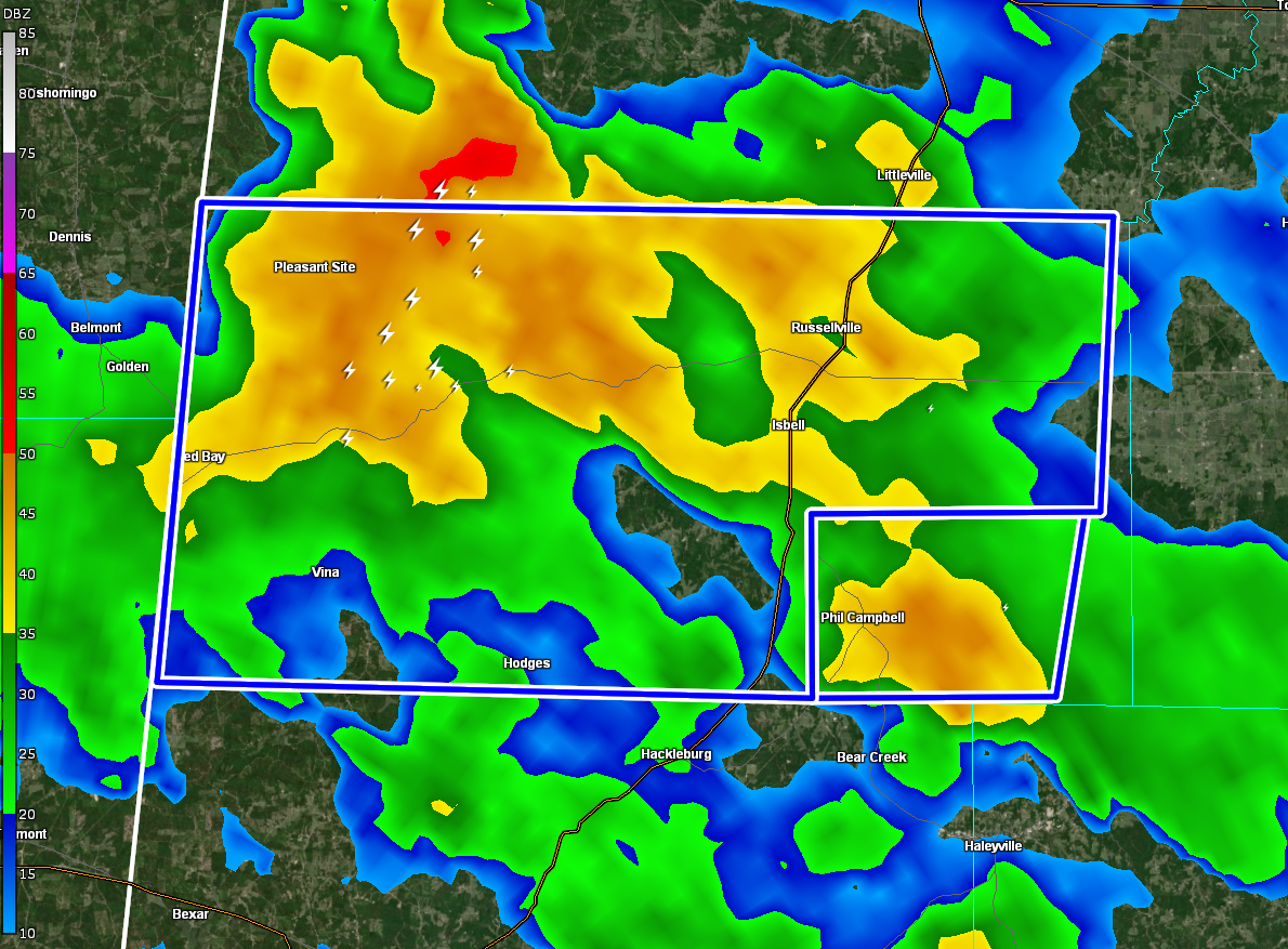
* Flash Flood Warning for…
Franklin AL County in northwestern Alabama…
* Until 800 PM CDT.
* At 551 PM CDT, Doppler radar indicated thunderstorms producing
heavy rain across the warned area. Between 1 and 3 inches of rain
have fallen. The expected rainfall rate is 1 to 2 inches in 1
hour. Flash flooding is ongoing or expected to begin shortly.
HAZARD…Flash flooding caused by thunderstorms.
SOURCE…Radar.
IMPACT…Flash flooding of small creeks and streams, urban
areas, highways, streets and underpasses as well as
other poor drainage and low-lying areas.
* Some locations that will experience flash flooding include…
Russellville, Red Bay, Littleville, Belgreen, Vina, Hodges, Little
Bear Creek Reservoir, Dempsey, Cedar Creek Reservoir, Rockwood,
Duketon, Isbell, Atwood, Halltown, Pleasant Site, Pogo, Tharptown,
Newburg and western Bankhead National Forest.
PRECAUTIONARY/PREPAREDNESS ACTIONS…
In hilly terrain there are hundreds of low water crossings which are
potentially dangerous in heavy rain. Do not attempt to cross flooded
roads. Find an alternate route.
Category: Alabama's Weather, ALL POSTS
About the Author (Author Profile)
Scott Martin is an operational meteorologist, professional graphic artist, musician, husband, and father. Not only is Scott a member of the National Weather Association, but he is also the Central Alabama Chapter of the NWA president. Scott is also the co-founder of Racecast Weather, which provides forecasts for many racing series across the USA. He also supplies forecasts for the BassMaster Elite Series events including the BassMaster Classic.Subscribe
If you enjoyed this article, subscribe to receive more just like it.


