

Weather Xtreme — A Few Strong Storms Possible Today
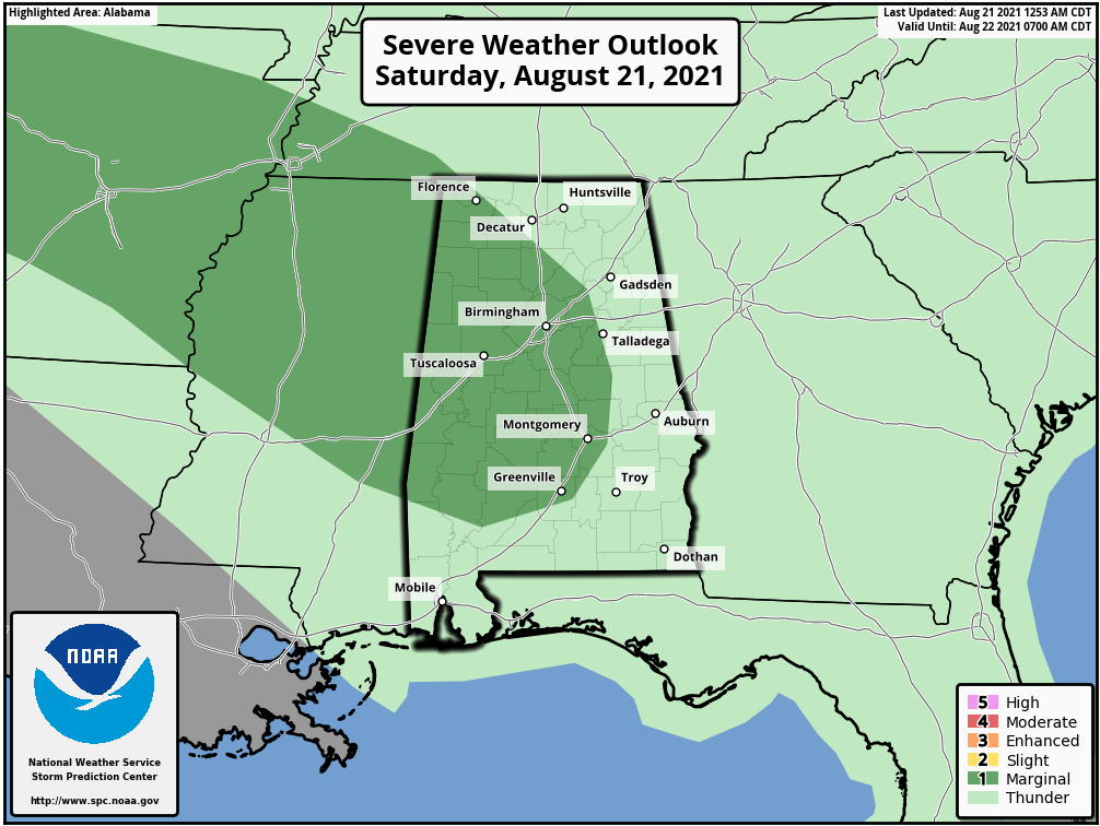
THIS WEEKEND: For today, we’ll have scattered showers and storms possible to start off the day, but storms will begin to move into the area by midday and quickly move southeast through Central Alabama throughout the afternoon and into the early evening hours. Some of these storms may become strong with gusty winds. As a matter of fact, the Storm Prediction Center has a Marginal Risk up for locations along and west of a line from Florence to Blountsville to Alexander City to Pike Road for the threat of damaging winds up to 60 mph. Heavier storms may produce some localized flooding issues as well. There is the potential for another round of storms to move in during the evening and late-night hours, but these will be weakening as the air will be worked over. Highs will be in the lower 80s to the lower 90s.
Scattered showers and storms will be possible for the northern half of the area on Sunday, with higher chances over the southern half. Highs will be in the upper 80s to the lower 90s.
THE WORK WEEK AHEAD: Ridging will take over the weather pattern across Central Alabama for to start off the work week. Monday will be a mostly sunny day with plenty of heat and only a very small chance of showers and storms over the southeastern parts of the area. Highs will be in the lower to mid-90s. Tuesday will feature a dry day with tons of sunshine. Highs will be in the lower to mid-90s.
On Wednesday, the ridging starts to weaken, which will bring back a chance of scattered showers and storms back into the forecast during the afternoon to early evening hours. Highs will be in the upper 80s to the lower 90s. Not much change for Thursday and Friday as there will be a good bit of sun to start each day with scattered showers and storms forming during the main heating of the day. Highs will be in the upper 80s to the lower 90s on both days.
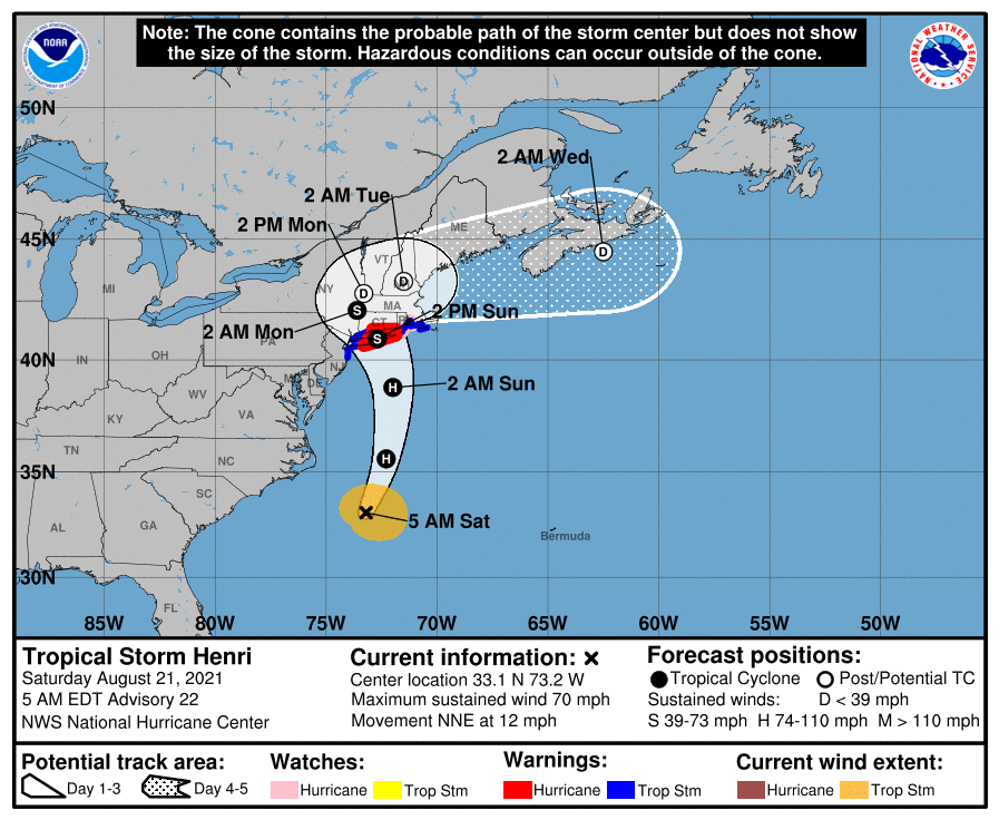
THE TROPICS: As of the 4 am update, Henri remains a strong tropical storm with maximum sustained winds at 70 mph and was located around 195 miles southeast of Cape Hatteras, North Carolina. Henri is expected to become a hurricane later this morning and the forecast track taking the center northward with an expected landfall on Long Island close to midday on Sunday as a category 1 hurricane. Dangerous storm surge is expected to start tonight from New Jersey to Cape Cod Bay, as surge heights could reach as high as 5 feet in some locations. Hurricane conditions are expected to begin tonight in those same regions, along with the threat of flooding due to the heavy rains. Deadly rip currents will continue to be likely along the east coast throughout the weekend.
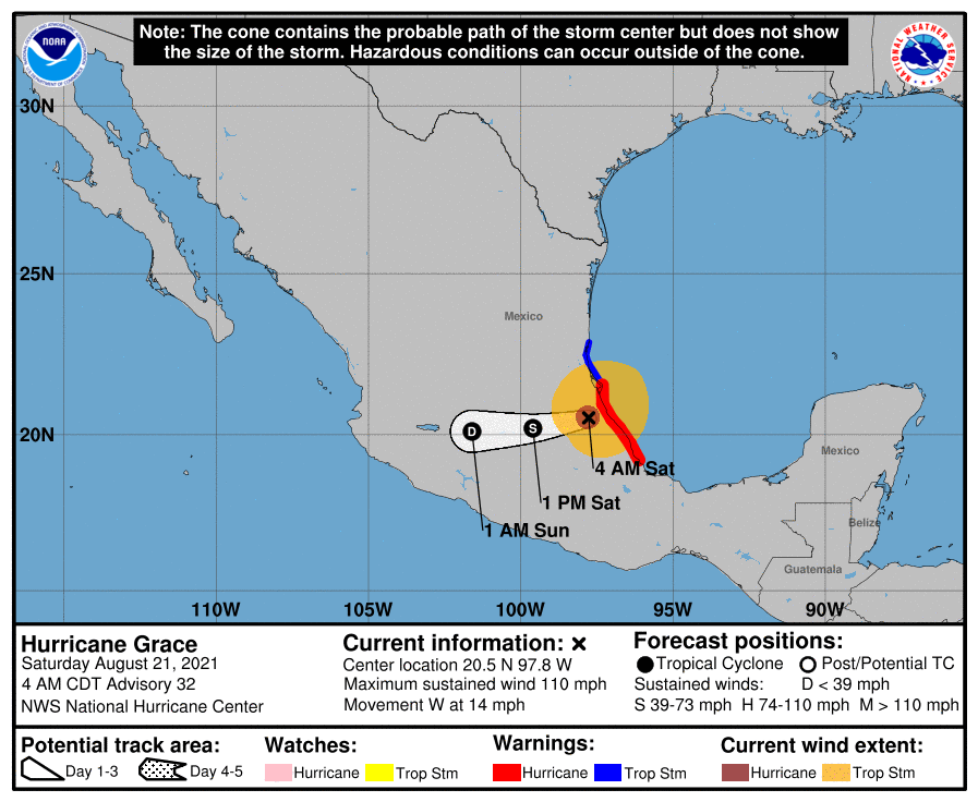
Also, Hurricane Grace moved onshore earlier this morning around midnight near Tecolutla, Mexico with maximum sustained winds at 125 mph. It has since weakened to 110 mph as of the 4 am update, but hurricane conditions with dangerous storm surge will continue for the next several hours from Puerto Veracruz to Cabo Rojo. Heavy rains will lead to significant flooding and the potential for mudslides in the mountainous regions in the area.
Category: Alabama's Weather, ALL POSTS, Severe Weather, Tropical, Weather Xtreme Videos
About the Author (Author Profile)
Scott Martin is an operational meteorologist, professional graphic artist, musician, husband, and father. Not only is Scott a member of the National Weather Association, but he is also the Central Alabama Chapter of the NWA president. Scott is also the co-founder of Racecast Weather, which provides forecasts for many racing series across the USA. He also supplies forecasts for the BassMaster Elite Series events including the BassMaster Classic.Subscribe
If you enjoyed this article, subscribe to receive more just like it.


