

Midday Nowcast: Dry Into The Weekend
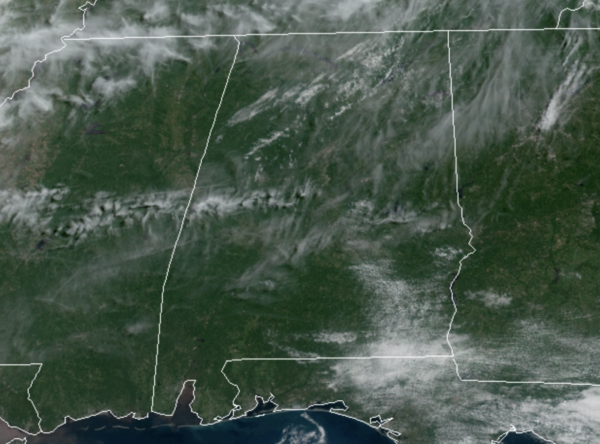
FANTASTIC FRIDAY: A refreshing start to day with many locations in the upper 50s, but as we roll into the afternoon hours, we are seeing plenty of sunshine warming us up into the upper 80s for most locations.
FRIDAY NIGHT LIGHTS: A great night for the high school football games tonight; the sky will be clear with temperatures falling from the low 80s at kickoff to the low 70s by the final whistle.
LABOR DAY WEEKEND: Sunny, very warm weather, and fair, pleasant nights are the forecast tomorrow and Sunday. Highs will be in the upper 80s for most locations, while lows will be in the 60s. Sunday looks mostly dry, but a few showers could creep into North Alabama late in the day and push south through the state Sunday night as a weak disturbance approaches from the north. For Monday, we will continue to mention a few possible showers or storms, but most locations will remain dry. Highs Monday will be in the upper 80s.
COLLEGE FOOTBALL FORECAST: Alabama takes on Miami in Atlanta tomorrow (2:30p CT kickoff on ABC 33/40)… the game will be played at Mercedes Benz Stadium with the roof open; the weather will be great with a sunny sky along with temperatures in the 80s.
Auburn hosts Akron tomorrow night (6:00p CT kickoff at Jordan-hare Stadium)… the sky will be clear with temperatures falling from 83 at kickoff into the mid 70s by the final whistle.
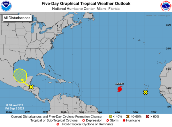
IN THE TROPICS: A surface trough over the Gulf of Honduras and portions of Central America is producing disorganized shower and thunderstorm activity. This system is expected to move west-northwestward across Central America and the Yucatan Peninsula, bringing heavy rains to that area during the next couple of days. The disturbance is expected to move over the southwestern Gulf of Mexico late this weekend, but unfavorable upper-level winds could limit significant development while the system moves northwestward or northward over the western Gulf of Mexico early next week. Formation chance through 5 days…low…30 percent. If it does develop it would be Mindy.
The other feature off the African coast is no longer a concern.
HURRICANE LARRY: The center of Hurricane Larry was located near latitude 14.8 North, longitude 40.7 West. Larry is moving
toward the west-northwest near 16 mph and this motion is expected to continue over the next few days. A turn to the northwest is forecast by early next week.
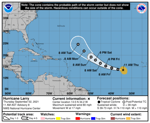
Maximum sustained winds are near 90 mph with higher gusts. Additional strengthening is forecast during the next few days, and Larry is forecast to become a major hurricane this weekend. Hurricane-force winds extend outward up to 30 miles from the center and tropical-storm-force winds extend outward up to 150 miles. The estimated minimum central pressure is 981 mb (28.97 inches).
BEACH FORECAST CENTER: Get the latest weather and rip current forecasts for the beaches from Fort Morgan to Panama City on our Beach Forecast Center page. There, you can select the forecast of the region that you are interested in visiting.
WORLD TEMPERATURE EXTREMES: Over the last 24 hours, the highest observation outside the U.S. was 120.6F at Jahra, Kuwait. The lowest observation was -94.7F at Nico, Antarctica.
CONTIGUOUS TEMPERATURE EXTREMES: Over the last 24 hours, the highest observation was 110F at Death Valley, CA. The lowest observation was 19F at Choteau, MT.
WEATHER ON THIS DATE IN 1861: Denver, CO, received 4.2 inches of snow, their earliest snow of record.
Category: Alabama's Weather, ALL POSTS
About the Author (Author Profile)
Macon, Georgia Television Chief Meteorologist, Birmingham native, and long time Contributor on AlabamaWX. Stormchaser. I did not choose Weather, it chose Me. College Football Fanatic. @Ryan_StinnetSubscribe
If you enjoyed this article, subscribe to receive more just like it.


