

Midday Nowcast: Sun, Clouds, Showers and Storms
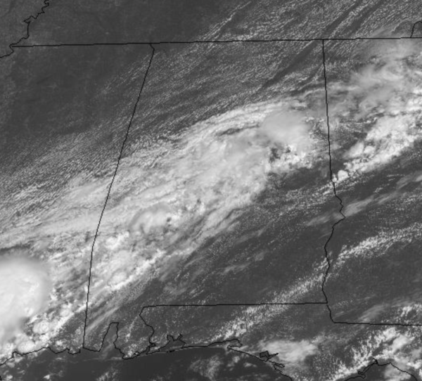
A weak front will continue to slowly move southward through Central Alabama today and has been producing scattered showers and thunderstorms across the area today.
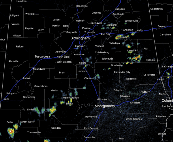
These will continue at times with more clouds than sun for at least the southern two-thirds of the state. Highs today across are the state are ranging from the lower 80s to the lower 90s.
REST OF THIS WEEK: The front stalls out across the region for Tuesday with scattered showers and and storms remaining in the forecast and those will continue into Wednesday as well. By late Wednesday and into Thursday, another front will drop into the state, and will bring a drier air mass into the state setting the stage for a very nice September weekend of weather for Alabama. Highs this week will be in the mid to upper 80s.
FRIDAY AND THE WEEKEND: Dry air settles into the state with Friday morning lows in the upper 50s and lower 60s. For Friday, Saturday, and Sunday, expect sunny, dry days and it will remain comfortable. Highs Friday will be in the mid 80s, followed by upper 80s Saturday and Sunday.
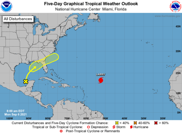
IN THE TROPICS: Disorganized showers and thunderstorms over the northern portion of the Yucatan Peninsula and south-central Gulf of Mexico are associated with a surface trough and an upper-level disturbance. The system is forecast to move slowly northward or northeastward over the central and then northeastern Gulf of Mexico, likely reaching the northern Gulf coast in a few days. Although upper-level winds are currently unfavorable for development to occur, they are expected to become marginally conducive for tropical cyclone formation in a couple of days. The disturbance is then expected to cross the southeastern United States beginning midweek, and some development will be possible once it emerges over the Atlantic waters late this week. Formation chance through 5 days…low…30 percent.
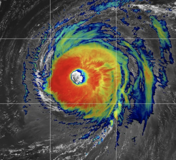
HURRICANE LARRY: The center of Hurricane Larry was located near latitude 22.1 North, longitude 52.9 West. Larry is moving toward the northwest near 10 mph, and this general motion is expected to continue through Wednesday, followed by a turn toward the north-northwest and north on Thursday.
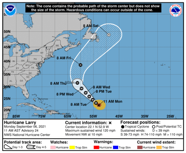
Maximum sustained winds are near 120 mph with higher gusts. Larry is a category 3 hurricane on the Saffir-Simpson Hurricane Wind Scale. Some fluctuations in intensity are possible during the next couple of days. Thereafter, some gradual weakening is forecast. Larry is a large hurricane. Hurricane-force winds extend outward up to 70 miles from the center, and tropical-storm-force winds extend outward up to 175 miles. The estimated minimum central pressure is 956 mb (28.23 inches).
SURF: Swells generated by Larry are affecting the Lesser Antilles and are expected to spread westward to portions of the Greater Antilles, the Bahamas, and Bermuda today through Tuesday. Significant swells should reach the east coast of the United States and Atlantic Canada by midweek and continue affecting these shores through the end of the week. These swells are likely to cause life-threatening surf and rip current conditions.
BEACH FORECAST CENTER: Get the latest weather and rip current forecasts for the beaches from Fort Morgan to Panama City on our Beach Forecast Center page. There, you can select the forecast of the region that you are interested in visiting.
WORLD TEMPERATURE EXTREMES: Over the last 24 hours, the highest observation outside the U.S. was 118.0F at Jahra, Kuwait. The lowest observation was -93.3F at Dome C, Antarctica.
CONTIGUOUS TEMPERATURE EXTREMES: Over the last 24 hours, the highest observation was 116F at Death Valley, CA. The lowest observation was 19F at Peter Sinks, UT.
Category: Alabama's Weather, ALL POSTS
About the Author (Author Profile)
Macon, Georgia Television Chief Meteorologist, Birmingham native, and long time Contributor on AlabamaWX. Stormchaser. I did not choose Weather, it chose Me. College Football Fanatic. @Ryan_StinnetSubscribe
If you enjoyed this article, subscribe to receive more just like it.


