

Dry Air Returns To Alabama Thursday
**No afternoon Weather Xtreme video today; back to the two a day schedule tomorrow**
RADAR CHECK: It is a mixed bag of weather across Alabama; the sky is mostly sunny across the Tennessee Valley, and also the southeast part of the state, but scattered showers and storms continue over central counties. they are moving eastward and and producing moderate to heavy rain in a few spots along with some lightning. Temperatures are mostly in the 80s; we will maintain the chance of showers tonight, although they should diminish after sunset.
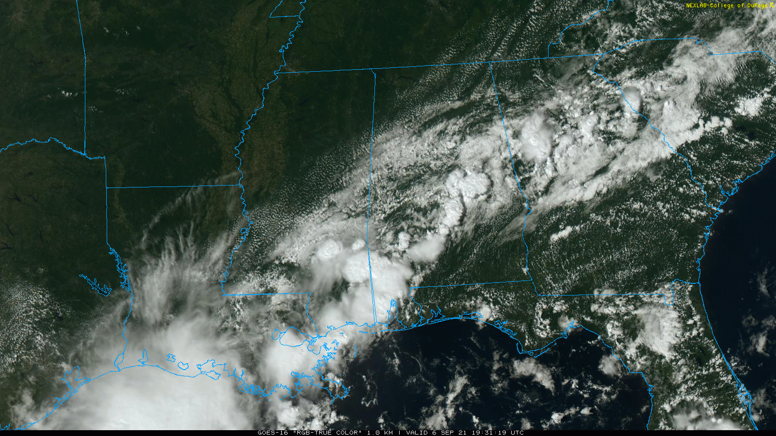
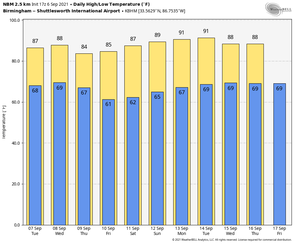
The weather won’t change much tomorrow and Wednesday… we expect a mix of and clouds both days with a few scattered showers and thunderstorms, mainly south of I-59 (Tuscaloosa to Birmingham to Gadsden to Fort Payne). Highs will be mostly in the 84-88 degree range, slightly below average values for early September in Alabama. The chance of any one spot getting wet both days is 30-40 percent.
THURSDAY THROUGH THE WEEKEND: A nice surge of dry air rolls into the state Wednesday night, and that will set the stage for rain-free weather Thursday through Sunday with sunny warm days and clear pleasant nights. Highs will be in the mid 80s Thursday and Friday, followed by upper 80s over the weekend. Lows will be mostly in the 60s, but many communities across North/Central Alabama will dip into the cool 50s early Friday morning.
NEXT WEEK: Dry weather continues Monday and Tuesday with highs around 90 degrees, then moisture levels rise and scattered showers and thunderstorms are possible Wednesday through Friday with highs in the upper 80s.
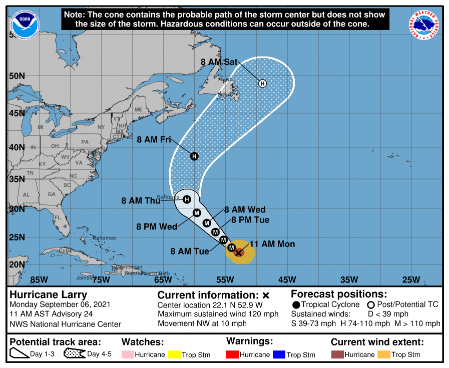
TROPICS: Hurricane Larry still has sustained winds of 120 mph in the central Atlantic. It will recurve into the Atlantic well east of the U.S. and east of Bermuda, but large swells will reach the East Coast later this week.
In the southern Gulf of Mexico, disorganized showers and thunderstorms are associated with a surface trough and an upper-level disturbance. The system is forecast to move slowly northward or northeastward over the central and then northeastern Gulf of Mexico, likely reaching the northern Gulf coast in a few days. Although upper-level winds are currently unfavorable for development to occur, they are expected to become marginally conducive for tropical cyclone formation in a couple of days. The disturbance is then expected to cross the southeastern United States beginning midweek, and some development will be possible once it emerges over the Atlantic waters late this week.

This feature will have no impact on most of Alabama, but it could bring increased shower coverage to the central Gulf Coast late Wednesday and Thursday.
The rest of the Atlantic basin is quiet.
ON THIS DATE IN 1881: Forest fires in “The Thumb” of Michigan and Ontario resulted in “Yellow Day” over the New England states. Twenty villages and over a million acres burned in Michigan. The smoke from these fires caused the sky to appear yellow over several New England cities. Twilight appeared at noon on this day.
ON THIS DATE IN 1933: The remnant low of the Treasure Coast Hurricane dumped 10.33? of rain in Charleston, which is the second-highest 24-hour rainfall total on record for the downtown station. The storm produced wind gusts of 51 mph and also spawned a tornado near the city.
ON THIS DATE IN 2017: Category 5 Hurricane Irma affected the US Virgin Island and Puerto Rico. Maximum sustained winds were at 180 mph when the storm hit St. Thomas and St. John. Catastrophic damage was reported over the US Virgin Island & significant damage over Puerto Rico, especially over Culebra.
BEACH FORECAST: Click here to see the AlabamaWx Beach Forecast Center page.
WEATHER BRAINS: Don’t forget you can listen to our weekly 90 minute show anytime on your favorite podcast app. This is the show all about weather featuring many familiar voices, including our meteorologists here at ABC 33/40.
CONNECT: You can find me on all of the major social networks…
Look for the next Weather Xtreme video here by 6:00 a.m. tomorrow…
Category: Alabama's Weather, ALL POSTS
About the Author (Author Profile)
James Spann is one of the most recognized and trusted television meteorologists in the industry. He holds the AMS CCM designation and television seals from the AMS and NWA. He is a past winner of the Broadcast Meteorologist of the Year from both professional organizations.Subscribe
If you enjoyed this article, subscribe to receive more just like it.


