

Tropical Storm Warnings Issued for the Florida Panhandle as Tropical Storm Mindy Forms in the NE Gulf of Mexico
SUMMARY OF 400 PM CDT…2100 UTC…INFORMATION
———————————————-
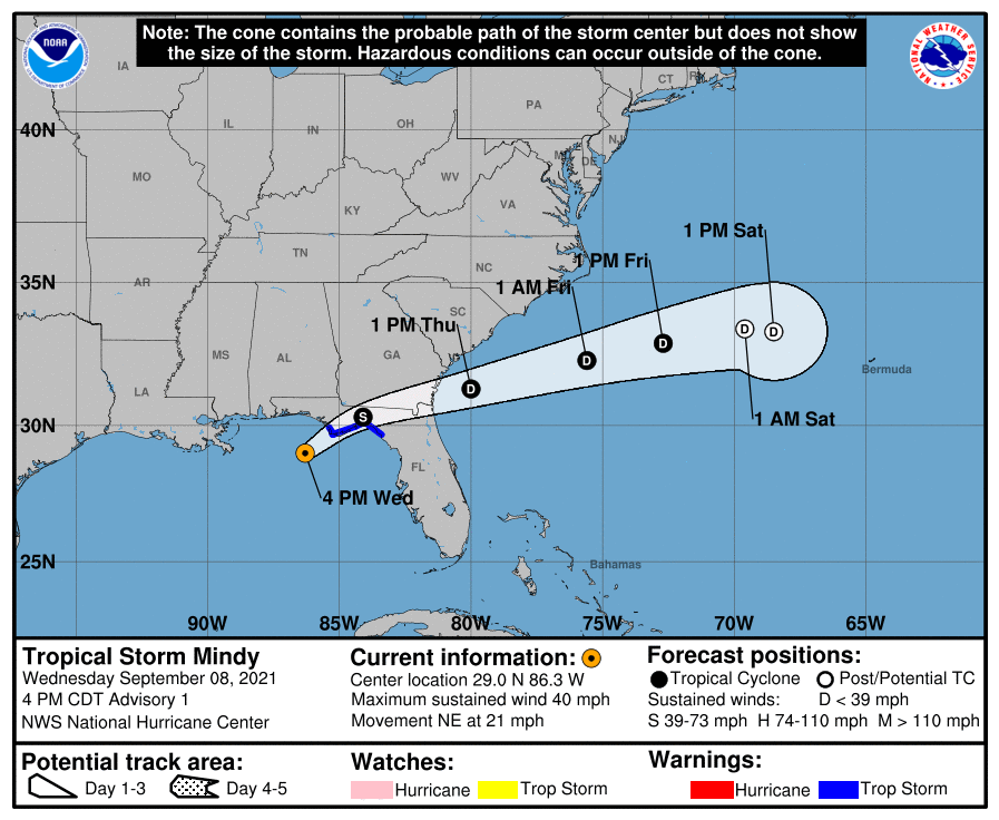
LOCATION…29.0N 86.3W
ABOUT 90 MI…150 KM WSW OF APALACHICOLA, FLORIDA
MAXIMUM SUSTAINED WINDS…40 MPH…65 KM/H
PRESENT MOVEMENT…NE OR 50 DEGREES AT 21 MPH…33 KM/H
MINIMUM CENTRAL PRESSURE…1008 MB…29.77 INCHES
WATCHES AND WARNINGS
——————–
SUMMARY OF WATCHES AND WARNINGS IN EFFECT:
A Tropical Storm Warning is in effect for…
* Mexico Beach to Steinhatchee River Florida
DISCUSSION AND OUTLOOK
———————-
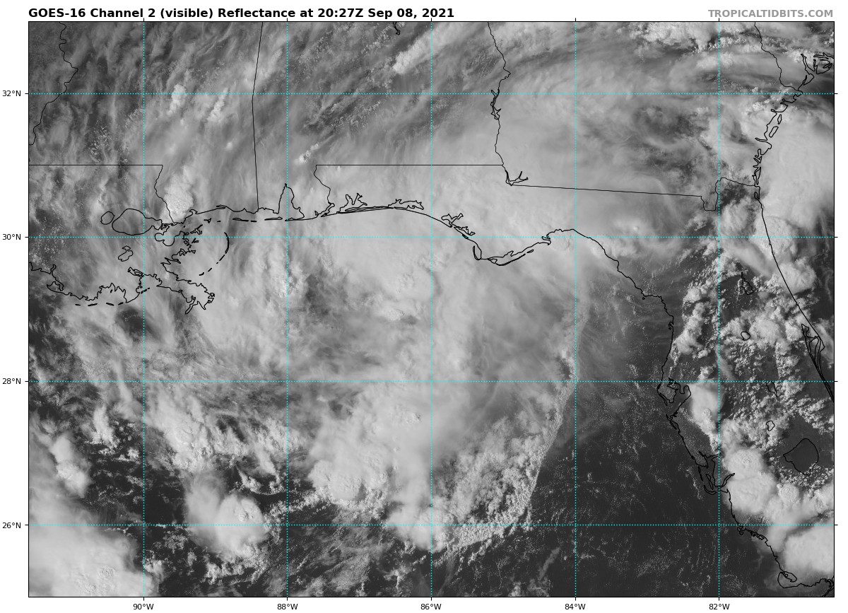
At 400 PM CDT (2100 UTC), the center of Tropical Storm Mindy was located near latitude 29.0 North, longitude 86.3 West. Mindy is moving toward the northeast near 21 mph (33 km/h) and northeast to east-northeastward motion is expected to continue over the next several days. On the forecast track, the center of Mindy is expected to cross the coastline of the Florida Panhandle later tonight, and then move offshore of the southeastern United States into the western Atlantic Ocean by tomorrow.
Maximum sustained winds are near 40 mph (65 km/h) with higher gusts. Little change in strength is expected before Mindy makes landfall in the Florida Panhandle tonight. Tropical-storm-force winds extend outward up to 35 miles (55 km) from the center. The estimated minimum central pressure is 1008 mb (29.77 inches).
KEY MESSAGES
———————-
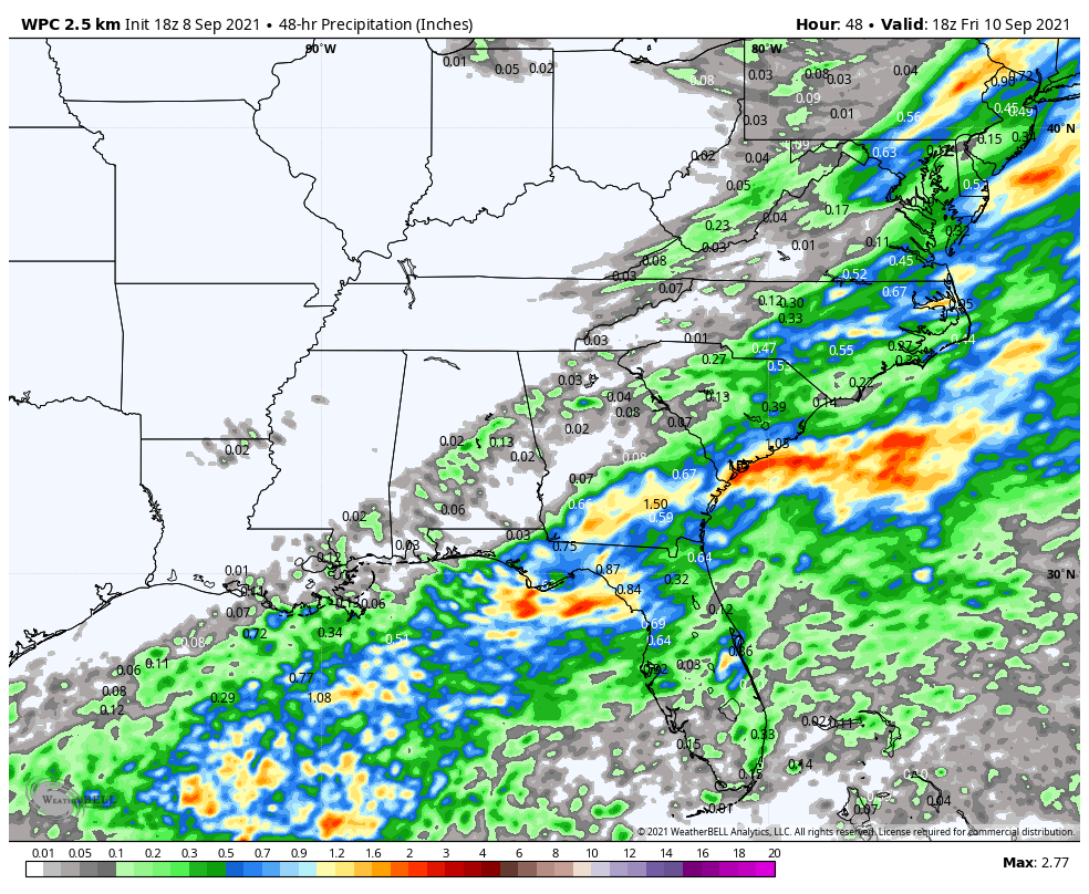
1. Mindy is expected to produce heavy rainfall from the Florida Panhandle into southern portions of Georgia and South Carolina through Thursday morning. This rainfall may produce isolated to scattered flash, urban, and small stream flooding.
2. Tropical storm conditions are expected through tonight in portions of the Florida Panhandle where a Tropical Storm Warning is in effect.
HAZARDS AFFECTING LAND
———————-
RAINFALL: Mindy is expected to produce storm total rainfall of 2 to 4 inches, with maximum amounts of 6 inches across the Florida Panhandle into southern portions of Georgia and South Carolina through Thursday morning. This rainfall may produce isolated to scattered flash, urban, and small stream flooding.
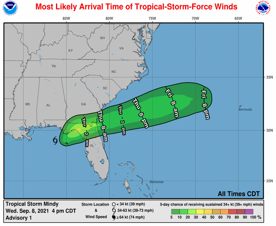
WIND: Tropical storm conditions are expected to reach the coast within the warning area later this evening and tonight.
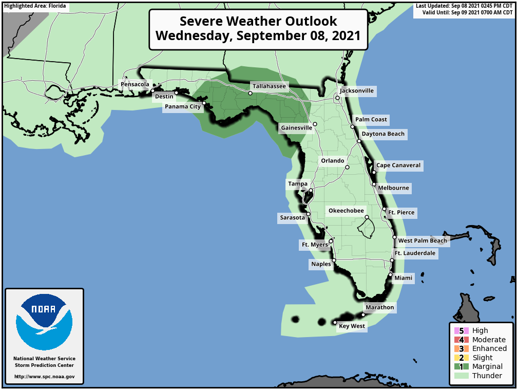
TORNADOES: A few isolated tornadoes are possible over portions of the Florida Panhandle this evening into tomorrow morning.
Category: ALL POSTS, Severe Weather, Tropical
About the Author (Author Profile)
Scott Martin is an operational meteorologist, professional graphic artist, musician, husband, and father. Not only is Scott a member of the National Weather Association, but he is also the Central Alabama Chapter of the NWA president. Scott is also the co-founder of Racecast Weather, which provides forecasts for many racing series across the USA. He also supplies forecasts for the BassMaster Elite Series events including the BassMaster Classic.Subscribe
If you enjoyed this article, subscribe to receive more just like it.


