

A Quick Sunday Evening Look at the Tropics
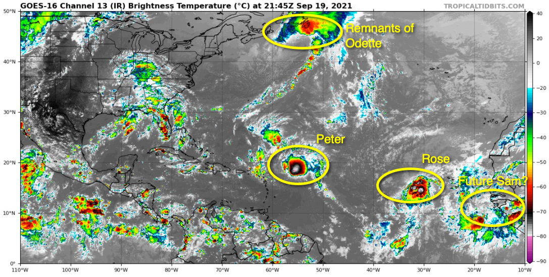
Tropical Depression 17 was upgraded to Tropical Storm Rose on the 4 p.m. advisory this afternoon. Top winds are 40 mph. The center of the weak tropical storm is about 2,100 miles east of the Leeward Islands. Moving northwest at 16 mph, it will remain over open water for its foreseeable life.
Tropical Storm Peter is 540 miles east of San Juan PR tonight. It developed quite an explosion of convection near and east of its center this afternoon, but the storm is strongly sheared, and that shear is expected to remove most of that convection tonight. The Hurricane Hunters did find enough evidence to increase the top winds to 45 mph. It is moving WNW at 17 mph and at its closest approach, the center of Peter will pass about 200 miles northeast of San Juan, keeping the northern Leewards and Puerto Rico out of harm’s way. Top winds are not expected to diminish as we go through the next couple of days, and Peter is expected to weaken to a Depression by Wednesday.
Elsewhere in the tropics, a disturbance moving off the coast of Africa has a pretty high chance of developing according to the NHC. The GFS keeps it at a lower latitude over the next few days, developing it slowly, but turning it northwest in time to miss the islands, and then moves the upper level high over the western Atlantic out of the way in time for it to recurve away from the United States. Lots of time for that to be watched. It is likely to become Sam.
We had written Odette off Friday night, but its remnants may redevelop subtropical or tropical characteristics as it has turned southeastward over the North-Central Atlantic Ocean.
About the Author (Author Profile)
Bill Murray is the President of The Weather Factory. He is the site's official weather historian and a weekend forecaster. He also anchors the site's severe weather coverage. Bill Murray is the proud holder of National Weather Association Digital Seal #0001 @wxhistorianSubscribe
If you enjoyed this article, subscribe to receive more just like it.


