

Quiet Weather Continues With Warm Afternoons
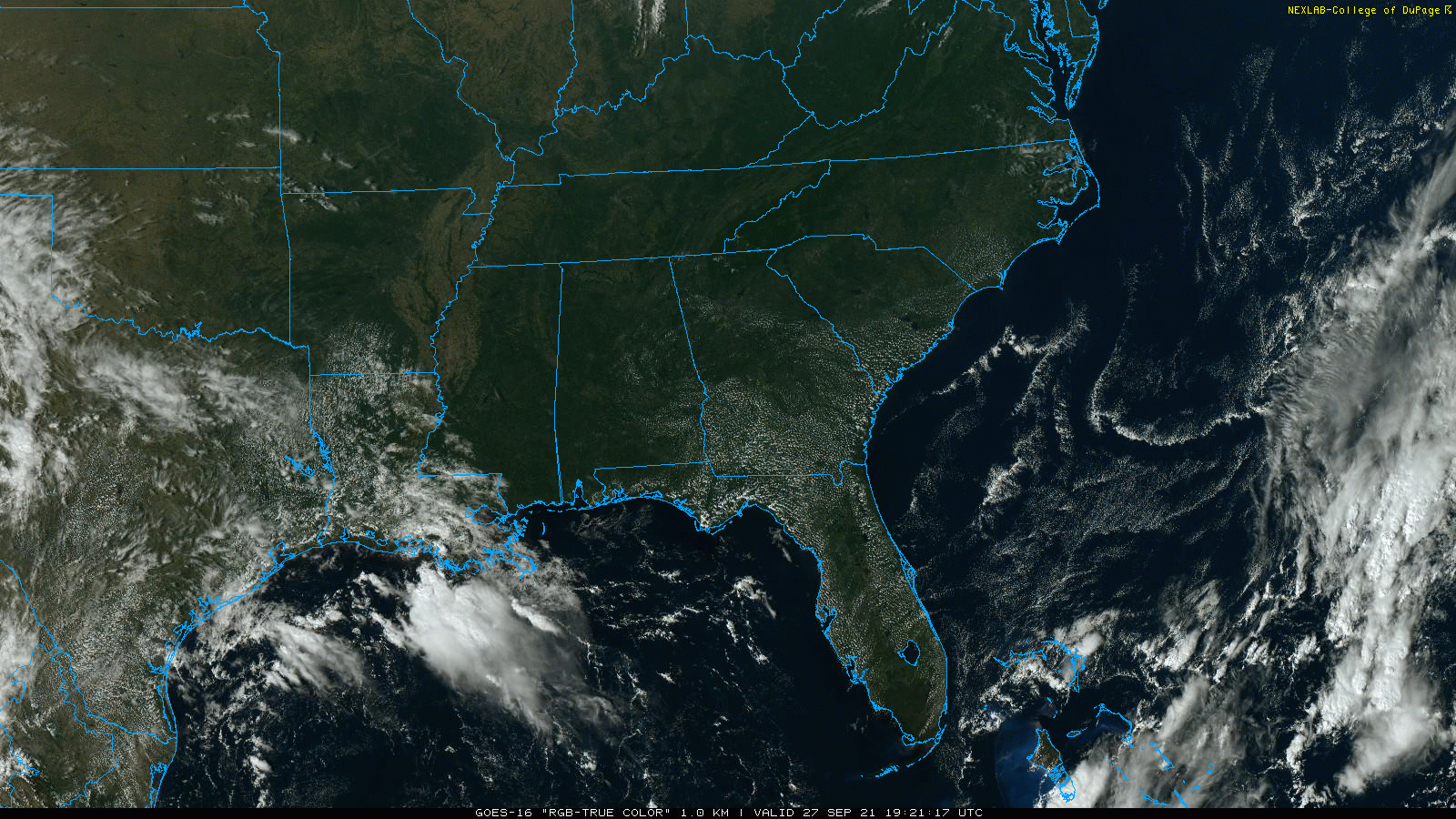
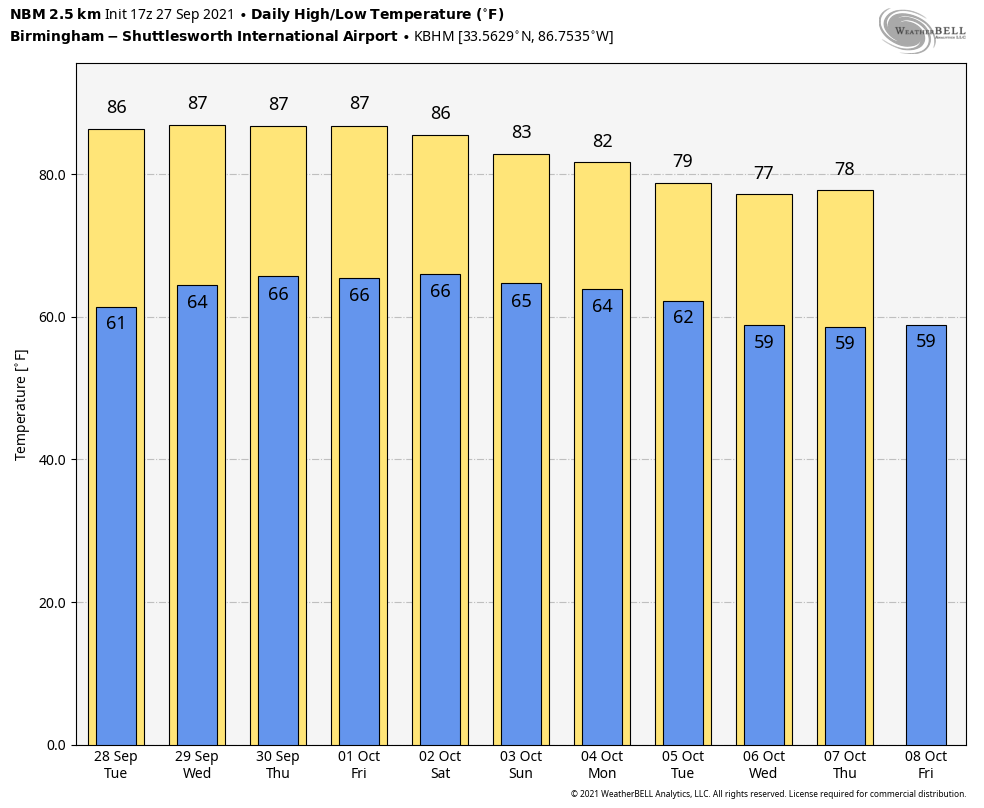
SUNNY MONDAY: No rain on radar across Alabama this afternoon; the sky is mostly sunny with temperatures mostly in the low to mid 80s. The sky will stay clear tonight with a low between 57 and 65 degrees for most places.
Tomorrow and Wednesday will be warm and mostly dry; a brief shower could pop up somewhere Wednesday afternoon over West Alabama, but for now the chance of any one spot getting wet is 10 percent or less, and we won’t mention it in our forecast. The high tomorrow will be in the mid 80s, followed by upper 80s Wednesday.
THURSDAY THROUGH THE WEEKEND: Moisture levels will rise a bit, and we will introduce the chance of isolated showers each day Thursday through Sunday. Understand when we say “isolated” that means most places won’t see any rain; odds of any one location getting wet each day is only 15-25 percent. Otherwise, expect partly to mostly days, fair night, and highs in the mid 80s. Sunday will be a bit cooler with a cold front pushing trough the state, the high will drop into the 78-82 degree range.
NEXT WEEK: A few isolated showers remain possible Monday, but the rest of the week looks mostly dry and cooler with highs dropping into the 70s and lows in the 50s. See the Weather Xtreme video for maps, graphics, and more details.
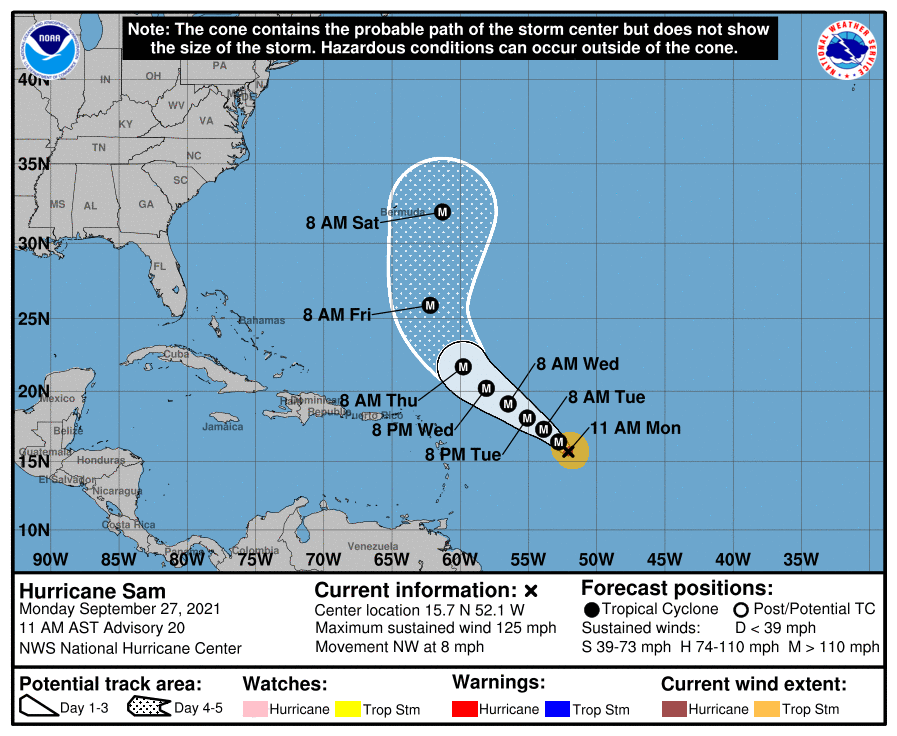
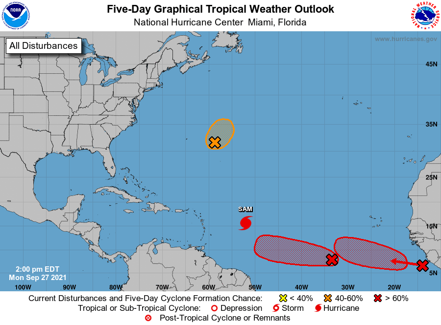
TROPICS: Sam has sustained winds of 125 mph, and is in the Atlantic about 740 miles east/southeast of the northern Leeward Islands. Sam is still forecast to remain a major hurricane over the next five days; it is expected to be east of Bermuda Saturday. From there is turns northeast into the open Atlantic; Sam will remain well east of the U.S.
There are two waves in the far eastern Atlantic with a high chance of becoming a tropical depression or storm over the next five days; still too early to know if they will impact the Lesser Antilles or the U.S. The Gulf of Mexico will remain vert quiet through the weekend.
RAIN UPDATE: These are rain totals since January 1, and the departure from average…
Mobile 72.93″ (+20.54″)
Tuscaloosa 58.76″ (+18.79″)
Huntsville 54.53″ (+14.43″)
Birmingham 54.11″ (+10.45″)
Dothan. 51.83″ (+9.72″)
Muscle Shoals 50.65″ (+9.99″)
Montgomery 44.27″ (+5.31″)
Anniston 38.94″ (-0.37″)
ON THIS DATE IN 1906: The second September storm of 1906 was one of great violence. On the 27th the hurricane reached the central Gulf Coast with destructive winds and unprecedented tides. At Pensacola, the tide was 10 feet above normal. At Mobile property damage was severe. An estimated 134 lives were lost on the central Gulf Coast from this storm.
ON THIS DATE IN 1985: Hurricane Gloria swept over the Outer Banks then rushed across Long Island, New England, and Canada. It was the first significant hurricane to hit New England in twenty-five years and brought heavy rains and high winds to the Mid-Atlantic states as well.
BEACH FORECAST: Click here to see the AlabamaWx Beach Forecast Center page.
WEATHER BRAINS: Don’t forget you can listen to our weekly 90 minute show anytime on your favorite podcast app. This is the show all about weather featuring many familiar voices, including our meteorologists here at ABC 33/40.
CONNECT: You can find me on all of the major social networks…
Look for the next Weather Xtreme video here by 6:00 a.m. tomorrow…
Category: Alabama's Weather, ALL POSTS, Weather Xtreme Videos
About the Author (Author Profile)
James Spann is one of the most recognized and trusted television meteorologists in the industry. He holds the AMS CCM designation and television seals from the AMS and NWA. He is a past winner of the Broadcast Meteorologist of the Year from both professional organizations.Subscribe
If you enjoyed this article, subscribe to receive more just like it.


