

Mostly Dry Tomorrow/Saturday; Showers Possible Sunday
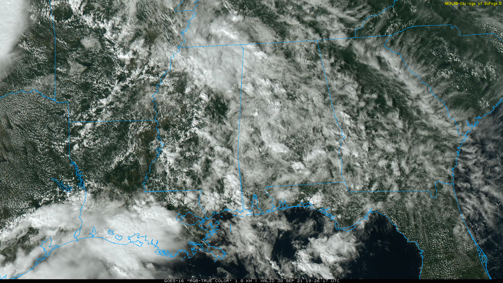
RADAR CHECK: We have scattered showers and a thunderstorm or two over the western half of the state this afternoon, mostly west of I-65. Otherwise, the sky is partly to mostly cloudy with temperatures generally in the low 80s. Showers will end this evening, and the sky becomes mostly fair late tonight.
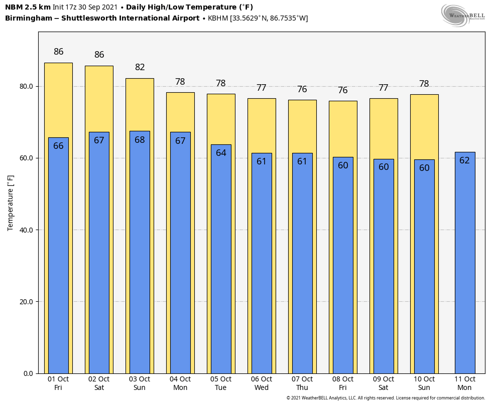
TOMORROW THROUGH THE WEEKEND: The weather will be warm and mostly dry tomorrow and Saturday; the sky will be partly to mostly sunny both days with highs in the mid 80s… a little above average for early October in Alabama. The chance of a shower both days is so small we won’t mention it in the forecast. Then, on Sunday, moisture levels rise and we will bring in the chance of showers. Not a “washout” by any means, but a passing shower or two is very possible during the day. Sunday will feature a mostly cloudy sky with a high around 80 degrees.
NEXT WEEK: An upper low sets up just west of the state, and we should see an increase in the coverage of showers Monday. Then, we will have some risk of scattered showers on a daily basis through the rest of the week, but the rain won’t be especially heavy. Highs will be mostly in the upper 70s… See the Weather Xtreme video for maps, graphics, and more details.
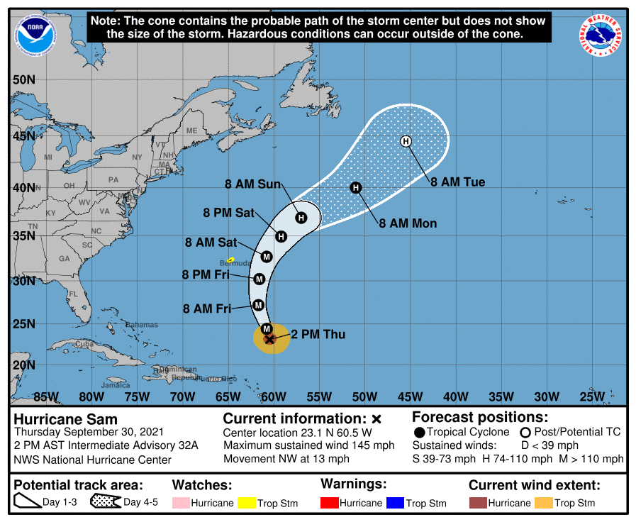
TROPICS: Sam remains a powerful hurricane in the Atlantic with sustained winds of 145 mph… it is about 680 miles south/southeast of Bermuda. Thankfully it passes well east of Bermuda tomorrow night, and then heads into the North Atlantic becoming post-tropical early next week. No threat to the U.S.
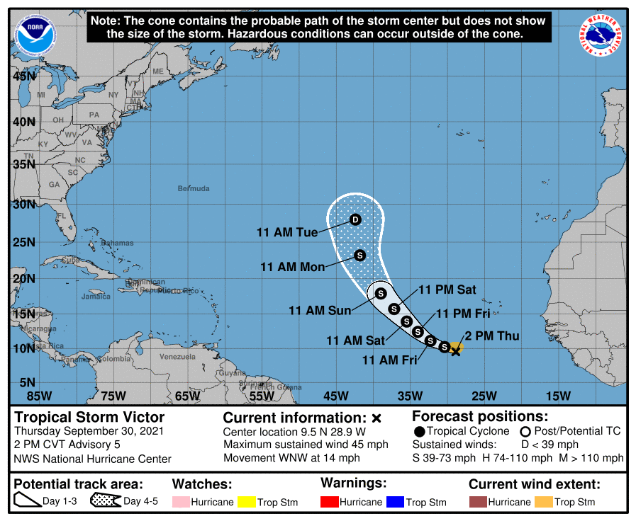
Out in the eastern Atlantic, Tropical Storm Victor is now expected to remain below hurricane strength as it turns to the north… it is no threat to land.
The rest of the Atlantic basin, including the Gulf of Mexico, remains very quiet.
RACE WEEKEND: The weather will be warm and dry in Talladega tomorrow and Saturday with a partly to mostly sunny sky; the high will be in the mid 80s. Then, on Sunday, expect more clouds than sun with a few passing showers possible. Certainly not an “all day” rain, and not a “washout”. But, some rain is very possible a few times during the day. The high Sunday will be around 80 degrees.
FOOTBALL WEATHER: The sky will be mostly fair for the high school games tomorrow night with temperatures falling through the 70s.
For the college games Saturday…
JACKSONVILLE STATE AT KENNESAW STATE (2:00p CT kickoff at Fifth Third Bank Stadium in Kennesaw, GA): Mostly sunny and warm; kickoff temperature near 84 degrees, falling into the upper 70s by the fourth quarter.
OLE MISS AT ALABAMA (2:30p CT kickoff at Bryant-Denny Stadium): Partly to mostly sunny and warm; temperatures falling from near 86 at kickoff, to near 80 by the final whistle.
TROY AT SOUTH CAROLINA (2:30p CT kickoff at Williams-Brice Stadium in Columbia SC): The weather will be warm and dry with a good supply of sunshine. About 88 degrees at kickoff, near 80 by the final whistle.
SAMFORD AT MERCER (5:00p CT kickoff in Macon, GA): A mostly clear sky during the game; temperatures will fall from 86 at kickoff into the upper 70s by the fourth quarter.
LIBERTY AT UAB (6:00p CT kickoff at Protective Stadium): Mostly fair; kickoff temperature near 78 degrees, falling into the low 70s by the end of the game.
AUBURN AT LSU (8:00p CT kickoff at Tiger Stadium in Baton Rouge): A passing shower or storm is possible during the first half, otherwise mostly fair with temperatures falling from around 80 at kickoff, into the mid-70s by the fourth quarter.
RACE WEEKEND: Saturday will be a mostly sunny, warm day at Talladega with a high in the mid-80s. Then, on Sunday, expect a mix of sun and clouds with a passing shower possible during the YellaWood 500. Most of the day will be dry, however, with a high around 80 degrees.
ON THIE DATE IN 1896: The great “Cedar Keys Hurricane” made landfall. It entered the Gulf of Mexico as the equivalent of a major hurricane on the Saffir–Simpson scale and struck the Cedar Keys, an offshore island chain that includes the island and city of Cedar Key, early on the morning of September 29 with winds of 125 mph. The area was inundated by a devastating 10.5-foot storm surge that undermined buildings, washed out the connecting railroad to the mainland, and submerged the smaller, outlying islands, where 31 people were killed.
Once inland, up to 20 inches of rain fell over parts of Georgia, South and North Carolina, Virginia, Washington D.C., and Pennsylvania. In all, there were 130 deaths attributed to the storm.
BEACH FORECAST: Click here to see the AlabamaWx Beach Forecast Center page.
WEATHER BRAINS: Don’t forget you can listen to our weekly 90-minute show anytime on your favorite podcast app. This is the show all about weather featuring many familiar voices, including our meteorologists here at ABC 33/40.
CONNECT: You can find me on all of the major social networks…
Look for the next Weather Xtreme video here by 6:00 a.m. tomorrow…
Category: Alabama's Weather, ALL POSTS, Weather Xtreme Videos
About the Author (Author Profile)
James Spann is one of the most recognized and trusted television meteorologists in the industry. He holds the AMS CCM designation and television seals from the AMS and NWA. He is a past winner of the Broadcast Meteorologist of the Year from both professional organizations.Subscribe
If you enjoyed this article, subscribe to receive more just like it.


