

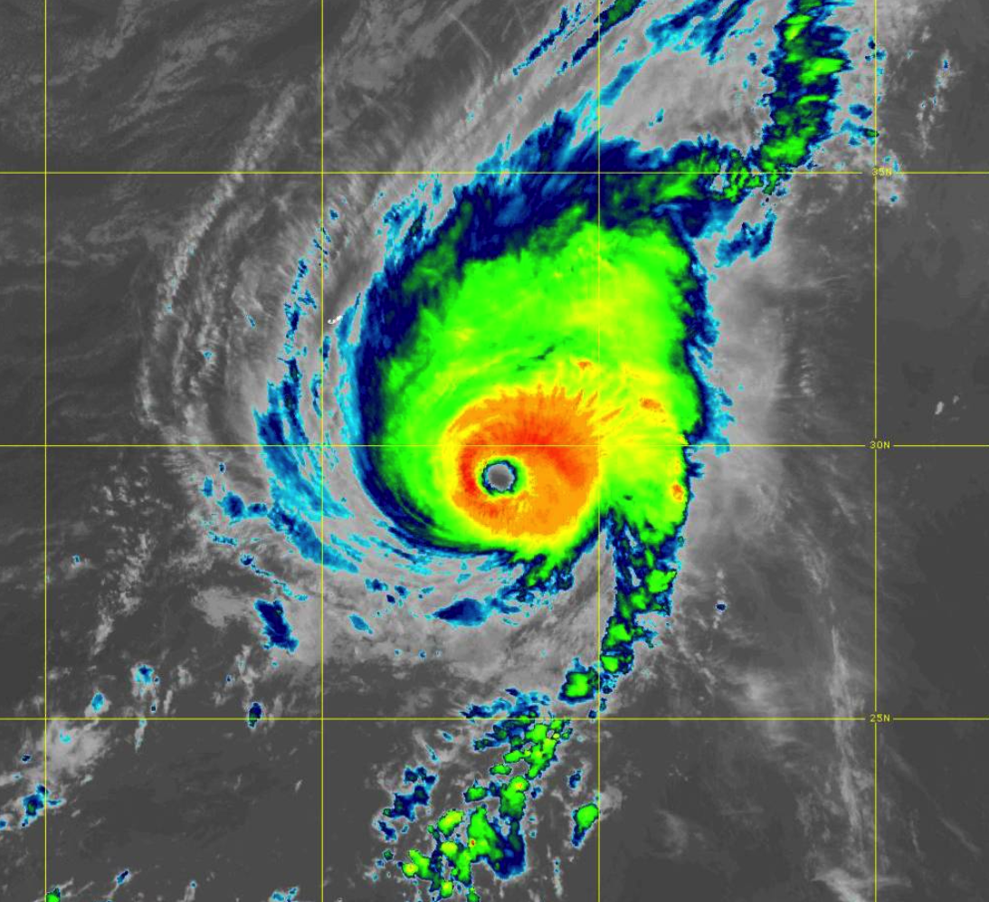
Hurricane Hunter Aircraft Shows That Sam Continues to Maintain Category 4 Strength
SUMMARY OF 200 PM AST…1800 UTC…INFORMATION
———————————————-
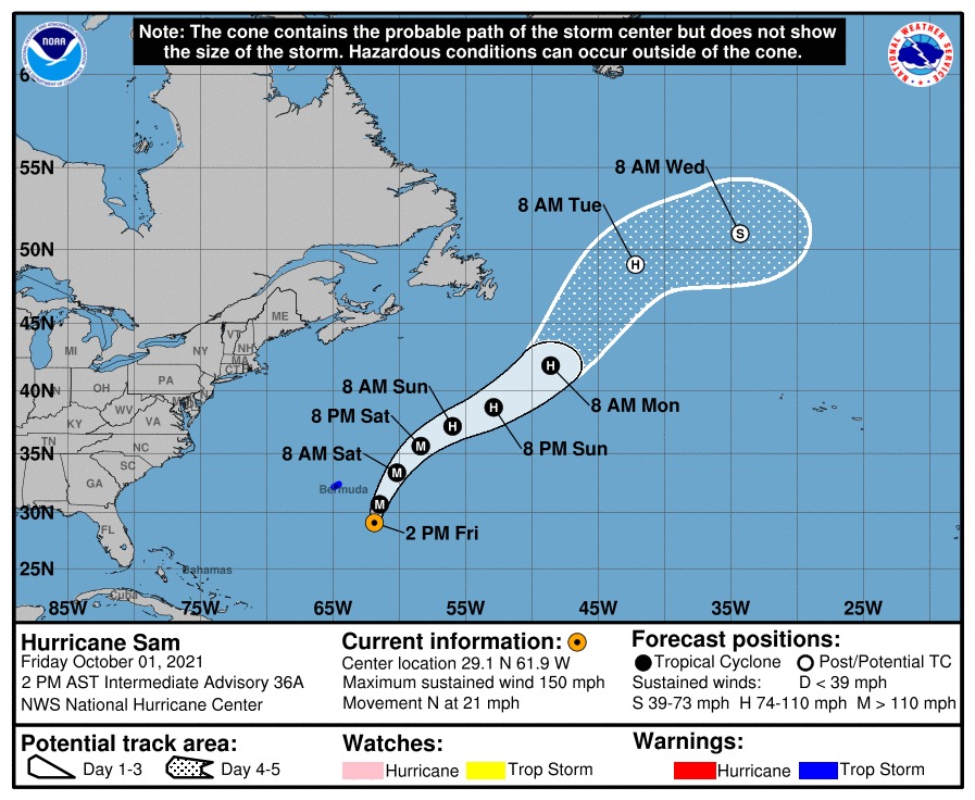
LOCATION…29.1N 61.9W
ABOUT 280 MI…450 KM SE OF BERMUDA
MAXIMUM SUSTAINED WINDS…150 MPH…240 KM/H
PRESENT MOVEMENT…N OR 355 DEGREES AT 21 MPH…33 KM/H
MINIMUM CENTRAL PRESSURE…937 MB…27.67 INCHES
WATCHES AND WARNINGS
——————–
A Tropical Storm Warning is in effect for…
* Bermuda
DISCUSSION AND OUTLOOK
———————-
At 200 PM AST (1800 UTC), the eye of Hurricane Sam was located near latitude 29.1 North, longitude 61.9 West. Sam is moving toward the north near 21 mph (33 km/h). A turn toward the north-northeast, at a slightly slower forward speed, is expected by tonight, followed by a northeastward motion Saturday night through Monday. On the forecast track, the center of Sam will pass well to the east of Bermuda tonight.
Data from the Air Force Hurricane Hunters indicate that maximum sustained winds remain near 150 mph (240 km/h) with higher gusts. Sam is a category 4 hurricane on the Saffir-Simpson Hurricane Wind Scale. Although fluctuations in intensity are still possible today, weakening is forecast during the next couple of days. However, Sam is expected to remain a major hurricane through at least Saturday night.
Hurricane-force winds extend outward up to 60 miles (95 km) from the center, and tropical-storm-force winds extend outward up to 205 miles (335 km). The minimum central pressure based on data from the Air Force Hurricane Hunters is 937 mb (27.67 inches).
HAZARDS AFFECTING LAND
———————-
WIND: Tropical storm conditions are possible on Bermuda beginning tonight or early Saturday.
SURF: Swells generated by Sam will impact the northern Leeward Islands and the Greater Antilles, including Puerto Rico, during the next couple of days. Swells are expected to reach Bermuda and the Bahamas this afternoon, and then spread to the United States east coast and Atlantic Canada on Saturday. These swells could cause life-threatening surf and rip current conditions. Please consult products from your local weather office.
Category: ALL POSTS, Severe Weather, Tropical
About the Author (Author Profile)
Scott Martin is an operational meteorologist, professional graphic artist, musician, husband, and father. Not only is Scott a member of the National Weather Association, but he is also the Central Alabama Chapter of the NWA president. Scott is also the co-founder of Racecast Weather, which provides forecasts for many racing series across the USA. He also supplies forecasts for the BassMaster Elite Series events including the BassMaster Classic.Subscribe
If you enjoyed this article, subscribe to receive more just like it.


