

A Few Showers Moving Into the Western Parts of the Area at Midday

As of 11:27 am, we do have a few light showers that have moved into the extreme western and northwestern parts of the area, while the rest of Central Alabama have partly to mostly cloudy skies. Temperatures were around the mid 70s to the mid 80s across the area. Troy was at 85 as the warm spot, while several locations were tied as the cool spots at 75 degrees. Birmingham was sitting at 77 degrees.
We have enough moisture in place for the chance of a few isolated to scattered showers and storms, mainly across the western half of the area during the afternoon and early evening hours. Much of the eastern half will stay dry, with only a slight chance of an isolated shower for those north of I-20. Highs will be in the 80s. If you are headed to either Tuscaloosa or downtown Birmingham for the football games, you might want to carry a poncho just in case. Patchy fog may be an issue during the overnight hours in some spots, and lows will be in the mid to upper 60s.
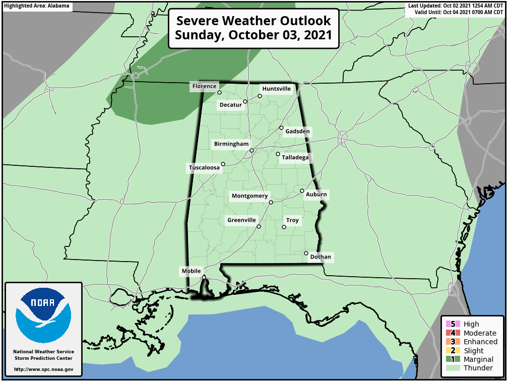
A cold front will be approaching the Mississippi River on Sunday that will put Central Alabama in the warm and humid sector. Scattered to numerous showers and storms will become likely by the afternoon hours. We can’t rule out a strong storm or two over the extreme northwestern corner of the state, and the Storm Prediction Center has a Marginal Risk up for those locations with the threat for gusty winds. Highs will be in the mid 70s to the mid 80s.

At 10:00 am CDT, the center of Hurricane Sam was located around 335 miles to the east-northeast of Bermuda. Sam is moving toward the northeast near 17 mph. This general track with an increase in forward speed is expected for the next few days. Maximum sustained winds remain near 130 mph, with higher gusts. Sam is a category 4 hurricane on the Saffir-Simpson
Hurricane Wind Scale. On the forecast track, Sam will continue to move away from Bermuda. Some slow weakening is forecast during the next 36 hours, followed by more significant weakening early next week. Sam could become a powerful post-tropical cyclone on Tuesday.
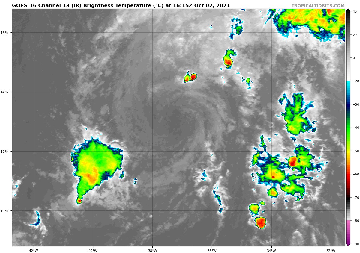
At 10:00 am CDT, the center of Tropical Storm Victor was located around 905 miles to the west of the Cabo Verde Islands. Victor is moving toward the northwest near 12 mph, and this general motion is expected to continue over the next few days. Maximum sustained winds are near 40 mph, with higher gusts. Gradual weakening is forecast over the next couple of days, and Victor could become a remnant low by tonight. The system is then forecast to dissipate by Tuesday.
Category: Alabama's Weather, ALL POSTS, Severe Weather, Tropical
About the Author (Author Profile)
Scott Martin is an operational meteorologist, professional graphic artist, musician, husband, and father. Not only is Scott a member of the National Weather Association, but he is also the Central Alabama Chapter of the NWA president. Scott is also the co-founder of Racecast Weather, which provides forecasts for many racing series across the USA. He also supplies forecasts for the BassMaster Elite Series events including the BassMaster Classic.Subscribe
If you enjoyed this article, subscribe to receive more just like it.


