

Midday Nowcast: Wet is the Word
An upper-level trough is developing over the Southeast, and with Central Alabama on the east side of the trough, this will keep our weather wet and unsettled for the next several days with scattered to numerous showers and storms on a daily basis through Wednesday.
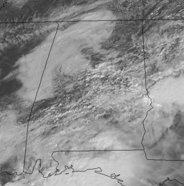
Expect more clouds than sun with periods of rain and highs in the upper 70s. We are seeing those clouds now and we continue to watch the radar as rain showers will increase in coverage and intensity as we head into and through the afternoon hours.
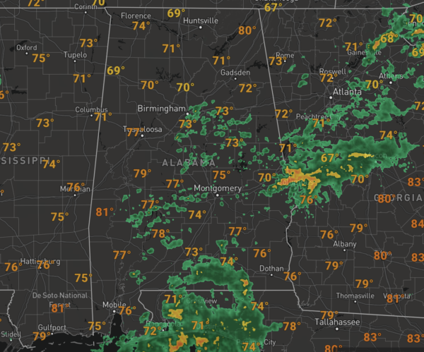
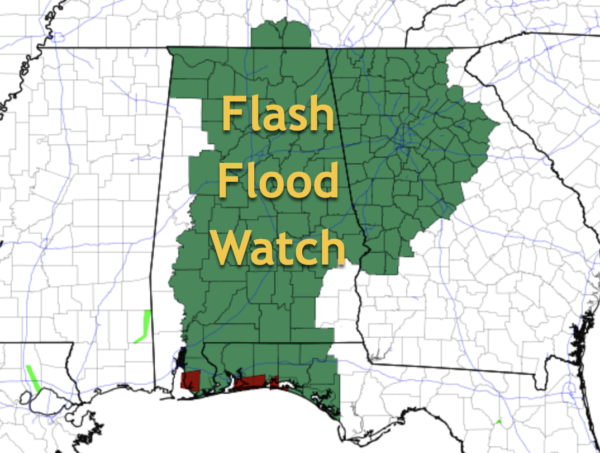
Periods of heavy rainfall could lead to flash flooding and almost all of Alabama in under a Flash Flood Watch until at least Wednesday. Rainfall totals through midweek will be in the 1-4 inch range, with isolated higher amounts.
BEYOND MIDWEEK: On Thursday, the trough will begin to lift out of the area and showers will begin to thin out with drier air returning to the state by Friday. Thursday’s highs will be in the upper 70s with a mix of sun and clouds, with lower 80s with ample sunshine Friday.
WARM, NICE WEEKEND: Dry weather will continue this weekend with tons of sunshine both Saturday and Sunday. Highs both days will feature highs in the low 80s, with lows in the 58-63 degree range. These highs and lows are pretty close to seasonal averages for early October in Alabama.
IN THE TROPICS: The National Hurricane Center is issuing advisories on Hurricane Sam, located over the far North Atlantic, and on Tropical Depression Victor, located over the central tropical Atlantic.
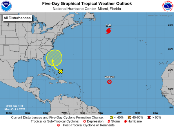
1. A large area of disorganized cloudiness and showers continues over the southeastern Bahamas and adjacent southwestern Atlantic waters in association with a surface trough. Upper-level winds are not expected to be especially conducive, and any development of this system should be slow to occur while it moves slowly northwestward through the end of this week. Formation chance through 5 days…low…10 percent.
HURRICANE SAM: The center of Hurricane Sam was located near latitude 42.6 North, longitude 45.7 West. Sam is moving toward the northeast near 32 mph. A faster northeastward motion is expected through tonight. A slower east-northeastward motion is forecast to begin on Tuesday and continue through midweek.
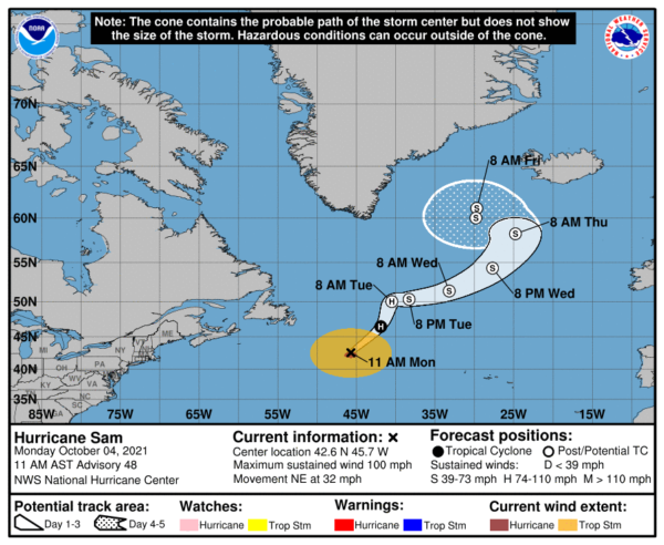
Maximum sustained winds are near 100 mph with higher gusts. Gradual weakening is forecast during the next few days, and Sam is expected to transition into a powerful post-tropical cyclone over the north Atlantic tonight or early Tuesday. Hurricane-force winds extend outward up to 60 miles from the center and tropical-storm-force winds extend outward up to 275 miles. The estimated minimum central pressure is 960 mb (28.35 inches).
VICTOR: Victor degenerates into an open trough over the Atlantic. The remnants of Victor were located near latitude 18.8 North, longitude 45.2 West. The remnants are moving toward the west-northwest near 15 mph, and this general motion is expected to continue through tonight. Recent satellite-derived wind data indicate that maximum sustained winds are near 30 mph with higher gusts. Weakening is forecast through tonight. The estimated minimum central pressure is 1011 mb (29.86 inches).
BEACH FORECAST CENTER: Get the latest weather and rip current forecasts for the beaches from Fort Morgan to Panama City on our Beach Forecast Center page. There, you can select the forecast of the region that you are interested in visiting.
WORLD TEMPERATURE EXTREMES: Over the last 24 hours, the highest observation outside the U.S. was 114.3F at Jahra, Kuwait. The lowest observation was -80.5F at Amundsen-Scott South Pole Station, Antarctica.
CONTIGUOUS TEMPERATURE EXTREMES: Over the last 24 hours, the highest observation was 103F at Death Valley, CA. The lowest observation was 10F at Peter Sinks, UT.
WEATHER ON THIS DATE IN 1969: Denver, CO, received 9.6 inches of snow. October of that year proved to be the coldest and snowiest of record for Denver, with a total snowfall for the month of 31.2 inches.
Category: Alabama's Weather, ALL POSTS
About the Author (Author Profile)
Macon, Georgia Television Chief Meteorologist, Birmingham native, and long time Contributor on AlabamaWX. Stormchaser. I did not choose Weather, it chose Me. College Football Fanatic. @Ryan_StinnetSubscribe
If you enjoyed this article, subscribe to receive more just like it.


