

A Brief Update Just Before 5 pm
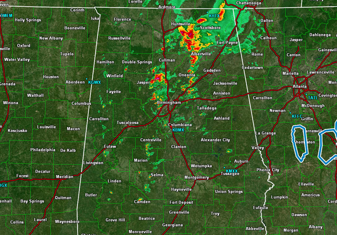
At 4:40 pm, much of the shower and thunderstorm activity was located in between the I-65 and I-59 corridors north of the I-20 corridor. At the moment, none of these storms are severe.
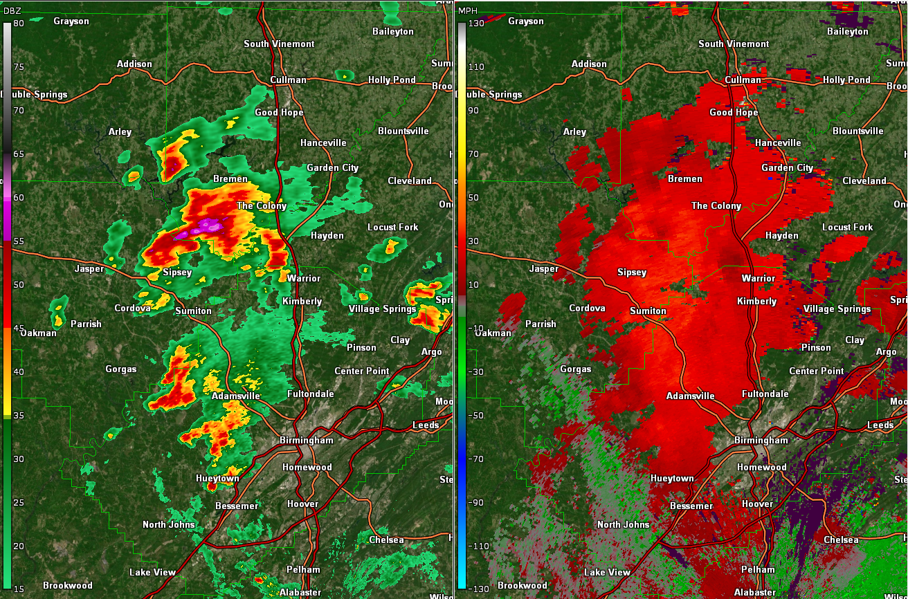
The strongest storm on radar is located around Arkadelphia and was moving to the north at 25 mph. Wind gusts up to 55 mph and some hail will be possible with this storm.
Gusty winds could knock down tree limbs and blow around unsecured objects. Minor damage to outdoor objects is possible.
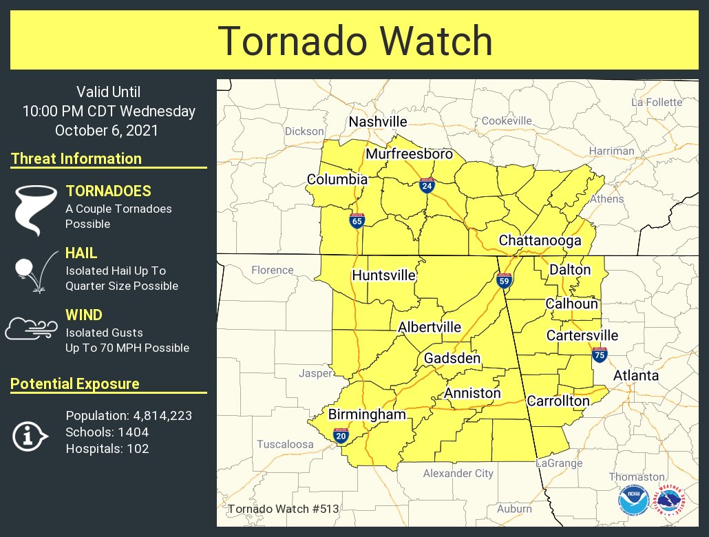
A Tornado Watch remains in effect until 10 pm tonight for Blount, Calhoun, Cherokee, Clay, Cleburne, Etowah, Jefferson, Randolph, Shelby, St. Clair, Talladega counties in Central Alabama, and for Cullman, DeKalb, Jackson, Limestone, Madison, Marshall, Morgan counties in North Alabama.
A Flash Flood Watch remains in effect until 7 am Thursday for Autauga, Barbour, Bibb, Blount, Bullock, Calhoun, Chambers, Cherokee, Chilton, Clay, Cleburne, Coosa, Dallas, Elmore, Etowah, Jefferson, Lee, Lowndes, Macon, Montgomery, Perry, Pike, Randolph, Russell, Shelby, St. Clair, Talladega, Tallapoosa, Walker, Winston counties in Central Alabama.
A Flash Flood Watch remains in effect until 1 am Thursday for Colbert, Cullman, DeKalb, Franklin, Jackson, Lauderdale, Lawrence, Limestone, Madison, Marshall, Morgan counties in North Alabama.
Category: Alabama's Weather, ALL POSTS, Severe Weather
About the Author (Author Profile)
Scott Martin is an operational meteorologist, professional graphic artist, musician, husband, and father. Not only is Scott a member of the National Weather Association, but he is also the Central Alabama Chapter of the NWA president. Scott is also the co-founder of Racecast Weather, which provides forecasts for many racing series across the USA. He also supplies forecasts for the BassMaster Elite Series events including the BassMaster Classic.Subscribe
If you enjoyed this article, subscribe to receive more just like it.


