

Saturday Weather Xtreme — Nice & Warm Weekend; Severe Threat on Wednesday
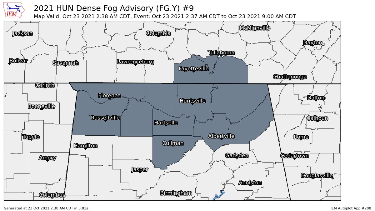
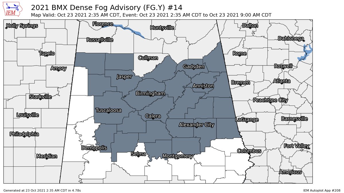
HAZARDS FOR THIS MORNING: A Dense Fog Advisory is in effect for much of Central Alabama and for all of North Alabama until 9 am this morning. Be sure to slow down and use your low beams if driving this morning, and leave plenty of distance ahead of you.
THIS WEEKEND: After the fog lifts later this morning, we’ll end up with sunny skies and nice temperatures for your Saturday, as highs will range from the mid to the upper 70s. Sunday will be a warmer day across the region with increasing clouds, but we’ll remain dry with highs in the upper 70s to the lower 80s.
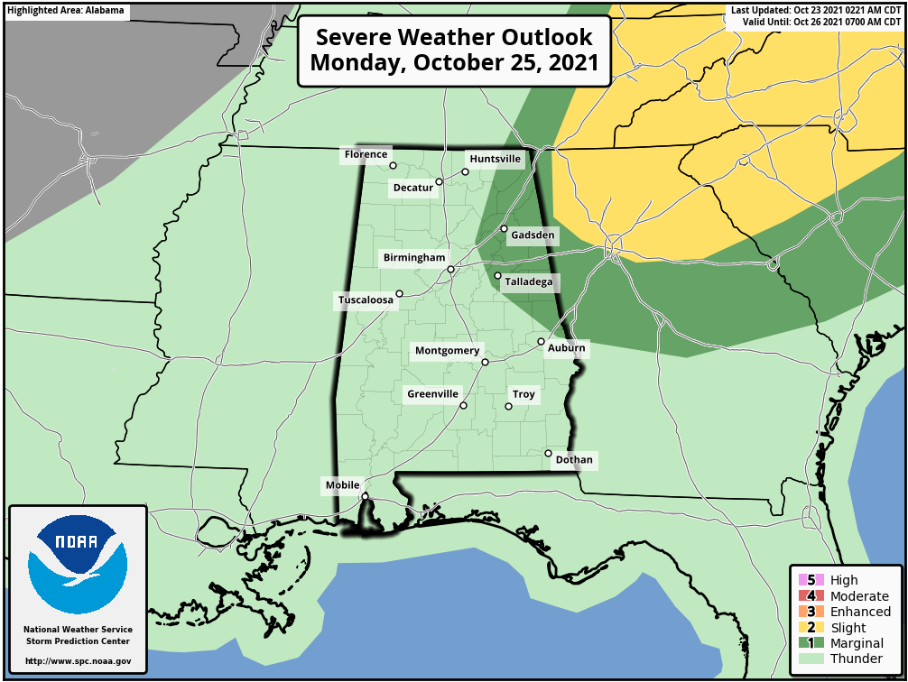
THE WORKWEEK AHEAD: A cold front will move across Central Alabama on Monday that will bring the chance of showers and thunderstorms. The good news is that the better dynamics will be far removed from the Deep South and the threat for any severe weather will be limited. However, a few strong to marginally severe storms may be possible, and the Storm Prediction Center has a marginal risk up for the east and northeastern parts of the area. Gusty winds and some hail will be the main threats if any storms become strong. Highs will be in the mid-70s to the mid-80s.
We’ll be in-between two systems on Tuesday as a sliver of high pressure briefly builds into the area. Skies will be mainly sunny, with highs reaching the mid-70s to the lower 80s.
The good news for Wednesday is that the Storm Prediction Center has moved the slight risk for severe storms closer to the Gulf Coast and only leaving a small portion of the southern parts of Central Alabama in the risk. However, a system will move through bringing rain and storms to all of the area, and we still can’t rule out a few strong to severe storms. I wouldn’t be surprised if much of the area is placed in at least a marginal risk for the day. Models are still not in complete agreement with timing and exact placement, so we’ll have to keep our eyes on the models through the next few days. We’ll get a much clearer picture when the high-resolution models come into play. Highs will be in the 70s.
With a low stationed over eastern Illinois on Thursday, it will keep a chance for a few showers in the forecast, mainly for the northern half of the area. Highs will be in the upper 60s to the mid-70s. Nearly the identical story for Friday, as showers will remain possible for the northern portions of the area. Highs will be in the mid-60s to the lower 70s.
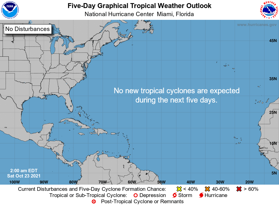
THE TROPICS: The tropics remain astonishingly quiet, and no new tropical cyclones are expected to develop within the next five days. Remember, the end of the season doesn’t arrive until the end of the day on November 30th.
Category: Alabama's Weather, ALL POSTS, Severe Weather, Tropical
About the Author (Author Profile)
Scott Martin is an operational meteorologist, professional graphic artist, musician, husband, and father. Not only is Scott a member of the National Weather Association, but he is also the Central Alabama Chapter of the NWA president. Scott is also the co-founder of Racecast Weather, which provides forecasts for many racing series across the USA. He also supplies forecasts for the BassMaster Elite Series events including the BassMaster Classic.Subscribe
If you enjoyed this article, subscribe to receive more just like it.


