

Midday Nowcast: Clouds Linger the Rest of Today
Most of the rain has moved out of the area as we approach the midday hours. Clouds will linger the rest of today and temperatures will hold in the low to mid 50s for most locations, which remain well-below average for this time of year.
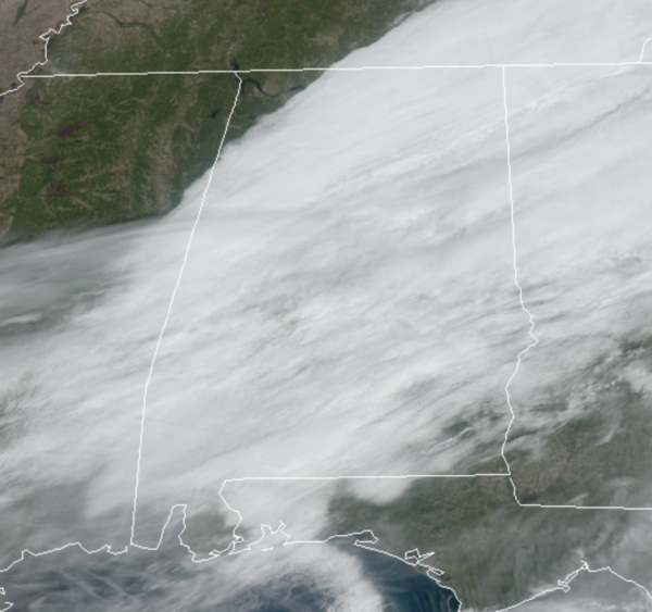
We do note, the sky is clear across the far northwest corner of Alabama. Tonight, the clouds will remain and lows should be in the low to mid 40s.
FRIDAY: Tomorrow starts off cloudy for most of us, but through the day, drier air will return to the area, allowing for a gradually clearing sky from northwest to southeast across the state. By late in the day, most of us will be seeing a clear sky. Temperatures will remain cool, but should at least return to the low 60s on Friday.
FRIDAY NIGHT LIGHTS: For the high school playoff games tomorrow night, the sky will be clear with temperatures falling into the 40s.
WEEKEND WEATHER: For Saturday and Sunday, expect sunny cool days, and clear cold nights. Highs Saturday will be in the low to mid 60s while upper 60s should return Sunday. Lows will drop into the upper 30s and lower 40s over the weekend, and some frost is expected, especially across North Alabama this weekend.
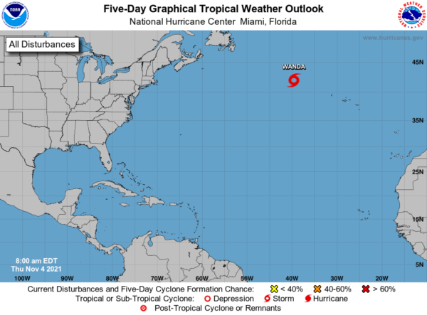
TROPICS: Tropical Storm Wanda, with sustained winds of 45 mph, will continue to meander over the North Atlantic far from land this week. The rest of the Atlantic basin is very quiet.
BEACH FORECAST CENTER: Get the latest weather and rip current forecasts for the beaches from Fort Morgan to Panama City on our Beach Forecast Center page. There, you can select the forecast of the region that you are interested in visiting.
WORLD TEMPERATURE EXTREMES: Over the last 24 hours, the highest observation outside the U.S. was 111.6F at Tete, Mozambique. The lowest observation was -68.8F at Vostok, Antarctica.
CONTIGUOUS TEMPERATURE EXTREMES: Over the last 24 hours, the highest observation was 94F at Thermal, CA. The lowest observation was 11F at Nekoosha, WI.
WEATHER ON THIS DATE IN 1927: A great Vermont flood occurred. Tropical rains deluged the Green Mountain area of Vermont causing the worst flood in the history of the state. Torrential rains, up to 15 inches in the higher elevations, sent streams on a rampage devastating the Winooski Valley. Flooding claimed 200 lives and caused 40 million dollars damage. The town of Vernon reported 84 deaths. Flooding left up to eight to ten feet of water in downtown Montpelier, VT.
Category: Alabama's Weather, ALL POSTS
About the Author (Author Profile)
Macon, Georgia Television Chief Meteorologist, Birmingham native, and long time Contributor on AlabamaWX. Stormchaser. I did not choose Weather, it chose Me. College Football Fanatic. @Ryan_StinnetSubscribe
If you enjoyed this article, subscribe to receive more just like it.


