

Saturday Weather Xtreme — Dry Weather Through Midweek
THE CENTRAL ALABAMA WEEKEND
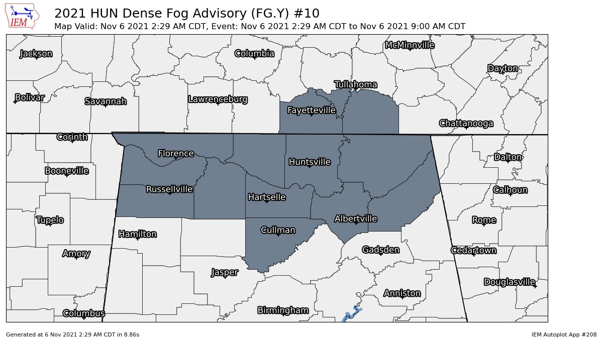
*** A Dense Fog Advisory is in effect for all of the North Alabama counties (Colbert, Cullman, DeKalb, Franklin, Jackson, Lauderdale, Lawrence, Limestone, Madison, Marshall, Morgan) until 9 am this morning. ***
After the fog mixes out this morning, skies will be mostly clear across Central Alabama today. Temperatures will remain rather cool, only reaching the lower to mid-60s across the area. Don’t forget to set those clocks back 1 hour tonight before heading to bed as Daylight Saving Time ends at 2 am.
Sunday will be a slightly warmer day across the area as skies will be sunny throughout the day. Highs will be in the mid to upper 60s.
NEXT WEEK
The first half of the workweek will feature brilliant weather across Central Alabama. Skies will be sunny on Monday with afternoon highs reaching the upper 60s to the lower 70s. Just a tad warmer on Tuesday with sunny skies. Highs in the lower to mid-70s. And again on Wednesday… skies will be mainly sunny with highs in the upper 60s to the mid-70s.
A cold front will be working its way toward Central Alabama on Thursday, but the rain looks to hold entering the northwestern parts of the area until evening and progressing to the I-59 corridor by midnight. There may be a rumble of thunder or two, but strong to severe storms are not expected as there is simply no instability. Highs will be in the upper 60s to the mid-70s.
The front continues to push through the area during the morning hours on Friday but will be weakening as it does. By the afternoon, much of the shower activity will have diminished with only the extreme southern parts of South Alabama getting rain. Highs will be in the upper 50s to the lower 70s from northwest to southeast.
THE TROPICS
At 4 am CDT, the center of Tropical Storm Wanda was located around 620 miles to the west of the Azores and moving toward the south near 5 mph. A sharp turn toward the northeast is forecast to occur by this afternoon, followed by an acceleration toward the northeast tonight, with that motion continuing on Sunday and Monday. Maximum sustained winds are near 50 mph with higher gusts. A little change in strength is expected during the next couple of days.
ON THIS DAY IN WEATHER HISTORY
2005 – Severe thunderstorms produced a deadly tornado near Evansville, Indiana during the early morning hours of November 6. There were 23 fatalities from the tornado, with 19 of the deaths occurring in the Eastbrook Mobile Home Park located just to the southeast of the city. It was Indiana’s deadliest tornado since the Super Outbreak on April 3, 1974.
Category: Alabama's Weather, ALL POSTS, Tropical, Weather Xtreme Videos
About the Author (Author Profile)
Scott Martin is an operational meteorologist, professional graphic artist, musician, husband, and father. Not only is Scott a member of the National Weather Association, but he is also the Central Alabama Chapter of the NWA president. Scott is also the co-founder of Racecast Weather, which provides forecasts for many racing series across the USA. He also supplies forecasts for the BassMaster Elite Series events including the BassMaster Classic.Subscribe
If you enjoyed this article, subscribe to receive more just like it.


