

Sunday Weather Xtreme — Dry Weather with Warming Temperature Through Midweek
TODAY’S WEATHER: We do have a Freeze Warning remaining in effect until 8 am this morning for all of North and Central Alabama until temperatures start to rise above freezing. The good news is that skies will be mostly sunny across the area and temperatures will quickly rise into the lower to mid-60s. Lows tonight will not be as cold, but some patchy frost will be possible. Overnight lows will be in the lower 30s to the lower 40s.
THE WORKWEEK AHEAD: Ridging starts to move into the area on Monday, which will allow temperatures to be a degree or two warmer. We’ll have sunny skies and highs in the upper 50s to the mid-60s. Sunny skies and warmer temperatures can be expected on Tuesday, as highs will top out in the upper 60s to the mid-70s. And again on Wednesday, sunny skies through much of the day, with highs reaching the 70s across the area. We’ll have some clouds begin to move in late, but no rain will be associated with those.
A cold front will begin to move into the area late on Thursday that will bring partly to mostly cloudy skies and a chance for a few showers, mainly for the northern half of the area. Highs will be in the upper 50s to the mid-70s across the area. High-pressure builds back in to our north, which will allow us to have a cooler and dry Friday. It will be mostly sunny, with highs in the mid-50s to the mid-60s.
THE START OF NEXT WEEKEND: And to finish out the seven-day forecast, next Saturday looks to be mainly sunny and dry, with highs in the upper 50s to the upper 60s.
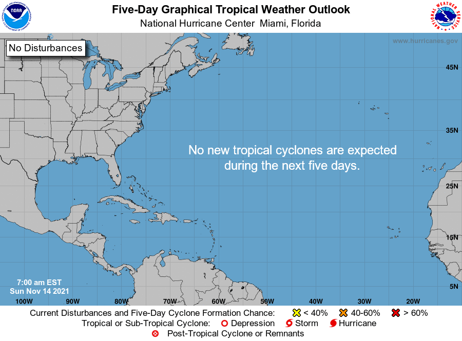
TROPICAL ATLANTIC UPDATE: The tropics are quiet at this point, and no new tropical cyclones are expected to form over the next five days. The end of the Atlantic Hurricane Season is just 16 days away on November 30th.
ON THIS DAY IN WEATHER HISTORY: 1988 – A massive storm produced snow and gusty winds in the western U.S., with heavy snow in some of the higher elevations. Winds gusted to 66 mph at Show Low, AZ, and Donner Summit, located in the Sierra Nevada Range of California, was buried under 23 inches of snow. Heavy rain soaked parts of California, with 3.19 inches reported at Blue Canyon.
Category: Alabama's Weather, ALL POSTS, Tropical, Weather Xtreme Videos, Winter Weather
About the Author (Author Profile)
Scott Martin is an operational meteorologist, professional graphic artist, musician, husband, and father. Not only is Scott a member of the National Weather Association, but he is also the Central Alabama Chapter of the NWA president. Scott is also the co-founder of Racecast Weather, which provides forecasts for many racing series across the USA. He also supplies forecasts for the BassMaster Elite Series events including the BassMaster Classic.Subscribe
If you enjoyed this article, subscribe to receive more just like it.


