

Midday Nowcast: Generally Sunny and Mild
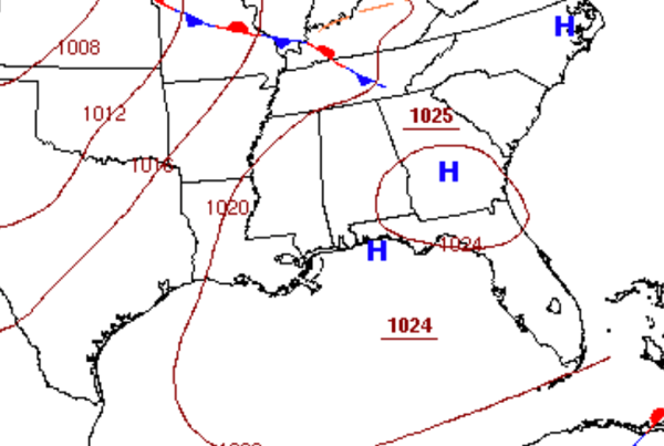
High pressure is centered to our southeast and is keeping us dry today and tomorrow, with a continued warming trend.
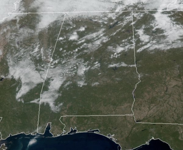
Today is featuring a generally sunny sky, despite some lingering morning clouds; highs today will be in the low 70s.
Tomorrow, highs will be a degree or two warmer with widespread mid 70s; some spots across South Alabama could see 80s tomorrow.
SOME SHOWERS THURSDAY: Clouds return to the state Thursday as a cold front approaches, and a few scattered light rain showers are possible over the northern half of the state by afternoon. Moisture will be very limited, and rain amounts should be under a quarter of an inch for most communities. Thursday’s high will be in the mid to upper 60s.
FRIDAY AND THE WEEKEND: Behind the front, a much cooler air mass will return to the state to end the week. Friday will be sunny and cooler with highs in the 50s. Our coldest morning should be Saturday with widespread 30s, but we expect nice warm with abundant sunshine, highs will return to the 60s. Sunday will remain dry with increasing clouds as some showers could return as early as Sunday evening; highs Sunday will be in the 60s.
THANKSGIVING WEEK: Monday looks to feature some rain and storms with our next front; severe storms are not anticipated. Tuesday looks to be sunny, breezy, and noticeably cooler with highs in the around 50°. Morning lows should be below freezing Tuesday and Wednesday mornings. Highs Wednesday will be in the mid to upper 50s, despite a sky full of sunshine. Beyond Thanksgiving the long range models suggest a lot of uncertainty with dry weather, cold weather, or wet weather depending on which model you look at, so forecast confidence is very low for Black Friday and Iron Bowl weekend.
BEACH FORECAST CENTER: Get the latest weather and rip current forecasts for the beaches from Fort Morgan to Panama City on our Beach Forecast Center page. There, you can select the forecast of the region that you are interested in visiting.
WORLD TEMPERATURE EXTREMES: Over the last 24 hours, the highest observation outside the U.S. was 114.4F at Mariental, Namibia. The lowest observation was -60.5F at Dome A, Antarctica.
CONTIGUOUS TEMPERATURE EXTREMES: Over the last 24 hours, the highest observation was 94F at Winterhaven, CA. The lowest observation was 8F at Mount Washington, NH.
Category: Alabama's Weather, ALL POSTS
About the Author (Author Profile)
Macon, Georgia Television Chief Meteorologist, Birmingham native, and long time Contributor on AlabamaWX. Stormchaser. I did not choose Weather, it chose Me. College Football Fanatic. @Ryan_StinnetSubscribe
If you enjoyed this article, subscribe to receive more just like it.


