

Saturday Weather Xtreme: A Few Scattered Showers Possible This Weekend
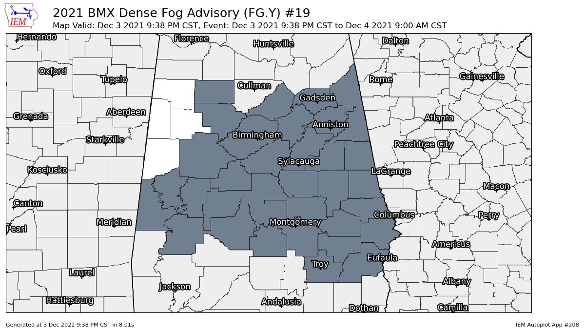
A Dense Fog Advisory is in effect for nearly every county in Central Alabama until 9 am this morning, with the exception of those extreme west and northwestern counties.
THIS WEEKEND: After the fog lifts, a weak front will be trying to push its way into the state, but it will eventually stall out over the northwest corner. Skies will be partly to mostly cloudy, with a small chance of showers for locations along and west of the I-59 corridor. Highs will be in the mid-60s to the mid-70s.
The stalled front will get a push and will move out of the area on Sunday as another stronger front will begin to move in our direction. Fog will once again be likely during the pre-dawn and early morning hours, then a small chance of showers will be possible throughout the rest of the day for nearly everyone in Central Alabama. Skies will be mostly cloudy and highs will be in the upper 60s to the mid-70s.
NEXT WEEK: That stronger front will move through on Monday that will bring showers and thunderstorms to the area for Monday. While a strong storm or two will be possible, severe weather is not likely. Highs in the lower 60s to the upper 70s from northwest to southeast. The front will stall out and eventually start to move back northward through the area as a warm front on Tuesday that will continue to bring a chance of showers and a few thunderstorms to Central Alabama. Highest rain chances will occur during the evening and late-night hours. Highs will be in the lower 50s in the northwest to the upper 60s in the southeast.
The pesky frontal system will eventually start to move out of the area on Wednesday, but showers and a few thunderstorms will stay in the forecast at least through much of the day. We dry out during the evening and overnight hours, but it will only be a short break from the rain. Highs will be in the mid-50s to the lower 70s across the area.
Moisture levels will continue to stay elevated through the end of the workweek, keeping scattered showers and a few thunderstorms in the forecast for both Thursday and Friday. Thursday’s activity looks to stay over the southern half of the area, then eventually spreading over the entire area for Friday. Thursday’s highs will be in the upper 50s to the upper 60s, then warming into the lower 60s to the lower 70s on Friday.
Category: Alabama's Weather, ALL POSTS, Weather Xtreme Videos
About the Author (Author Profile)
Scott Martin is an operational meteorologist, professional graphic artist, musician, husband, and father. Not only is Scott a member of the National Weather Association, but he is also the Central Alabama Chapter of the NWA president. Scott is also the co-founder of Racecast Weather, which provides forecasts for many racing series across the USA. He also supplies forecasts for the BassMaster Elite Series events including the BassMaster Classic.Subscribe
If you enjoyed this article, subscribe to receive more just like it.


