

Midday Nowcast: Cloudy and Warm; Storm Threats Ahead
Strong southerly flow continues across the state keeping moisture levels high, allowing for more clouds than sun and very mild temperatures.
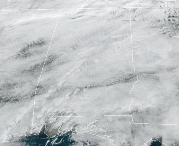
Temperatures are running 15-20 degrees above average with many locations today and in the coming days well into the 70s, while some 80s are expected across South Alabama. Most locations remain dry today, but we can’t completely rule out a few sprinkle or areas of mist at times today. A few showers are possible tomorrow, but they should be widely spaced, and much of the day will be dry.
SEVERE STORMS POSSIBLE WEDNESDAY: An approaching front will bring the threat of strong to severe thunderstorms to Alabama Wednesday afternoon and Wednesday night. The SPC has defined a “slight risk” (level 2/5) for areas north of a line from Grove Hill to Montgomery to Heflin… and a “marginal risk” (level 1/5) for most of the rest of the state.
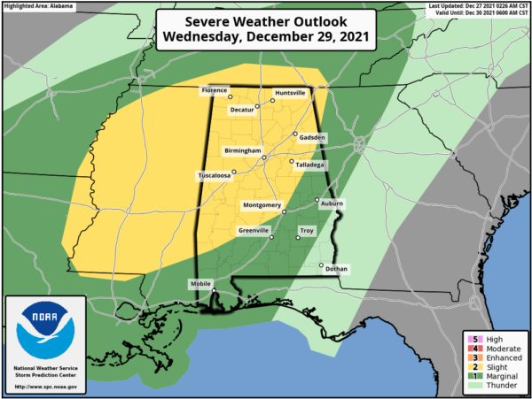
The main window for stronger storms will come from about Noon through 9PM Wednesday, and the primary threat will come from strong straight line winds, although an isolated tornado can’t be ruled out.
For Thursday and Friday, it stays mild with highs in the low 70s, and showers will remain in the forecast both days, as we continue to see more clouds than sun.
ANOTHER SEVERE WEATHER THREAT SATURDAY: The SPC has defined a risk of severe thunderstorms for about the northern half of Alabama on New Year’s Day as a strong cold front will approach.
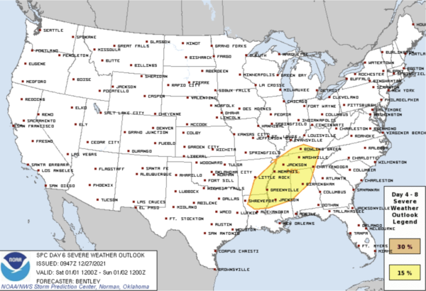
This could bring a more significant severe thunderstorm threat to the state, with all modes of severe weather possible. But, this is six days out and it is too early to be specific. Let’s get through the midweek threat before we focus on the weekend threat.
WINTER RETURNS: As the front moves through, much colder air will begin to flow into the state on Sunday. Expect a cloudy day with periods of light rain, and falling temperatures. The forecast high of 60° will most likely be reached during the pre-dawn hours as temperatures will fall through the 50s and 40s during the day with a brisk north wind. We will be in the 20s by daybreak Monday. As we roll into the first week of 2022, more typical weather is expected as highs should be in the 40s and 50s, while lows in the 30s are expected. The first few days of next look dry and sunny.
BEACH FORECAST CENTER: Get the latest weather and rip current forecasts for the beaches from Fort Morgan to Panama City on our Beach Forecast Center page. There, you can select the forecast of the region that you are interested in visiting.
WORLD TEMPERATURE EXTREMES: Over the last 24 hours, the highest observation outside the U.S. was 113.4F at Marble Bar, Australia. The lowest observation was -70.2F at Delyankir, Russia.
CONTIGUOUS TEMPERATURE EXTREMES: Over the last 24 hours, the highest observation was 94F at Rio Grande Village, TX. The lowest observation was -30F at Power, MT.
WEATHER ON THIS DATE IN 1982: The worst Louisiana rainstorm in more than 100 years came to an end. More than 18 inches fell at Vinton, LA, during the three day storm. Flooding was widespread, and property damage was estimated at 100 to 200 million dollars. President Reagan visited the state and declared ten parishes in northeastern Louisiana disaster areas.
Category: Alabama's Weather, ALL POSTS
About the Author (Author Profile)
Macon, Georgia Television Chief Meteorologist, Birmingham native, and long time Contributor on AlabamaWX. Stormchaser. I did not choose Weather, it chose Me. College Football Fanatic. @Ryan_StinnetSubscribe
If you enjoyed this article, subscribe to receive more just like it.


