

Sunday Weather Xtreme — Showers Today, Some Snow Possible Tonight for the Northern Parts
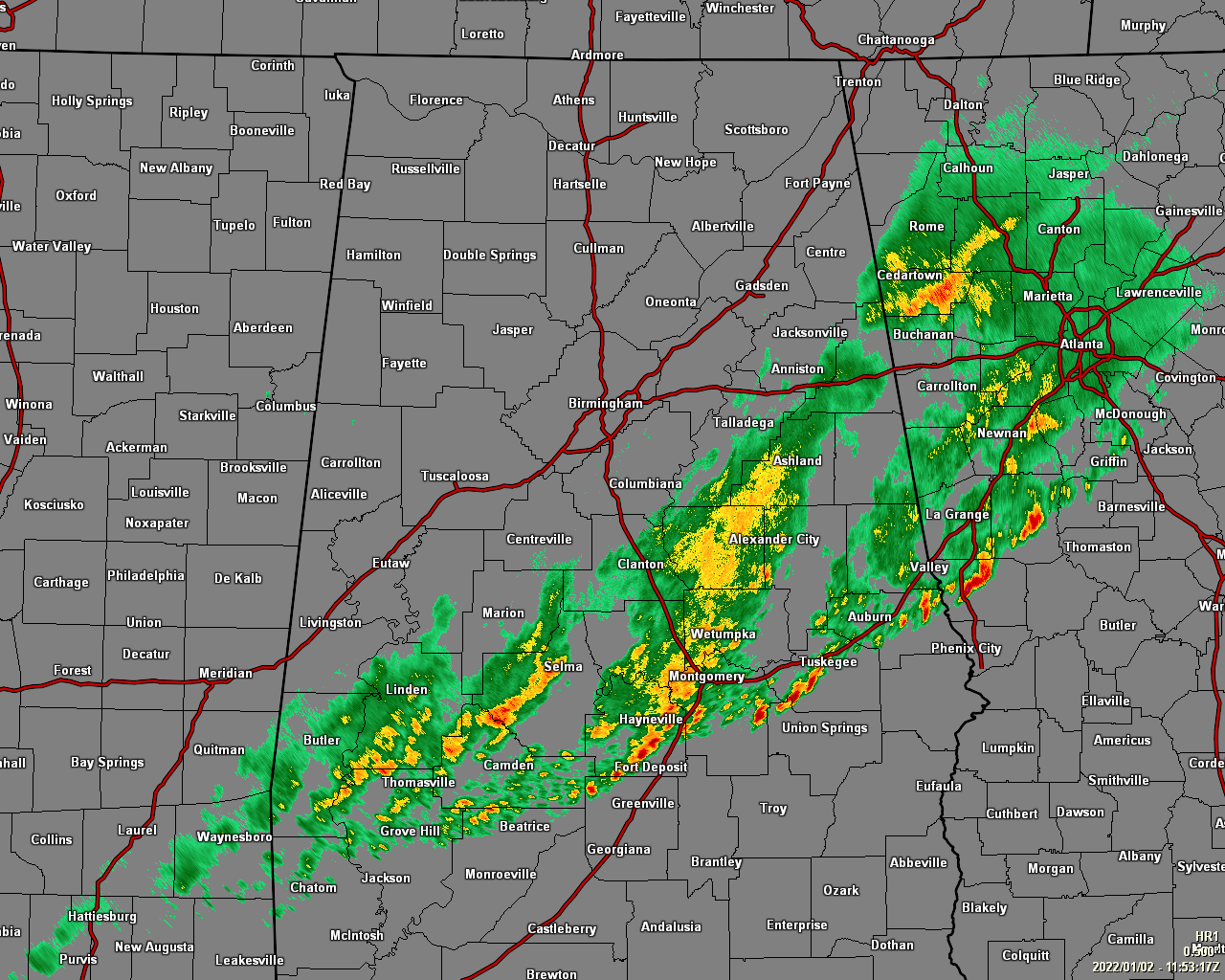
RADAR CHECK: As of 5:53 this morning, the squall line associated with the cold front has made it down into the southern and southeastern parts of the area, stretching roughly from Opelika to Fort Deposit to Grove Hill down in South Alabama. None of these storms within the line are strong at the moment, and hopefully they will stay well-behaved until they move out of the area later this morning.
FROM MILD TO CHILLY TODAY: After several cities set record highs on Saturday, temperatures will be tumbling downward throughout the day, with the warmest temperatures you are going to see today happening earlier today right after the clock struck 12 am. A surface low has set up on the backside of this front that will bring more showers to the area later into the day, but with the influx of colder air, we will see the rain changing over to snow over the extreme northern and northwestern counties tonight before the precipitation ends. Lows across the area tonight will drop into the mid-20s to the mid-30s across the area.
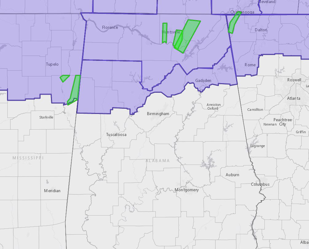
A Winter Weather Advisory has been issued for all of North Alabama and for the extreme northern counties in Central Alabama, including Blount, Cherokee, Etowah, Fayette, Lamar, Marion, Walker, and Winston. Slippery road conditions may develop this evening through the overnight hours once the temperatures drop below freezing, so please slow down and use caution if having to travel.
THE FIRST WORK WEEK OF 2022: High pressure moves in on Monday that will cause our skies to clear out, but our temperatures will not make a big recovery, only reaching the lower 40s to right around 50 degrees across the area. Skies will be sunny on Tuesday, and it will be a touch warmer, reaching the lower to mid-50s for most across the area. Clouds and moisture will start to move into the area on Wednesday ahead of another cold front, but it will stay dry during the daylight hours. A few showers may be possible during the evening and late-night hours. Highs will be in the lower 50s to the lower 60s. We can expect some showers at times throughout the day on Thursday, but those will quickly end by the evening hours. Highs will be in the mid-40s to the mid-60s. Much colder air moves into the area for Friday, and the completely sunny skies will not help it feel any warmer. Highs will be in the upper 30s to the lower 50s.
NEXT WEEKEND: Next weekend will start off dry as we’ll have mostly clear skies on Saturday, but moisture returns on Sunday as another front will push through the area. Saturday’s highs will be in the 50s, then warming up into the upper 50s to the upper 60s on Sunday. With a big warm-up like that, we may have to watch for the potential of stronger storms.
Category: Alabama's Weather, ALL POSTS, Weather Xtreme Videos, Winter Weather
About the Author (Author Profile)
Scott Martin is an operational meteorologist, professional graphic artist, musician, husband, and father. Not only is Scott a member of the National Weather Association, but he is also the Central Alabama Chapter of the NWA president. Scott is also the co-founder of Racecast Weather, which provides forecasts for many racing series across the USA. He also supplies forecasts for the BassMaster Elite Series events including the BassMaster Classic.Subscribe
If you enjoyed this article, subscribe to receive more just like it.


