

Coldest Air So Far This Season Arrives Tonight
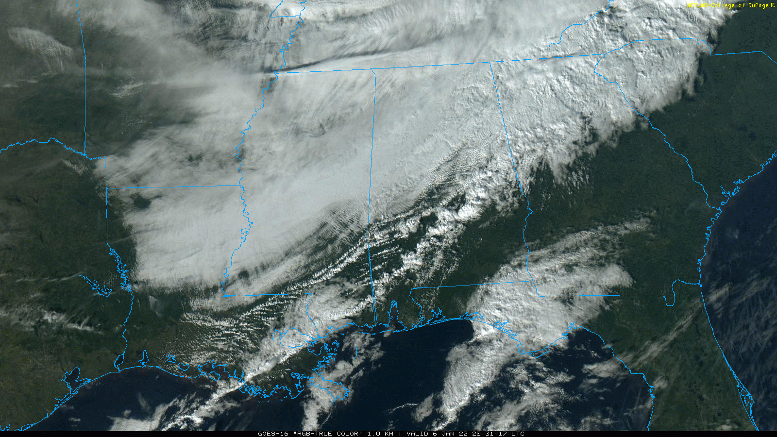
RADAR CHECK: Showers continue ahead of a sharp cold front across East and South Alabama this afternoon. North of the front, temperatures are now below freezing across Northwest Alabama and the Tennessee Valley, but south of the boundary some spots have hit the low 70s. The front will continue southward this evening, and the cold air so far this season will settle into the state. By daybreak tomorrow we project lows in the 18-24 degree range, with a wind chill index as low as 10 degrees. The sky will gradually clear overnight.
A winter weather advisory remains in effect for Lauderdale, Colbert, Limestone, Madison, and Jackson counties this evening due to the potential for black ice on bridges… all other counties have been removed from the advisory.
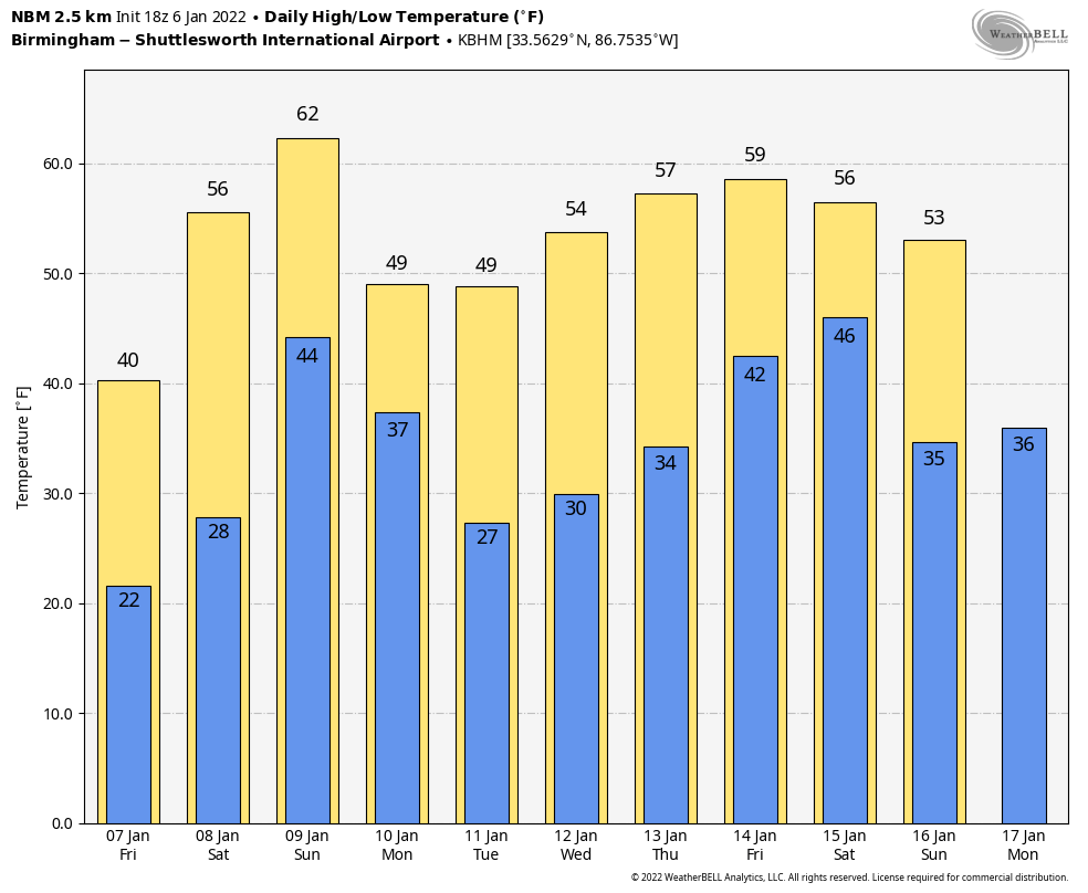
TOMORROW AND THE WEEKEND: Tomorrow will be sunny but cold with a high between 37 and 41 degrees. Then, on Saturday, after starting the day in the 20s afternoon temperatures rise into the 50s with a mostly sunny sky. Clouds move in Saturday night, and rain is likely statewide Sunday as another cold front approaches. Some thunder is possible, but for now severe storms are not expected. Sunday’s high will be in the 57-62 degree range.
NEXT WEEK: Monday will feature a clearing sky, and another shot of colder air arrives with a high back in the mid to upper 40s. The rest of the week looks quiet, with dry conditions through at least Thursday. Temperatures most of the week will be rather seasonal, with highs in the 50s and low in the 30s. See the Weather Xtreme video for maps, graphics, and more details.
ON THIS DATE IN 1886: The “Great Blizzard of 1886” struck the Midwest with high winds, subzero temperatures, and heavy snowfall. These conditions caused as many as 100 deaths, and 80% of the cattle in Kansas perished.
ON THIS DATE IN 1996: A severe nor’easter paralyzed the East Coast from January 6 to the 8. In Washington D.C., this storm is also known as the “Great Furlough Storm” because it occurred during the 1996 federal government shutdown. Snowfall amounts from this event include 47 inches in Big Meadows, Virginia; 30.7″ in Philadelphia; 27.8″ in Newark; 24.6″ at the Dulles International Airport; 24.2″ in Trenton; 24″ in Providence; 22.5″ in Baltimore; 18.2″ in Boston; 17.1″ in D.C.; and 9.6″ in Pittsburgh
BEACH FORECAST: Click here to see the AlabamaWx Beach Forecast Center page.
WEATHER BRAINS: Don’t forget you can listen to our weekly 90 minute show anytime on your favorite podcast app. This is the show all about weather featuring many familiar voices, including our meteorologists here at ABC 33/40.
CONNECT: You can find me on all of the major social networks…
Look for the next Weather Xtreme video here by 6:00 a.m. tomorrow…
Category: Alabama's Weather, ALL POSTS, Weather Xtreme Videos
About the Author (Author Profile)
James Spann is one of the most recognized and trusted television meteorologists in the industry. He holds the AMS CCM designation and television seals from the AMS and NWA. He is a past winner of the Broadcast Meteorologist of the Year from both professional organizations.Subscribe
If you enjoyed this article, subscribe to receive more just like it.


