

Midday Nowcast: Nice Afternoon Before Big Weekend Changes
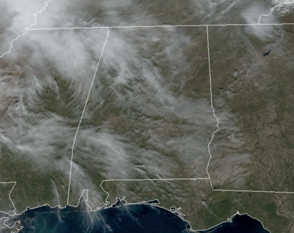
Today is featuring plenty of sunshine with just those high level clouds giving us that filtered sunshine across the state. Temperatures this afternoon will be a few degrees cooler than yesterday, but still not bad for January in Alabama with mid to upper 50s in the forecast. It is dry the rest of today, but clouds begin to increase tonight ahead of the weekend system.
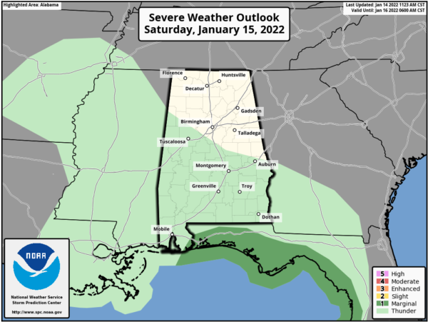
SATURDAY SOAKER: Tomorrow will be cloudy as rain begins to overspread the state from west to east through the afternoon hours, and sticking around through tomorrow night. This will be a good soaking for much of the state with rain amounts of 1-2 inches likely. A few strong thunderstorms are possible along the Gulf Coast; and SPC has defined a low end “marginal risk” of severe thunderstorms along the Florida Panhandle and the western Florida Peninsula. Highs tomorrow will be in the 50s.
SUNDAY SNOW: Sunday will be much colder as temperatures will be falling and will likely fall into the 30s by afternoon with a blustery north wind. The lingering rain showers will transition to snow showers over the northern half of Alabama during day.
Some accumulation is possible on grassy areas over about the northern third of Alabama (north of Birmingham)… amounts should be generally one inch or less. However, isolated heavier totals are possible north of the Tennessee River, and across the high terrain of northeast Alabama.
Temperatures will likely be in the mid 30s (above freezing) as the snow falls, and initially travel impacts are not expected as roads will be just wet. Some patchy “black ice” is possible Sunday night on bridges where water lingers and temperatures go below freezing.
As always, know this forecast can change, so watch for updates over the weekend. This should not be a major event for Alabama with most of the precipitation falling as rain. The bigger winter weather issues will come north, northeast, and east of Alabama, across Tennessee northern Georgia and the Carolinas, where snow and the potential for a crippling ice storm are likely.
NEXT WEEK: Monday will be cold and dry with highs in the 40s. Temperatures begin to warm on Tuesday with the return of 50s. Our next front will bring rain back to Alabama Wednesday afternoon and Wednesday night. Another shot of cold, dry air rolls into the state Thursday and Friday.
BEACH FORECAST CENTER: Get the latest weather and rip current forecasts for the beaches from Fort Morgan to Panama City on our Beach Forecast Center page. There, you can select the forecast of the region that you are interested in visiting.
WORLD TEMPERATURE EXTREMES: Over the last 24 hours, the highest observation outside the U.S. was 118.4F at Onslow Airport Australia. The lowest observation was -56.0F at Kerbo, Russia.
CONTIGUOUS TEMPERATURE EXTREMES: Over the last 24 hours, the highest observation was 82F at Del Rio, TX. The lowest observation was -15F at Grand Marais, MN.
WEATHER ON THIS DATE IN 1882: Southern California’s greatest snow occurred on this date. Fifteen inches blanketed San Bernardino, and even San Diego reported a trace of snow.
Category: ALL POSTS
About the Author (Author Profile)
Macon, Georgia Television Chief Meteorologist, Birmingham native, and long time Contributor on AlabamaWX. Stormchaser. I did not choose Weather, it chose Me. College Football Fanatic. @Ryan_StinnetSubscribe
If you enjoyed this article, subscribe to receive more just like it.


