

Dry Weekend With A Warming Trend
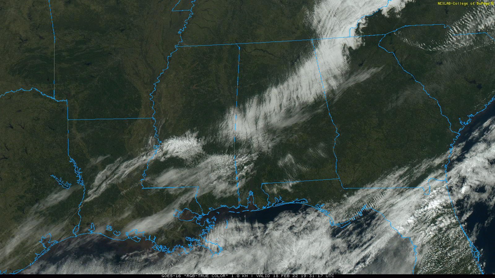
THIS AFTERNOON: The sky has cleared across most of Alabama at mid-afternoon, but there is a lingering, narrow band of clouds around I-20/59. Those clouds are dissipating quickly, and the sky will be clear statewide tonight. As expected, temperatures are much colder today with readings mostly in the 40s. The low early tomorrow morning will be in the 20s for most communities.
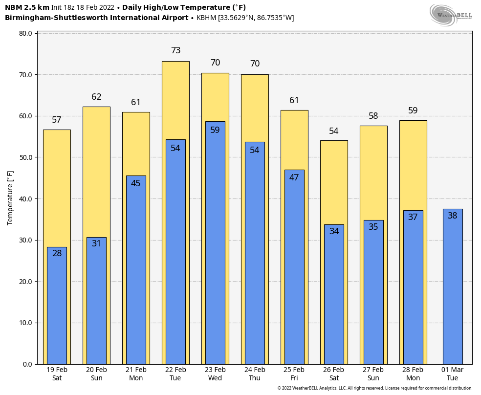
Look for sunny weather over the weekend with a warming trend. The high tomorrow will be in the upper 50s, followed by mid 60s Sunday.
NEXT WEEK: A northward moving warm front will bring widespread rain to the state Monday… with a cloudy sky the high will be in the 60-65 degree range. Tuesday will be very mild with a high in the 70s along with a chance of showers; most likely the heaviest rain Tuesday will be to the north over parts of Arkansas and Tennessee.
Global models are having a hard time resolving details over the latter half of the week, but the weather will remain generally unsettled. The latest data suggests that a temporary surge of cooler, drier air could arrive Wednesday, but rain chances return Thursday and Friday as moisture surges northward again. There could be some risk of strong storms toward the end of the week, but way too early to know if severe thunderstorms will be an issue. See the Weather Xtreme video for maps, graphics, and more details.
STORM SURVEYS: NWS Birmingham has confirmed EF1 tornado damage in parts of Jefferson and Shelby counties in the area between Greystone and Leeds. Also, EF-0 damage has been confirmed at Boley Springs, in Fayette County. Survey teams continue their work this afternoon in other parts of the state.
ON THIS DATE IN 1992: A thunderstorm spawned a powerful F4 tornado for so far north for the time of the year in southern Van Wert County in Ohio. The tornado touched down just west of US Route 127 and traveled northeastward for about 3 miles. One house was completely leveled, and nine others experienced severe damage. Six people were injured.
ON THIS DATE IN 2021: Cold, Arctic air covered Alabama… and snow amounts of 2-5 inches were common across counties like Madison, Limestone, Morgan, Lauderdale, Cobert, Lawrence, Marion, and Winston.
BEACH FORECAST: Click here to see the AlabamaWx Beach Forecast Center page.
WEATHER BRAINS: Don’t forget you can listen to our weekly 90 minute show anytime on your favorite podcast app. This is the show all about weather featuring many familiar voices, including our meteorologists here at ABC 33/40.
CONNECT: You can find me on all of the major social networks…
Look for my next Weather Xtreme video here by 6:00 a.m. Monday… enjoy the weekend!
Category: Alabama's Weather, ALL POSTS, Weather Xtreme Videos
About the Author (Author Profile)
James Spann is one of the most recognized and trusted television meteorologists in the industry. He holds the AMS CCM designation and television seals from the AMS and NWA. He is a past winner of the Broadcast Meteorologist of the Year from both professional organizations.Subscribe
If you enjoyed this article, subscribe to receive more just like it.


