

Late Saturday Afternoon Weather Update; Timing Updated on Tuesday/Wednesday Severe Threat
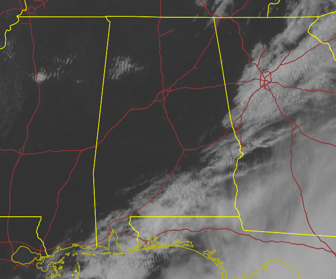
JUST BEFORE 4 PM — After cloud cover kept temperatures on the cooler side throughout the morning hours across Central Alabama, skies have cleared out nicely for the most part, with the only cloud cover remaining over the southeastern parts of the area. Temperatures have rebounded nicely, currently sitting in the mid 60s to the lower 70s across the area.
A SEASONAL CENTRAL ALABAMA WEEKEND — While clouds continue to move out of the area in the southeast, we’ll have mainly clear skies for the rest of the area through the rest of the daylight hours. Afternoon highs will top out in the upper 60s to the lower 70s across the area. Those clear skies will continue through the late-night and overnight hours, with lows in the lower 40s to just below 50 degrees.
Sunday will continue to be bright and sunny as drier air moves over Central Alabama. That will keep clouds out of our skies, and highs will top out in the mid 60s to the mid 70s.
MONDAY: THE CALM BEFORE THE STORMS — While we stay dry on Monday, winds will shift out of the southeast to the south and will allow for humidity levels to start to rise across the area. Skies will be mostly sunny, with highs warming up into the lower 70s to the lower 80s across the area. A warm front will start to move into the area after midnight that will bring a chance of showers during the overnight hours. No severe weather to worry about until just before daybreak on Tuesday.
SLIGHT RISK FOR SEVERE STORMS ON TUESDAY & WEDNESDAY — A warm front moves across the area on Tuesday that will destabilize the atmosphere during the morning hours. A shortwave will move through the area that will bring the potential for strong to severe storms through the morning hours. A second round may develop during the afternoon and into the early evening hours, as the atmosphere looks to stay relatively unstable. Any cells that can develop and get going may become severe.
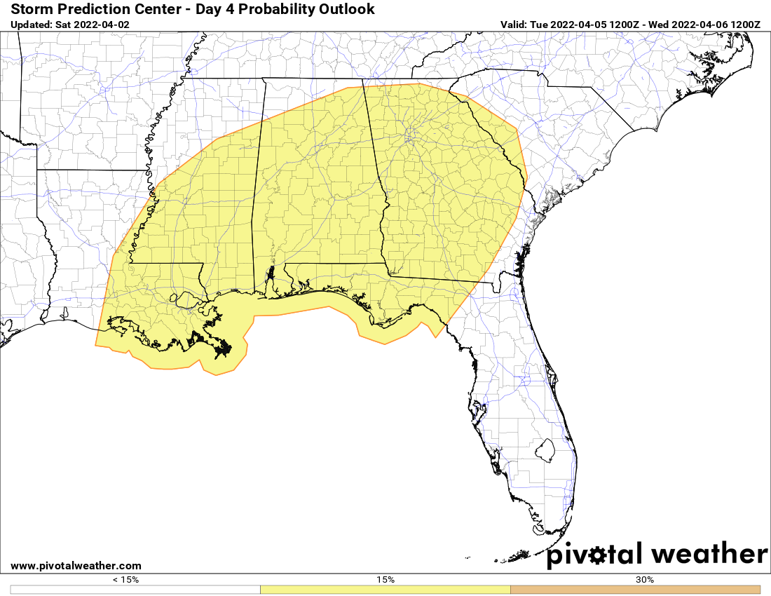
All modes of severe weather will be possible, and the SPC continues a Slight Risk for nearly all of North/Central Alabama, except for the extreme northern and northwestern locations. As of now, timing for stronger to severe storms will be from roughly 5 am to 8 pm. Highs will range from the lower 70s in the north to the upper 70s in the south.
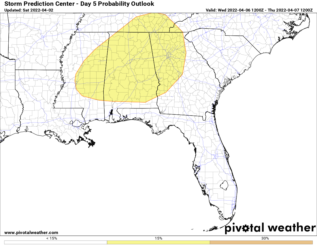
A cold front will move through the area during the afternoon and evening hours on Wednesday that will bring another risk of strong to severe storms to the area, this time in the form of a squall line. Once again, all modes of severe weather will be possible, and the SPC continues a Slight Risk for everyone in North/Central Alabama except for the extreme northwestern corner of the area. Highs will be in the upper 70s to the mid 80s.
We’ll get a better look at both of these days as the higher-resolution models come into view. Bill Murray will have updates for you on Sunday, and James Spann will have updates on Monday. Just remember to be prepared and stay weather aware on both Tuesday and Wednesday.
Category: Alabama's Weather, ALL POSTS, Severe Weather
About the Author (Author Profile)
Scott Martin is an operational meteorologist, professional graphic artist, musician, husband, and father. Not only is Scott a member of the National Weather Association, but he is also the Central Alabama Chapter of the NWA president. Scott is also the co-founder of Racecast Weather, which provides forecasts for many racing series across the USA. He also supplies forecasts for the BassMaster Elite Series events including the BassMaster Classic.Subscribe
If you enjoyed this article, subscribe to receive more just like it.


