

More Counties Removed from the Watch… Will Be Allowed to Expire at 11 pm
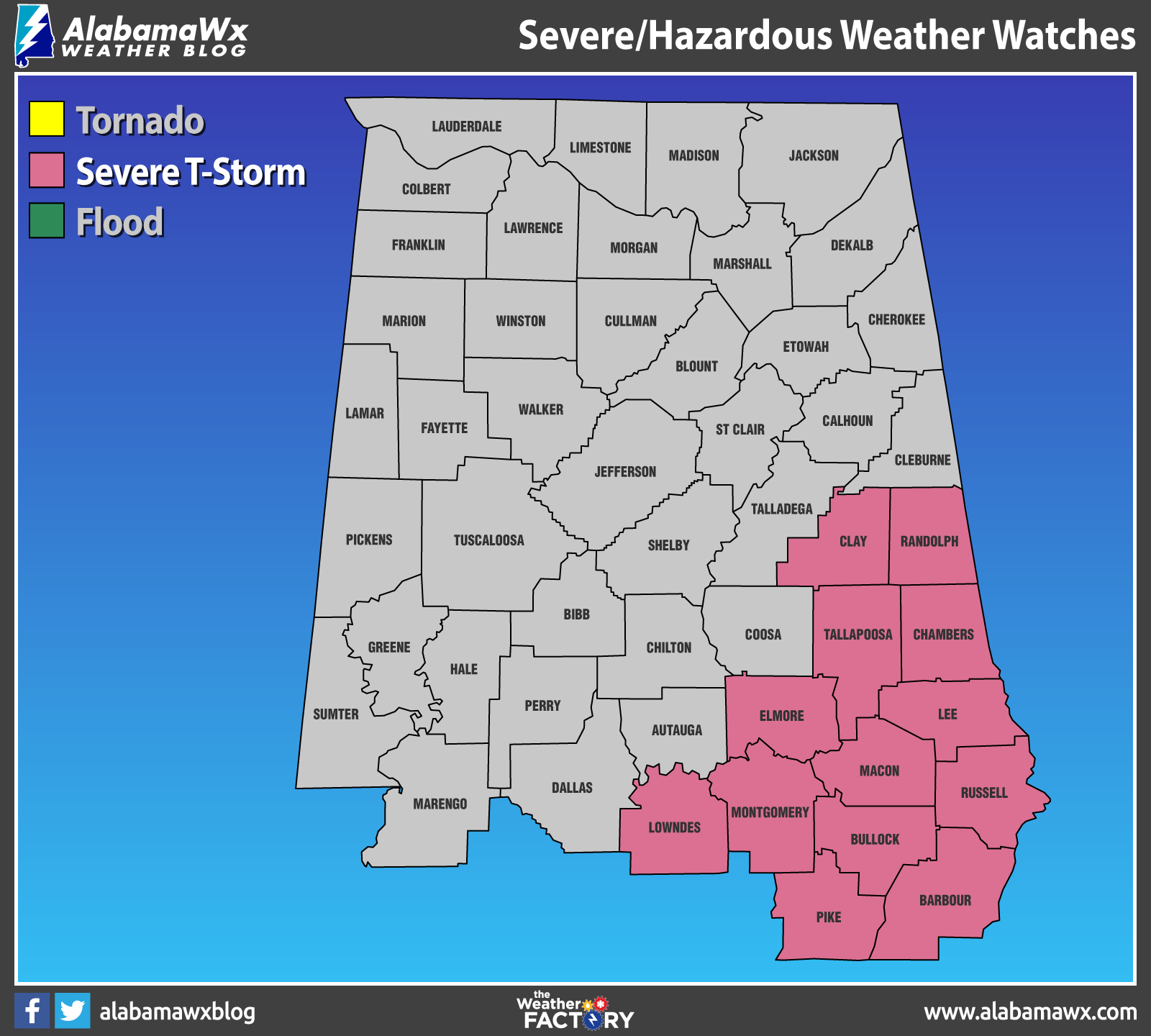
NWS Birmingham has canceled the SEVERE THUNDERSTORM WATCH for Autauga, Coosa, Dallas, Chilton, Cleburne, and Marengo counties in Central Alabama, as the severe threat has ended for those locations tonight.
NWS Birmingham continues the SEVERE THUNDERSTORM WATCH until 11 pm tonight for Barbour, Bullock, Chambers, Clay, Elmore, Lee, Lowndes, Macon, Montgomery, Pike, Randolph, Russell, and Tallapoosa counties in Central Alabama.
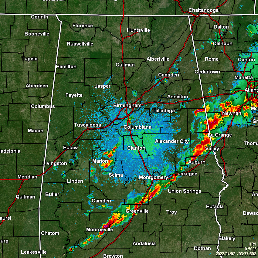
The overall severe threat is very low at this point and the idea from NWS Birmingham is to let the watch expire at 11 pm with no extension or issuance of a new watch. As of 10:39 pm, the line of storms was roughly line up along or just north of the I-85 corridor down to just south of Montgomery, and along I-65 through Fort Deposit and down into the South Alabama market. Instability is still elevated along and south of the line of storms, but there seems to be a cap in place that is keeping the storms from becoming severe. While a severe thunderstorm is still possible, it is not likely to happen.
A few scattered storms have developed behind the main line and the cold front, but these will be elevated, with no severe weather expected. Just might be a little loud with a few rumbles of thunder.
Category: Alabama's Weather, ALL POSTS, Severe Weather
About the Author (Author Profile)
Scott Martin is an operational meteorologist, professional graphic artist, musician, husband, and father. Not only is Scott a member of the National Weather Association, but he is also the Central Alabama Chapter of the NWA president. Scott is also the co-founder of Racecast Weather, which provides forecasts for many racing series across the USA. He also supplies forecasts for the BassMaster Elite Series events including the BassMaster Classic.Subscribe
If you enjoyed this article, subscribe to receive more just like it.


