

Midday Nowcast: New Day, Same Forecast
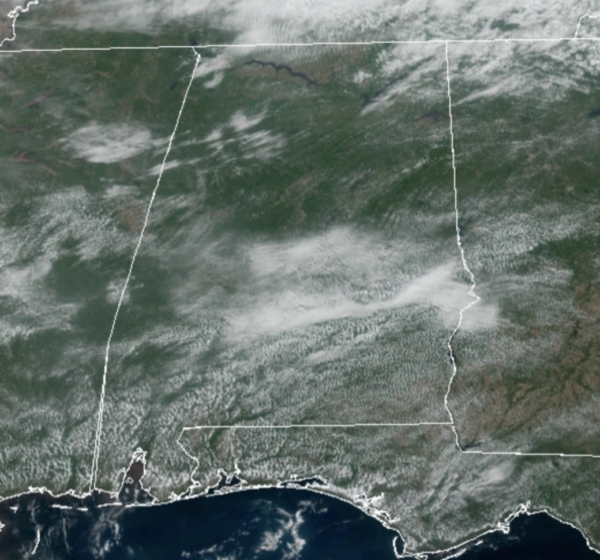
Little change in the weather today as it remains warm and humid across Alabama with a mix of sun and clouds; we are seeing temperatures surge well into the 80s again this afternoon. A few pop-up showers and storms are possible today, but most locations will remain dry. More of the same tomorrow, but late tomorrow night, an approaching cold front will bring rain and storms back to Alabama, likely after midnight and into Friday.
FRIDAY FRONT: A band of organized showers and storms will move into and through the Friday. The SPC has defined a “slight risk” (level 2/5) of severe thunderstorms for much Alabama for Friday.
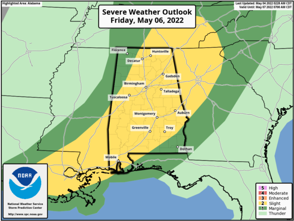
Ample instability in place will allow for strong to severe storms in Alabama and these storms will pack a punch with heavy rainfall, frequent lightning, and some of the stronger storms could produce strong winds and hail. The tornado threat is very low, but not zero. Highs Friday will be close to 80°, but late in the day, behind the front, drier air returns, bringing an end to the rain and storms.
MOTHER’S DAY WEEKEND: Saturday and Sunday will be dry and pleasant day with a good supply of sunshine both days. Highs will around 80° Saturday and in the mid 80s Sunday; lows drop into the 50s.
CRANKING UP THE HEAT: Much of the week looks quiet, although an isolated afternoon shower could pop up from time to time, however, it looks like we will see our hottest week of weather so far in 2022. The upper-ridge builds in across the region, and we are likely see high temperatures closer to 90° at times next week.
BEACH FORECAST CENTER: Get the latest weather and rip current forecasts for the beaches from Fort Morgan to Panama City on our Beach Forecast Center page. There, you can select the forecast of the region that you are interested in visiting.
WORLD TEMPERATURE EXTREMES: Over the last 24 hours, the highest observation outside the U.S. was 114.8F at N’Guigmi, Niger. The lowest observation was -100.8F at Concordia, Antarctica.
CONTIGUOUS TEMPERATURE EXTREMES: Over the last 24 hours, the highest observation was 102F at Rio Grande Village, TX. The lowest observation was 16F at Wolf Creek Pass, CO.
Category: Alabama's Weather, ALL POSTS
About the Author (Author Profile)
Macon, Georgia Television Chief Meteorologist, Birmingham native, and long time Contributor on AlabamaWX. Stormchaser. I did not choose Weather, it chose Me. College Football Fanatic. @Ryan_StinnetSubscribe
If you enjoyed this article, subscribe to receive more just like it.


