

Sunday Noon Update: Isolated Storms This Afternoon
We’re off to a hot start on this May Sunday. Temperatures are in the 80s across the area. It was 86F at Selma and Evergreen and 89F at Dothan.
A couple of storms have formed over Northwest Alabama over Marion and Winston Counties. Another is just north of Prattville along I-65. Additional storms will bubble out of this hot, humid, and unstable airmass, but almost zero wind shear means they will go straight and rain themselves out pretty quickly. They could have gusty winds of 40-50 mph, small hail, and lightning.
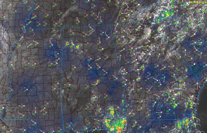
They shouldn’t become severe.
We note that the SPC does have a marginal risk for northwestern Alabama for the storms back to our northwest.
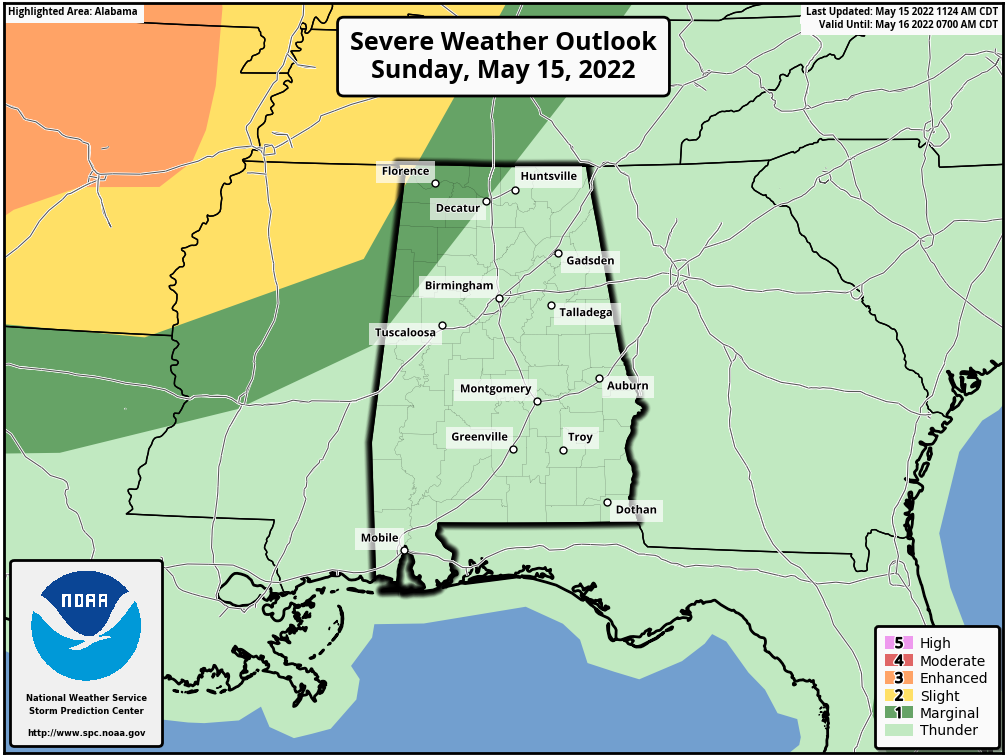
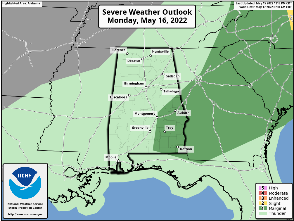
Those stronger storms are back over Arkansas, southeastern Kansas, northeastern Oklahoma, and southern Missouri, where severe thunderstorm watches are in effect. These storms should weaken with time as they push southeastward. These storms will reach Alabama during the morning hours on Monday when they should be a shadow of their current selves. We will need to be alert for a few showers and some storms in the morning hours tomorrow for areas along and northwest of I-59. The storms could get their second wind over southeastern sections of the area by afternoon, where the SPC has a marginal risk severe weather outlook for tomorrow.
Tuesday will be dry and warm with highs in the upper 80s. Then things will be heating up starting Wednesday. 90s will be widespread Wednesday through Saturday. The next best rain chances will come Sunday.
No real adjustments to the forecast at this time.
We continue to monitor the long-range output from the global models for tropical mischief in the Gulf of Mexico the last week of the month. The models are all over the place with a strong tropical storm everywhere from Louisiana to Key West. The general consensus is that the storm could end up somewhere on the western coast of Florida between the Big Bend and Naples, likely north of Tampa.
Have a great Sunday afternoon!
Category: Alabama's Weather, ALL POSTS
About the Author (Author Profile)
Bill Murray is the President of The Weather Factory. He is the site's official weather historian and a weekend forecaster. He also anchors the site's severe weather coverage. Bill Murray is the proud holder of National Weather Association Digital Seal #0001 @wxhistorianSubscribe
If you enjoyed this article, subscribe to receive more just like it.


