

Occasional Showers/Storms Through Thursday Night
RADAR CHECK: Clusters of showers and strong thunderstorms continue to move northward through Alabama this afternoon. Heavier storms are capable of producing hail and strong winds; a “marginal risk” (level 1/5) of severe thunderstorms remains defined for all of Alabama through tonight.
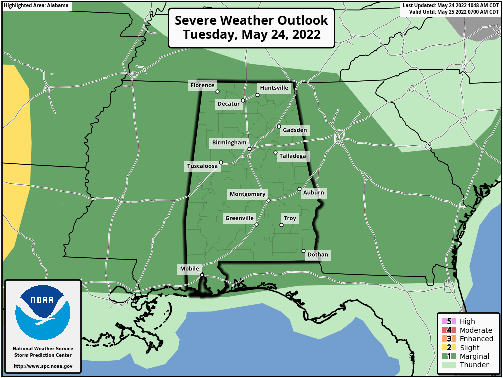
Unsettled weather will continue through Thursday night as an unstable, tropical airmass remains parked across the state, and an upper trough/cold front combo approaches. Expect occasional showers and thunderstorms with additional rain amounts of 1-3 inches likely. SPC maintains a “marginal risk” (level 1/5) of severe storms statewide tomorrow and Thursday; the main threats are hail and strong, gusty winds. However, we do note a low end tornado threat could develop Thursday as shear values are increasing.
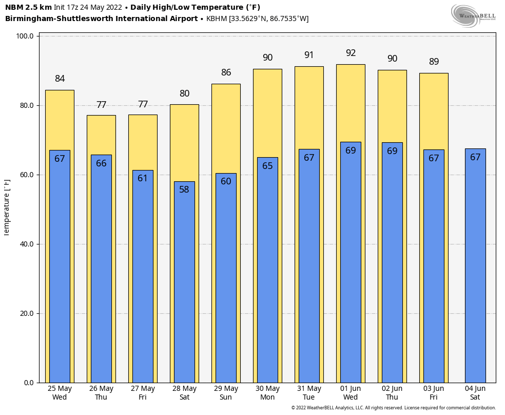
Highs will be in the 75-80 degree range with only a limited amount of sun; showers and storms will end from west to east Thursday night as a cold front pushes through the state. Then, the sky becomes partly sunny Friday as a slot of dry air works into the state… any showers Friday will be confined to areas near the Tennessee state line. The high Friday will be from 74-78… about ten degrees below average for late May in Alabama.
HOLIDAY WEEKEND: We expect sunny warm days, and fair pleasant nights for the three day Memorial Day weekend. The high Saturday will be in the low 80s, followed by upper 80s Sunday, and a high near 90 Monday. Lows will be mostly in the 60s, but cooler spots will drop into the 50s Saturday morning.
REST OF NEXT WEEK: An upper ridge will keep the weather quiet and mostly dry next week… highs will be close to 90 degrees with just a few spotty showers around by Thursday and Friday. See the Weather Xtreme video for maps, graphics, and more details.
ON THIS DATE IN 1973: An F4 tornado tore through the small town of Union City, Oklahoma, killing two and injuring four others. This tornado was the first storm to be studied in detail by the National Severe Storms Laboratory Doppler Radar Unit at Norman, OK and an armada of researchers in the field. Research of the radar data from the storm would lead to the discovery of a “TVS,” or Tornado Vortex Signature. The presence of a TVS on Doppler radar data is a very strong indication of tornadic potential in a severe thunderstorm
BEACH FORECAST: Click here to see the AlabamaWx Beach Forecast Center page.
WEATHER BRAINS: Don’t forget you can listen to our weekly weather show all about weather anytime on your favorite podcast app. James Spann and a team of meteorologists from around the nation bring on interesting guests; a great podcast for weather geeks/dweebs/weenies.
CONNECT: You can find me on all of the major social networks…
Look for the next Weather Xtreme video here by 6:00 a.m. tomorrow…
Category: Alabama's Weather, ALL POSTS, Weather Xtreme Videos
About the Author (Author Profile)
James Spann is one of the most recognized and trusted television meteorologists in the industry. He holds the AMS CCM designation and television seals from the AMS and NWA. He is a past winner of the Broadcast Meteorologist of the Year from both professional organizations.Subscribe
If you enjoyed this article, subscribe to receive more just like it.


