

Storms Continue to Slowly Push Through the Area at Midday; Slight Risk for Severe Storms Added for Today
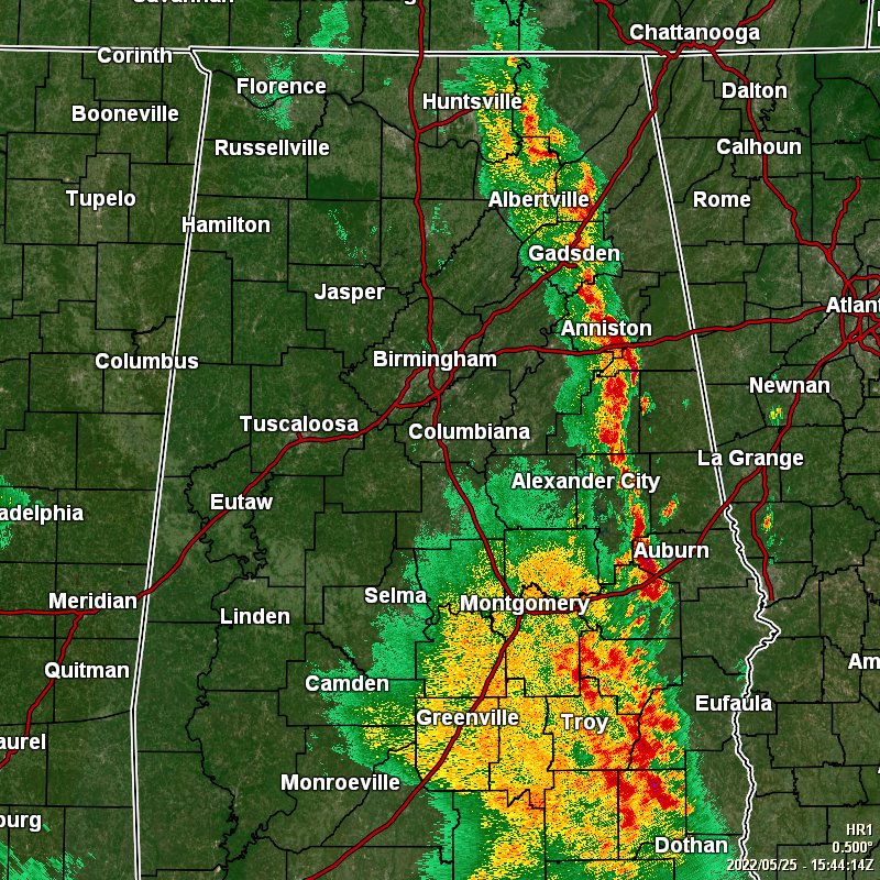
Radar as of 10:44 am continues to show rain and thunderstorms over the eastern half of the area roughly stretching from Huntsville to Gadsden to Auburn to Clio and continues to push just slightly east of due north. At this point, the activity has stayed well-behaved, but that may not be the case this afternoon.
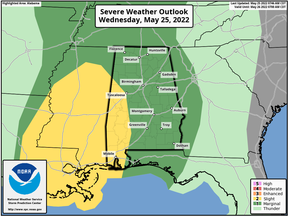
Much of Central Alabama remains in a Marginal Risk for severe storms, but the SPC has upgraded the western and southwestern parts of the area to a Slight Risk, mainly along and west of a line from Millport to Moundville to Uniontown. Damaging winds up to 60 mph and quarter size hail will be the main threats, but there is a very small risk of a tornado or two, especially in the Slight Risk area. The main window for the threat of severe storms will be from 1 pm this afternoon until around 9 pm tonight. Today’s highs will be in the upper 70s to the lower 80s. Showers and a few storms will continue through the late-night and overnight hours, with the best rain chances occurring over the western half of the area. Lows will be in the 60s.
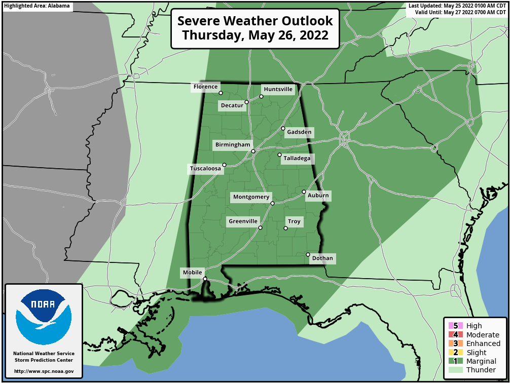
A risk for stronger to severe storms will once again be in place across all of Central Alabama on Thursday as the SPC has a Marginal Risk up for the threat of damaging winds up to 60 mph, quarter size hail, and a very small risk of a tornado or two. This threat window will take place during the morning and afternoon hours. We can expect periods of showers and thunderstorms, with highs in the mid 70s to the lower 80s.
After this activity moves out of the area on Thursday night, we can expect a nice stretch of drier weather with mainly sunny skies through the end of the forecast period on Tuesday, but there will be much warmer temperatures moving in. Friday’s highs will be in the mid 70s to the lower 80s, warming into the upper 70s to the mid 80s on Saturday, mid 80s to the lower 90s on Sunday, and the upper 80s to the lower 90s on Monday and Tuesday.
Category: Alabama's Weather, ALL POSTS, Severe Weather
About the Author (Author Profile)
Scott Martin is an operational meteorologist, professional graphic artist, musician, husband, and father. Not only is Scott a member of the National Weather Association, but he is also the Central Alabama Chapter of the NWA president. Scott is also the co-founder of Racecast Weather, which provides forecasts for many racing series across the USA. He also supplies forecasts for the BassMaster Elite Series events including the BassMaster Classic.Subscribe
If you enjoyed this article, subscribe to receive more just like it.


