

Storms Fewer In Number Today; Heat Levels Rise Next Week
RADAR CHECK: At daybreak we have a band of showers and thunderstorms dropping southward through the southern third of Alabama, and a handful of isolated showers over the Tennessee Valley of far North Alabama. Better chance of strong storms today will be over extreme South Alabama, where SPC has defined a “marginal risk” of severe thunderstorms due to the potential for some hail and strong gusty winds.
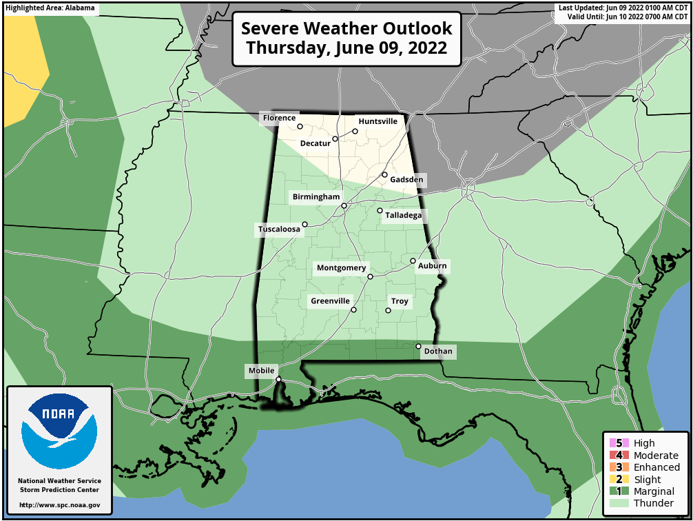
Look for a partly sunny sky today with a high between 85 and 89 degrees for most places. Odds of any one spot seeing a shower or storm this afternoon is only 10-20 percent for most of the state, with higher probabilities over the far southern part of the state.
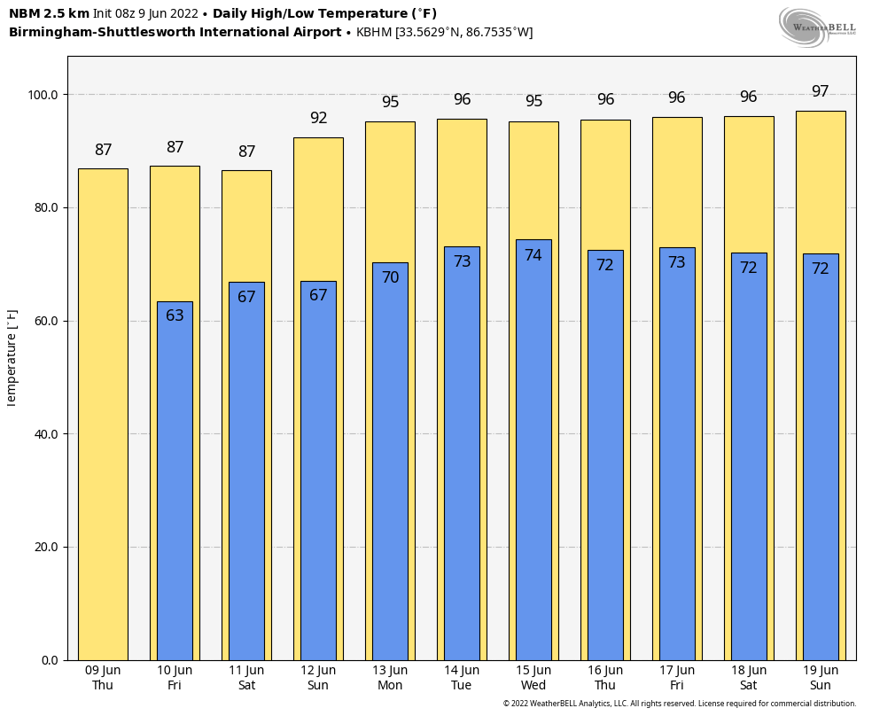
TOMORROW AND THE WEEKEND: We are looking at some routine summer weather with partly sunny days, mostly fair nights, and the chance of “scattered, mostly afternoon and evening showers and thunderstorms”. Most of the scattered storms will come from about 2:00 until 10:00 p.m… and the chance of any specific location seeing rain each day is 30-40 percent. Highs will be in the mid to upper 80s tomorrow and Saturday, followed by low 90s Sunday as an upper ridge begins to build over the region.
NEXT WEEK: It looks like the hottest week so far this year with highs in the low to mid 90s each day. There is always the risk of a pop up storm during the heat of the day, but they should be few and far between thanks to the subsidence associated with the ridge. See the Weather Xtreme video for maps, graphics, and more details.
TROPICS: All remains very quiet across the Atlantic basin, and tropical storm formation is not expected through the weekend.
RAIN TOTALS: Here are some rain totals yesterday from the team of ABC 33/40 Skywatchers…
Dunnavant Valley Road (between Shoal Creek and Dunnavant) 7.37″
Mountain Brook 5.82″
Grayson Valley 5.72″
Birmingham (Oxmoor Valley) 5.53″
Chelsea 4.89″
Margaret (St Clair County) 4.80″
Bessemer 4.61″
Carbon Hill 4.33″
Morris 4.27″
Lay Lake 4.26″
Crestwood 3.74″
Pell City 3.70″
Moody 3.69″
Jemison 3.64″
Alabaster 3.58″
Helena 3.37″
Cropwell 2.76″
Bibbville 2.36″
West Blocton 1.30″
Heflin 1.07″
Egypt (Etowah County) 1.03″
Weaver 1.01″
Coker 0.08″
ON THIS DATE IN 1966: Hurricane Alma made landfall over the eastern Florida panhandle becoming the earliest hurricane to make landfall on the United States mainland.
BEACH FORECAST: Click here to see the AlabamaWx Beach Forecast Center page.
WEATHER BRAINS: Don’t forget you can listen to our weekly weather show all about weather anytime on your favorite podcast app. James Spann and a team of meteorologists from around the nation bring on interesting guests; a great podcast for weather geeks/dweebs/weenies.
CONNECT: You can find me on all of the major social networks…
Look for the next Weather Xtreme video here by 3:00 this afternoon… enjoy the day!
Category: Alabama's Weather, ALL POSTS, Weather Xtreme Videos
About the Author (Author Profile)
James Spann is one of the most recognized and trusted television meteorologists in the industry. He holds the AMS CCM designation and television seals from the AMS and NWA. He is a past winner of the Broadcast Meteorologist of the Year from both professional organizations.Subscribe
If you enjoyed this article, subscribe to receive more just like it.


