

EXPIRED Severe T-Storm Warning: Parts of Chambers, Lee, Tallapoosa Co. Until 4 pm
The National Weather Service in Birmingham has issued a
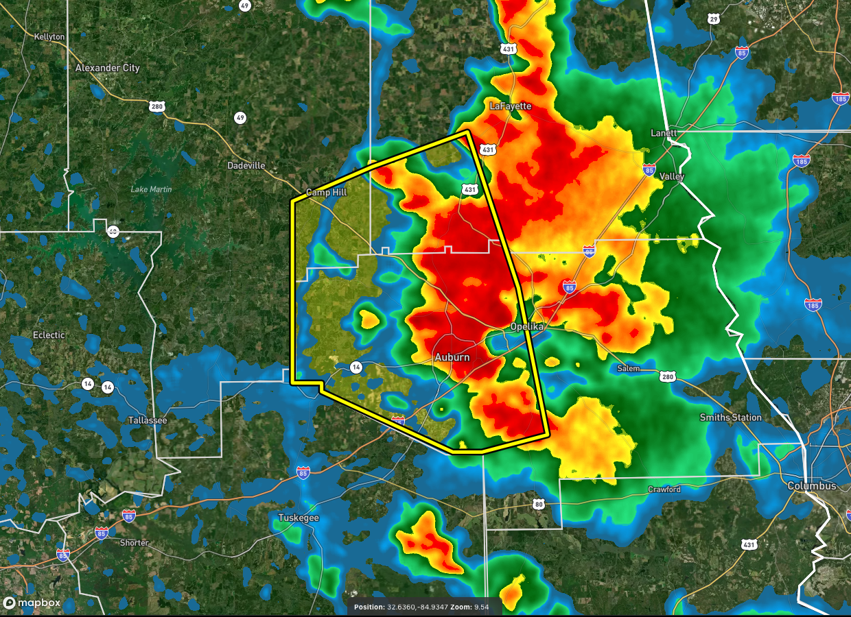
* Severe Thunderstorm Warning for…
Northwestern Lee County in east central Alabama…
Southeastern Tallapoosa County in east central Alabama…
Southwestern Chambers County in east central Alabama…
* Until 400 PM CDT.
* At 319 PM CDT, severe thunderstorms were located along a line
extending from near Auburn to near Auburn University to near
Sturkie, moving southwest at 20 mph.
HAZARD…60 mph wind gusts.
SOURCE…Radar indicated.
IMPACT…Expect damage to roofs, siding, and trees.
* Locations impacted include…
Auburn, Opelika, Camp Hill, Notasulga, Waverly, Auburn University,
Beauregard, Sturkie, Oak Bowery, West Chambers, Loachapoka, Robert
G. Pitts Airport, Chewacla State Park and Roxana.
PRECAUTIONARY/PREPAREDNESS ACTIONS…
For your protection move to an interior room on the lowest floor of a
building.
Category: Alabama's Weather, ALL POSTS, Severe Weather
About the Author (Author Profile)
Scott Martin is an operational meteorologist, professional graphic artist, musician, husband, and father. Not only is Scott a member of the National Weather Association, but he is also the Central Alabama Chapter of the NWA president. Scott is also the co-founder of Racecast Weather, which provides forecasts for many racing series across the USA. He also supplies forecasts for the BassMaster Elite Series events including the BassMaster Classic.Subscribe
If you enjoyed this article, subscribe to receive more just like it.


