

EXPIRED Severe T-Storm Warning: Parts of Montgomery Co. Until 8:15 pm
The National Weather Service in Birmingham has issued a
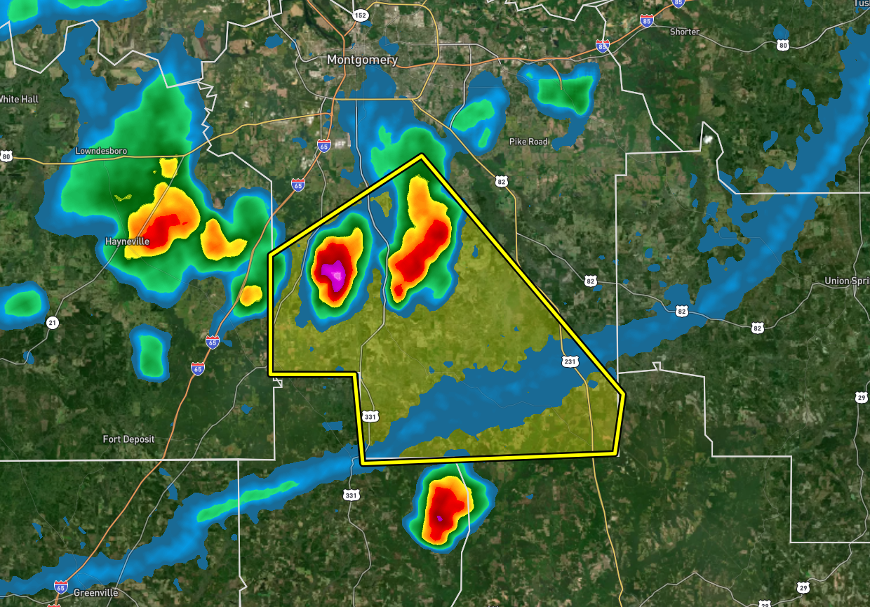
* Severe Thunderstorm Warning for…
Southern Montgomery County in south central Alabama…
* Until 815 PM CDT.
* At 737 PM CDT, a severe thunderstorm was located over Sprague, or
10 miles northwest of Meadville, moving southeast at 20 mph.
HAZARD…60 mph wind gusts and quarter size hail.
SOURCE…Radar indicated.
IMPACT…Hail damage to vehicles is expected. Expect wind damage
to roofs, siding, and trees.
* Locations impacted include…
Meadville, Pine Level, Strata, Dublin, Naftel, Sprague, Grady,
Sellers, Davenport, Ramer, Lapine, Pintlala and Currys.
PRECAUTIONARY/PREPAREDNESS ACTIONS…
For your protection move to an interior room on the lowest floor of a
building.
Category: Alabama's Weather, ALL POSTS, Severe Weather
About the Author (Author Profile)
Scott Martin is an operational meteorologist, professional graphic artist, musician, husband, and father. Not only is Scott a member of the National Weather Association, but he is also the Central Alabama Chapter of the NWA president. Scott is also the co-founder of Racecast Weather, which provides forecasts for many racing series across the USA. He also supplies forecasts for the BassMaster Elite Series events including the BassMaster Classic.Subscribe
If you enjoyed this article, subscribe to receive more just like it.


