

Mesoscale Discussion — Damaging Winds and Sporadic Large Hail Threat Continues
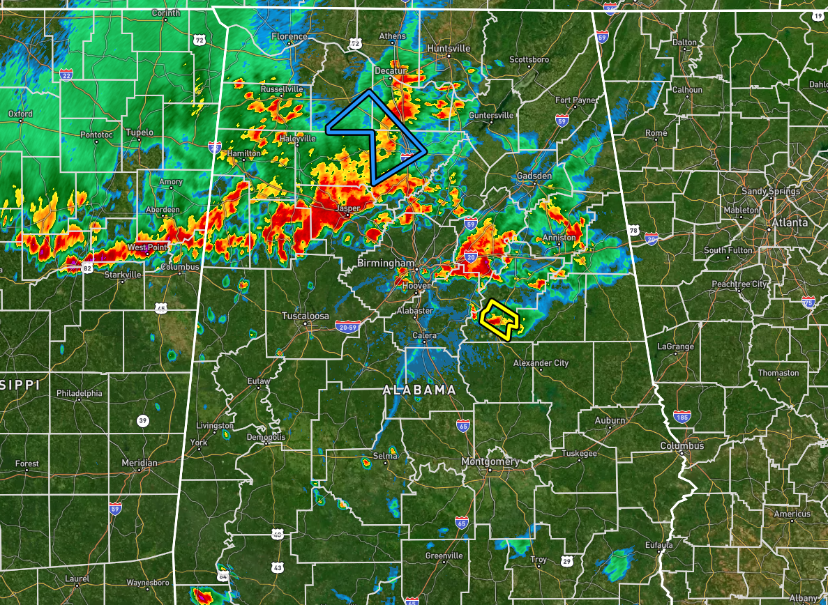
Only one severe thunderstorm warning on the board at this point for portions of Talladega County, but strong to severe storms will continue to be possible for the next few hours. Also, we’ll have to watch for some flooding issues as heavy rain is likely in these stronger storms. Here is the latest from the Storm Prediction Center:
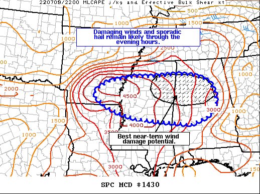
The severe weather threat for Severe Thunderstorm Watch 451
continues.
SUMMARY… The potential for damaging winds and sporadic large hail
continues across WW 451. The best near-term wind damage threat will
likely reside across eastern Mississippi into central Alabama.
DISCUSSION… Thunderstorms continue to propagate southward along a
cool front across the lower MS River Valley and the Mid-South.
Although many of the initial cells have become outflow dominant
and/or consolidated into a few clusters, several wind damage reports
have been noted over the past 1-2 hours with this activity. The
environment ahead of the front remains very thermodynamically
favorable for strong to severe convection. Temperatures in the upper
90s with dewpoints in the low to mid 70s are maintaining upwards of
4000-4500 J/kg MLCAPE with negligible inhibition. The nearly 30 F
dewpoint depressions are also indicative of the steep low-level
lapse rates in place that will further aid the downburst wind
potential.
Despite weak deep-layer flow, the strong thermodynamics will
maintain a severe threat for most of WW 451 well into the evening
hours. The best near-term potential for damaging winds will likely
reside across east-central MS into western/central AL. Regional
reflectivity and velocity trends show loosely organized clusters
beginning to show cold pool amalgamation with new development on the
leading edge of the outflow. Consequently, this may support a more
widespread damaging wind threat compared to locations further west
where cells are more isolated in nature.
Category: Alabama's Weather, ALL POSTS, Severe Weather
About the Author (Author Profile)
Scott Martin is an operational meteorologist, professional graphic artist, musician, husband, and father. Not only is Scott a member of the National Weather Association, but he is also the Central Alabama Chapter of the NWA president. Scott is also the co-founder of Racecast Weather, which provides forecasts for many racing series across the USA. He also supplies forecasts for the BassMaster Elite Series events including the BassMaster Classic.Subscribe
If you enjoyed this article, subscribe to receive more just like it.


