

Early Afternoon Weather Check Shows Rain & Storms Out There
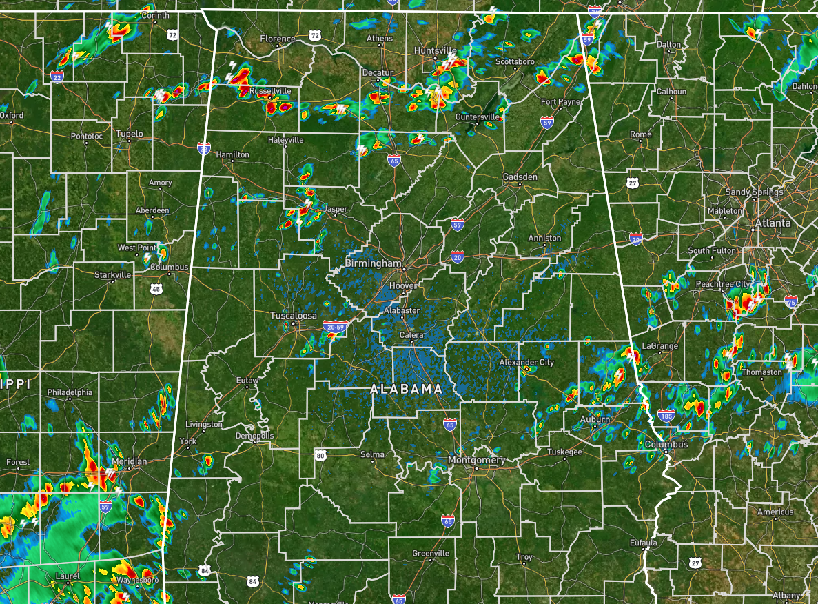
RADAR & TEMP CHECK: We have scattered showers and storms already popping across the area as expected as the front remains stationary across the Tennessee Valley. Much of the activity is along and just south of the front, but other pockets of rain are falling in the southeastern parts of the area and the western parts of the area. At noon, temperatures were in the upper 70s to the lower 90s, with the hot spots being Montgomery and Eufaula at 92º. The cool spot was Alexander City at 79º with rain-cooled air. Birmingham was at 86º.
REST OF TODAY: Rain and storms will continue to be likely across the area during the afternoon and early evening hours, with rain chances dropping and coverage decreasing during the late-night and overnight hours. A couple of storms may be strong with gusty winds, dangerous cloud-to-ground lightning, and heavy rainfall that may lead to localized flooding issues. Highs will reach the mid 80s to the lower 90s, with overnight lows in the lower to mid 70s.
SUNDAY’S WEATHER: Isolated to scattered storms can be expected across the area again on Sunday, with rain chances higher as you go northward in the area. For locations along and north of I-20, rain and storms will be likely at times, but there is no promise that everyone will get rain. Highs will be in the mid 80s to the mid 90s.
Category: Alabama's Weather, ALL POSTS
About the Author (Author Profile)
Scott Martin is an operational meteorologist, professional graphic artist, musician, husband, and father. Not only is Scott a member of the National Weather Association, but he is also the Central Alabama Chapter of the NWA president. Scott is also the co-founder of Racecast Weather, which provides forecasts for many racing series across the USA. He also supplies forecasts for the BassMaster Elite Series events including the BassMaster Classic.Subscribe
If you enjoyed this article, subscribe to receive more just like it.


