

Scattered Summer Soakers Around Again Today
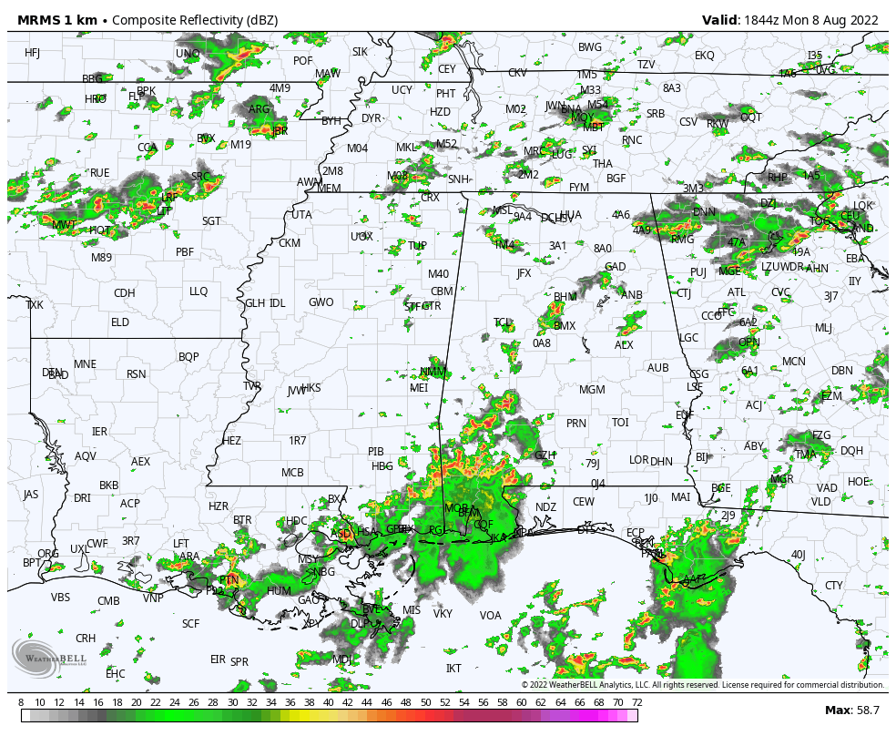
RADAR CHECK: Like recent days, we have your classic case of random, scattered showers and thunderstorms across Alabama this afternoon. They are slow moving, and in come cases are producing torrential rain, gusty winds, and lots of lightning. Away from the storms, temperatures are in the 88-92 degree range with a mix of sun and clouds. Storms will end tonight after sunset.
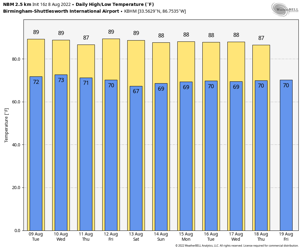
REST OF THE WEEK: No real change. Expect warm, humid days with scattered showers and storms around, generally between noon and midnight. Odds of any one spot getting wet each day are 50-60 percent, and highs will be mostly between 87 and 90 degrees, below average for mid-August in Alabama.
THE ALABAMA WEEKEND: Still seeing evidence that drier air will filter into the northern 2/3 of the state over the weekend, meaning fewer showers, more sunshine, slightly lower humidity levels, and slightly cooler nights. Best coverage of showers Saturday and Sunday will be over South Alabama, and highs will stay in the 87-90 degree range for most places.
NEXT WEEK: For now we expect fairly typical summer weather for the state with warm, humid days along with “scattered, mostly afternoon and evening showers and thunderstorms”. Temperatures are expected to remain a little below average, with highs in the upper 80s many days. See the daily Weather Briefing video for maps, graphics, and more details.
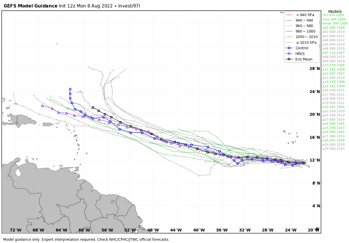
TROPICS: A large area of showers and thunderstorms over the far eastern tropical Atlantic south of the Cabo Verde islands is associated with a tropical wave. This system has changed little in organization today, but environmental conditions appear conducive for gradual development over the next several days while it moves westward to west-northwestward at 15 to 20 mph across the eastern and central tropical Atlantic. A tropical depression could form by the middle to latter portion of this week before environmental conditions become less favorable by this weekend.
NHC gives it a 40 percent chance of development over the next five days; if anything does form it most likely will turn north before getting close to the U.S. The Gulf of Mexico remains quiet.
ON THIS DATE IN 2007: A tornado bounces across Staten Island and Brooklyn, New York, ripping off roofs and damaging dozens of buildings. The EF-2 twister hop-scotched through Brooklyn’s Bay Ridge and Sunset Park neighborhoods around 6:30 am.
BEACH FORECAST: Click here to see the AlabamaWx Beach Forecast Center page.
Look for the next Weather Briefing video here by 6:00 a.m. tomorrow…
Category: Alabama's Weather, ALL POSTS, Weather Xtreme Videos
About the Author (Author Profile)
James Spann is one of the most recognized and trusted television meteorologists in the industry. He holds the AMS CCM designation and television seals from the AMS and NWA. He is a past winner of the Broadcast Meteorologist of the Year from both professional organizations.Subscribe
If you enjoyed this article, subscribe to receive more just like it.


